PYRENEES
back to front page: Ines hiking
- PYRENEES – DAY 00
Travel Day to Pau, France
22-07-04
This holiday starts with a very early morning: getting up just after 4 to reach a flight at 7, even with the forecast chaos due to staff shortages and high season. But it all runs smoothly and the plane is 40mins late – so no stress 😉

arrived in Paris Since I was all too late getting the ticket for my train, the fast TGV during the afternoon is already booked out. So I have to get the night train instead of spending a night in Pau.
But why not, leaves me with half a day sightseeing in sunny Paris!

Notre Dame – under reconstruction 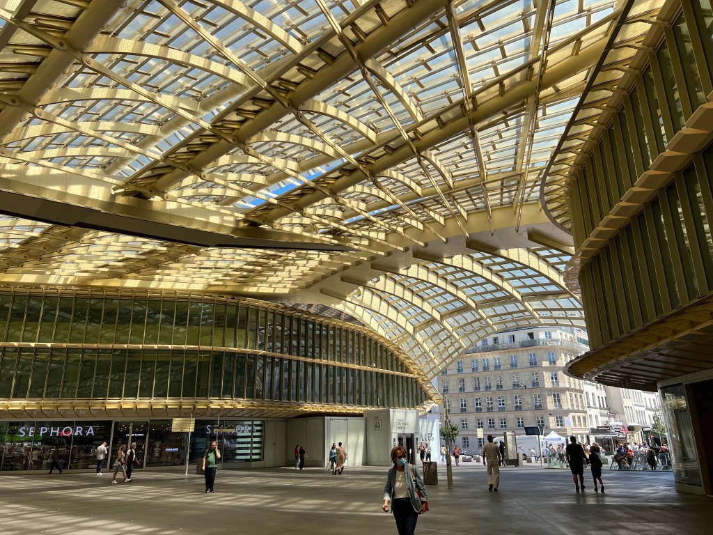
the new Les Halles shopping centre And I also manage to get a gas canister, and the last bits of food supplies.
Then I just chill in the Jardin des Plantes, next to Gare d’ Austerlitz where my train leave around 21.

Gare d’ Austerlitz – also under reconstruction Now looking forward to a good night’s sleep (fingers crossed), and wake up in sight of the Pyrenees at Pau.
- PYRENEES – DAY 01
From Somport (border) to Lac du Peyreguet
22-07-05
After an okay night’s sleep on the night train I arrive at Pau, from where I can’t see any mountains just yet – maybe I was a bit optimistic 😉
I get some coffee at the station cafe and then hop on the cutest/shortest train ever, which takes me to Bedous.
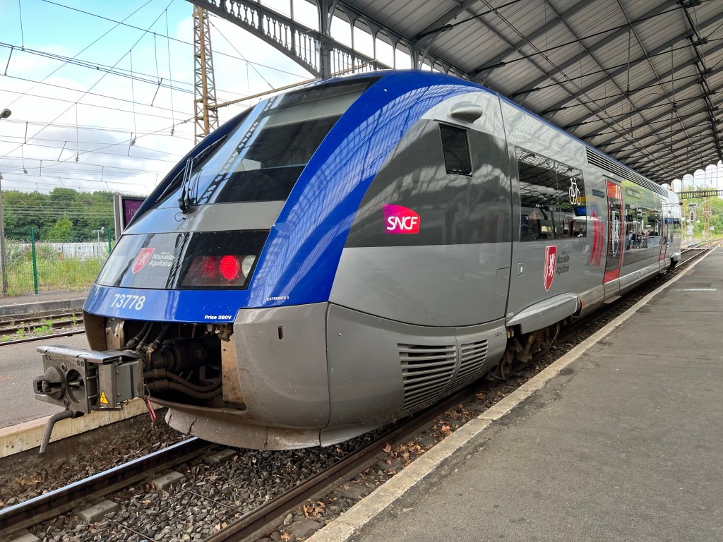
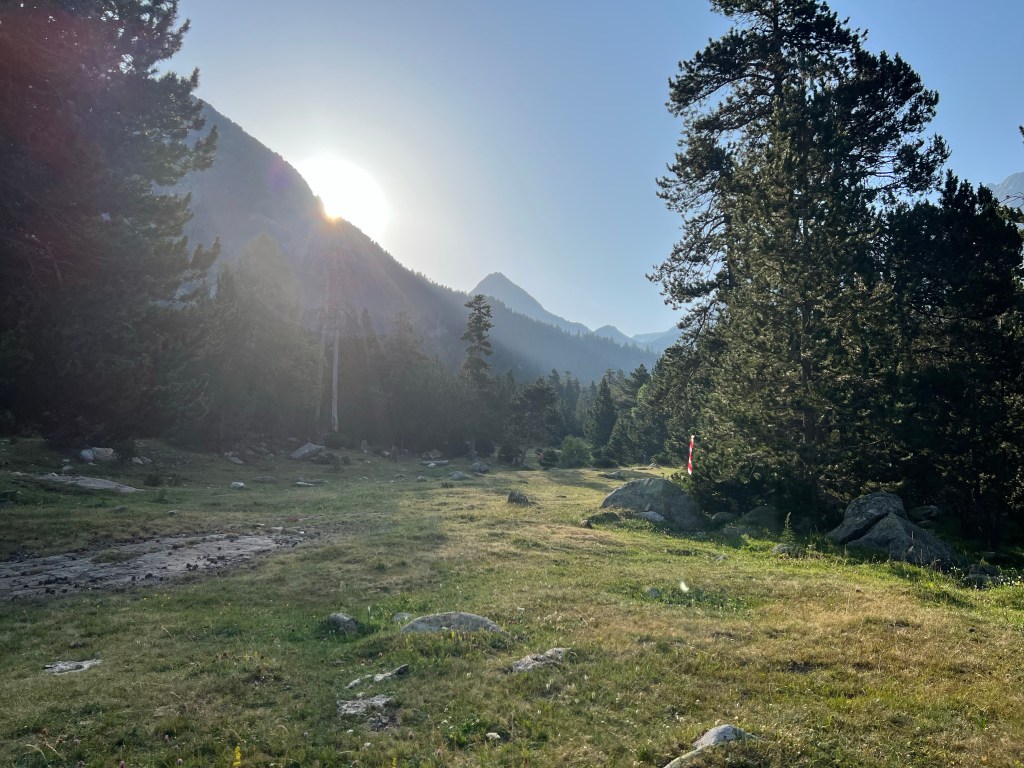
cute TER from Pau There I change to a bus and a short hour later I get out at the border station of Somport (1630m asl), and walk into Spain – and thick fog.

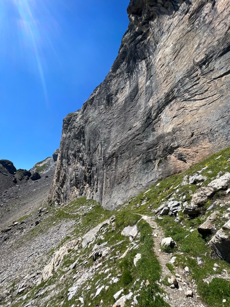
Somport But literally 10minutes’ walk later the sun breaks through and I finally get to see the mountains: they’re gorgeous!
Not so nice: the ski resort of Astun…

Astun But they do have even a proper sized ski jump; looking forward to eventually see Spanish skijumpers in the worldcup! 😉

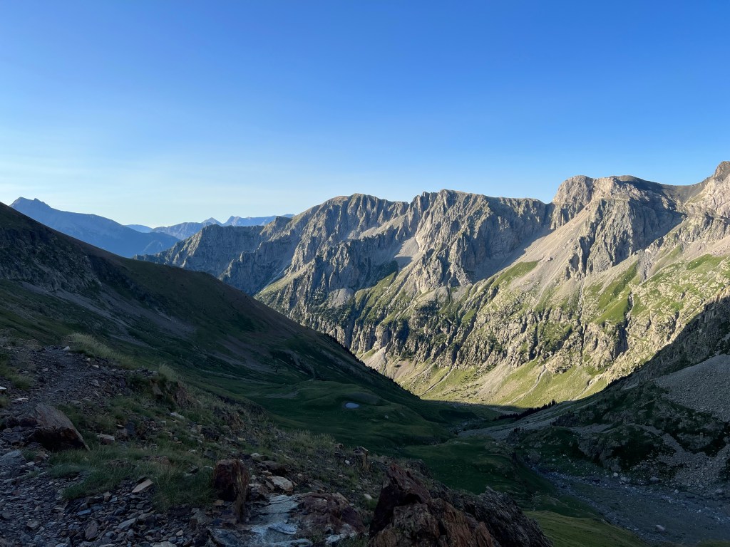
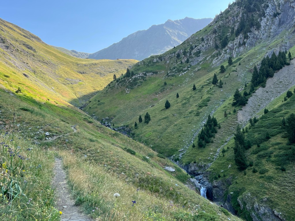
ski jump at Astun ski resort I make my way up and up and up past a nice lake and then across Col de Moines at 2168m, where I cross back into France.
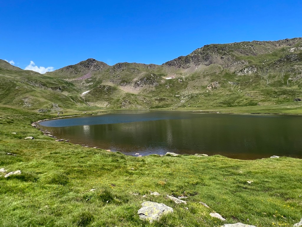
Ibón de Escalar 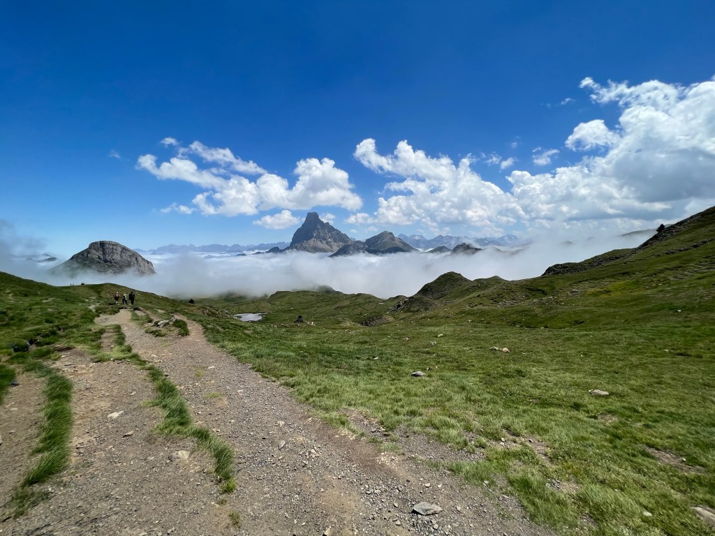
view onwards from near Col de Moines I take my chances to greet the people I meet with alternatively ‘¡Hola!’ or ‘Bonjour!’, and get it wrong more than 50% of the time.
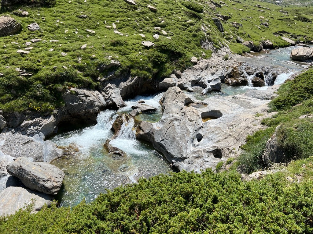
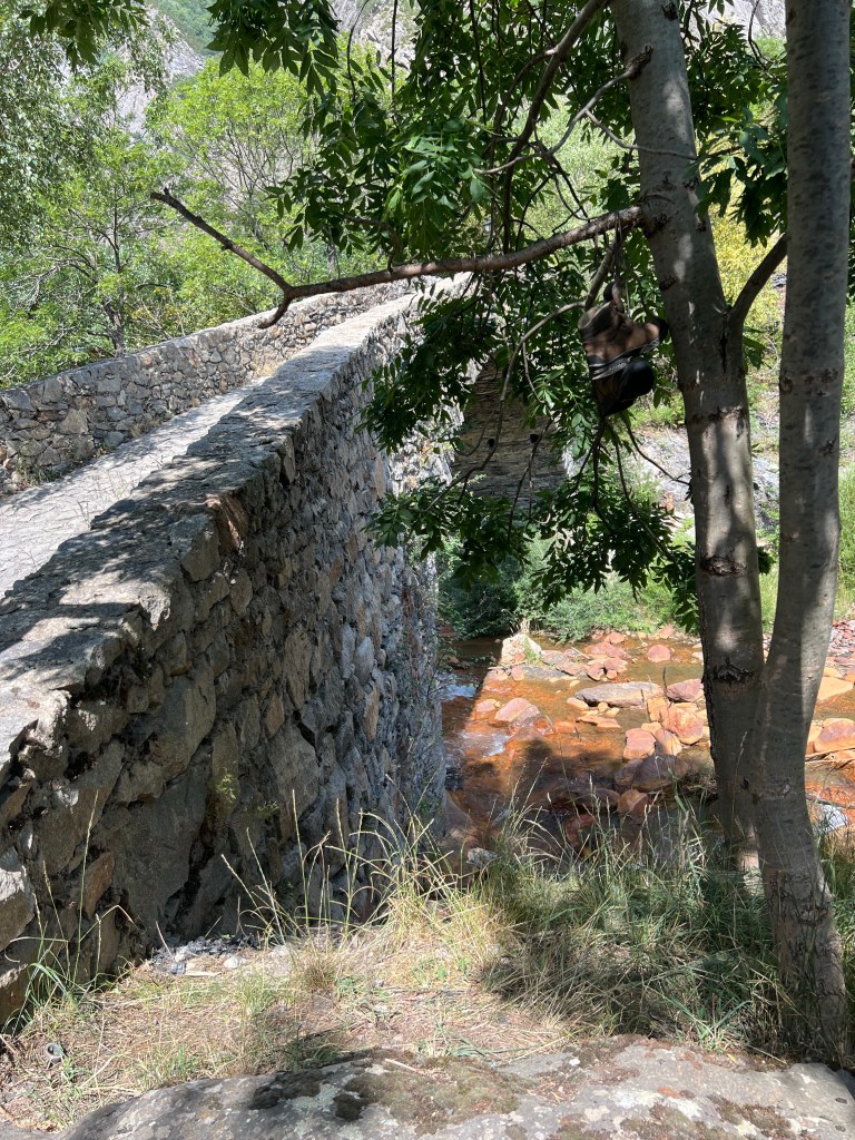
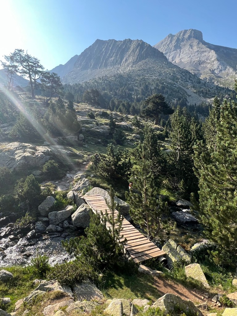
…very popular shit… I stop by another lake, Lac Castérau, for lunch, before I’m heading lower down into the next valley of the river Gave de Biou, which I cross by bridge.

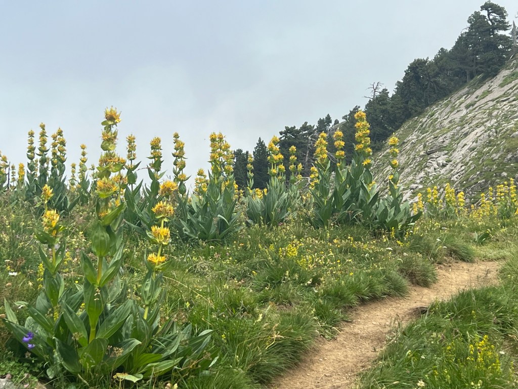
bridge over Gave de Biou From there it’s upwards again, past some lovely huge flowers, and the fog is slowly coming back.
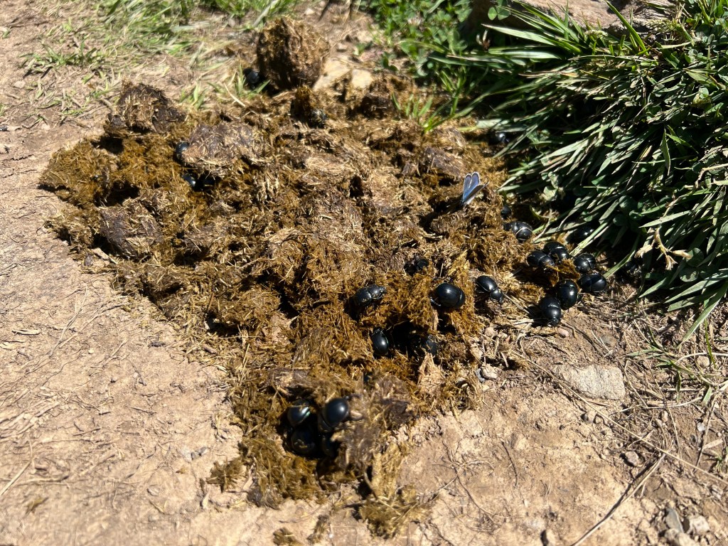
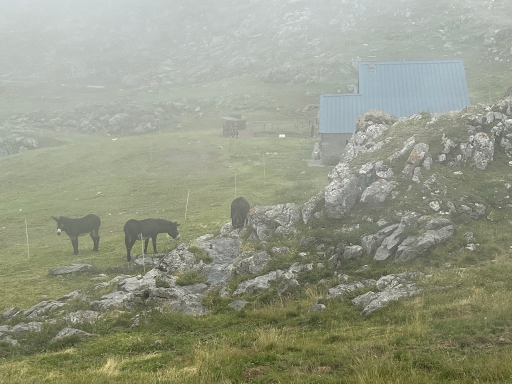
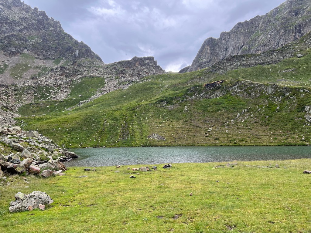
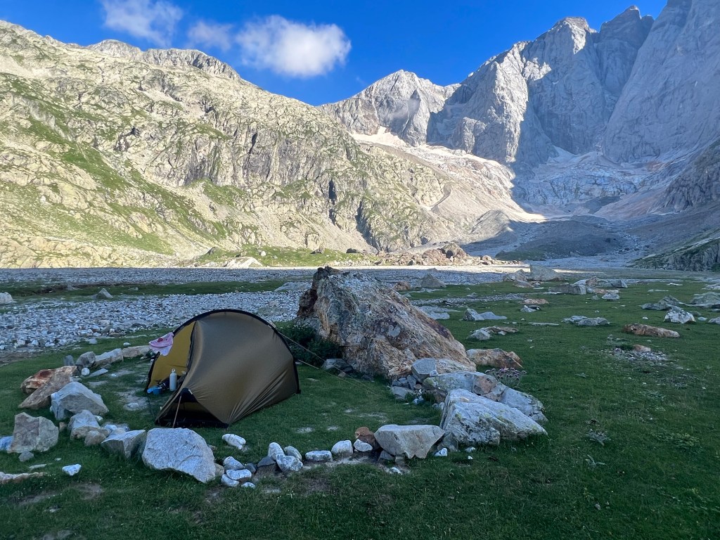
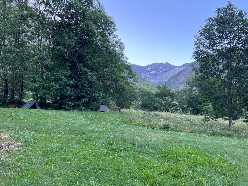
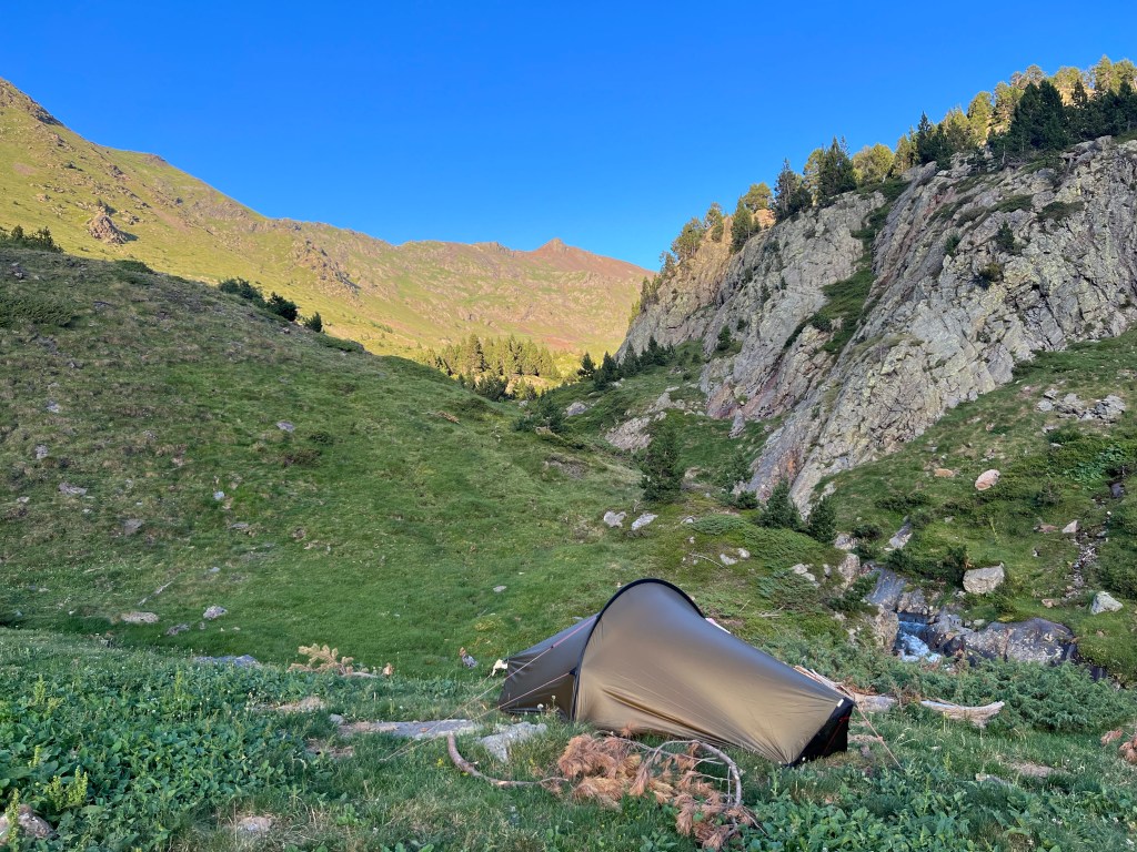
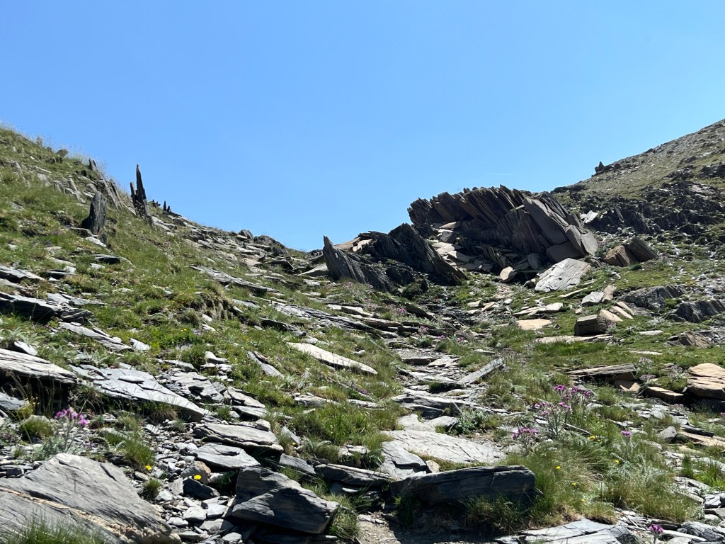
Eventually I pass Cabane de Peyreguet, but I don’t buy any cheese, just say ‘hi’ to the mules(?). A little further I meet the berger/shepherd with another pack-mule coming up from the valley. He tells me – in French only – that just half an hour on there is a great spot for bivouacing by Lac du Peyreguet (2080m asl).
pack-mules(?) at Cabane de Peyreguet And he is right… once I’ve found the lake in the fog and escaped about a million sheep stampede-ing.
‘attack’ of the sheep Then it got too foggy to take more pictures, but I met a danish-english couple that also camped near me. Had a chat and then went to sleep.
approx. 5,5h incl. breaks;
11,6km, 1000m ascent, 550m descent
- PYRENEES – DAY 02
From Lac du Peyreguet to Refuge d’ Arrémoulit
22-07-06
Woke up around 5:30 from distant thunders, turned around and slept some more. Woke from my alarm at 7, and now it’s raining and the thunderstorm is nearer – can even see some lightning. But I feel pretty safe with some higher rocks and hills just next to my tent and the storm doesn’t seem to come nearer than about 3km (judging by counting the elephants between lightning and thunder). So I just take it slow and bend the bivouacing rule, that only permits it until 9am.
packed up campsite with distant thunderclouds Around 10 it’s clearing up a bit, so I decide to pack up and leave.
leaving from Lac du Peyreguet Just as I do the rain and distant thunder starts up again… but what can you do? Judging by the wind direction the dark clouds are moving away, so I take the risk and head up across two small cols towards Refuge de Pombie. By the time I arrive there, it has stopped raining again, so I just enjoy the ‘Alpenrosen’, have a look around and then head on down to make use of the dry spell.

alpenrosen and Refuge de Pombie I meet another big flock of calves and sheep with their herders and more mules. And soon I’m low enough to get emerged in a beautiful thick forest.

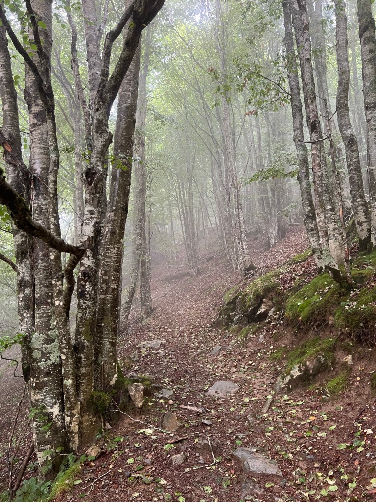
After crossing the river and a road (D934) at the valley bottom (about 1350m asl), I climb up steeply in a similar forest – now with more fog and occational rain again.
I have a lunch break sheltered by a huge rock by the private hut Québe d’ Arriou.

rock shelter by Québe d’ Arriou And the hike on over Col d’ Arriou at 2259m.

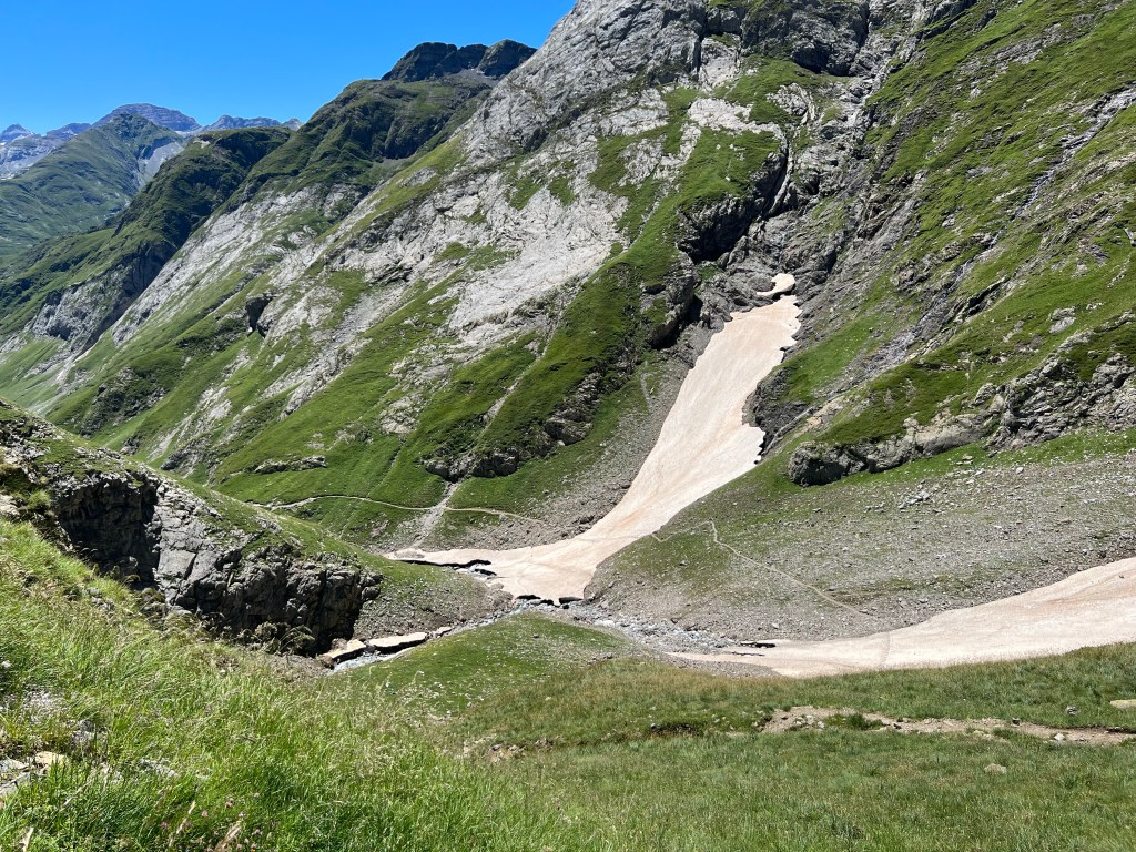
Col d’ Arriou I decide not to take the «vertigous and difficult» Passage d’ Orteig (in light that it’s propably wet and slippery, and there’s no view anyway due to the fog), but rather opt for descending 200m and then climbing again, to reach Lac d’ Arrémoulit (2270m asl).
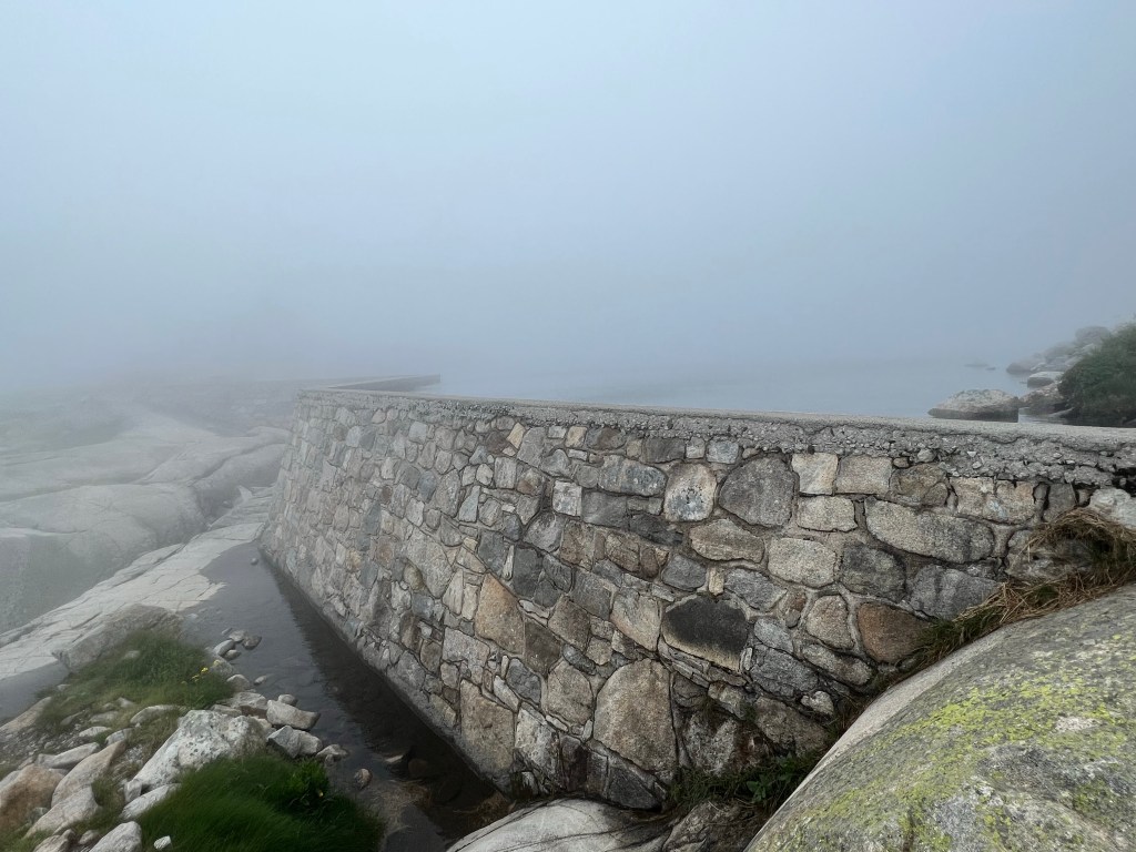
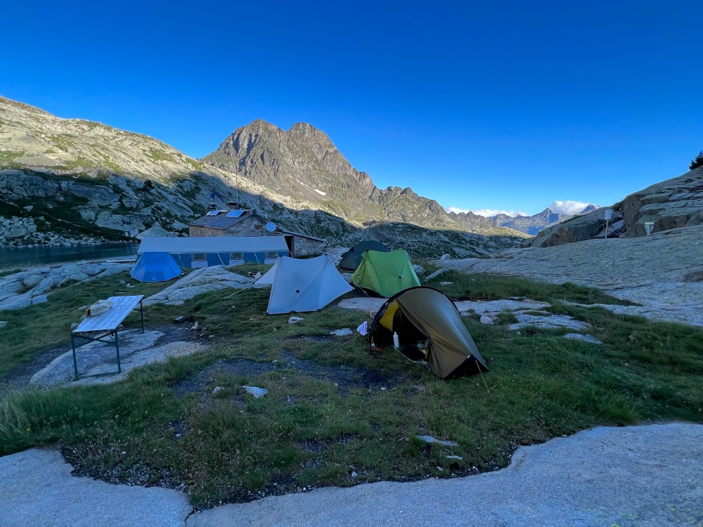
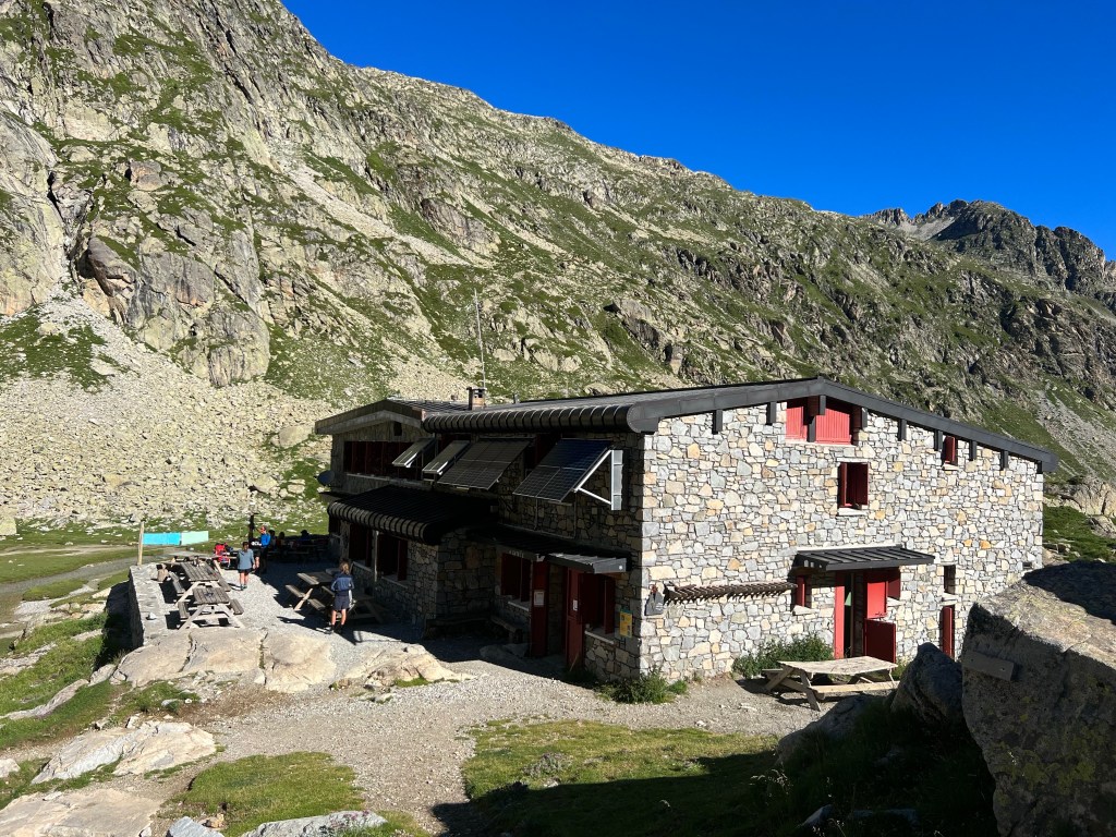
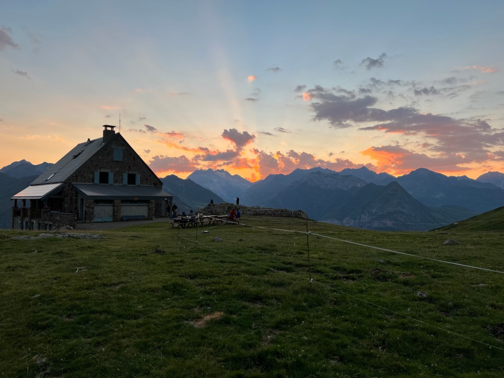
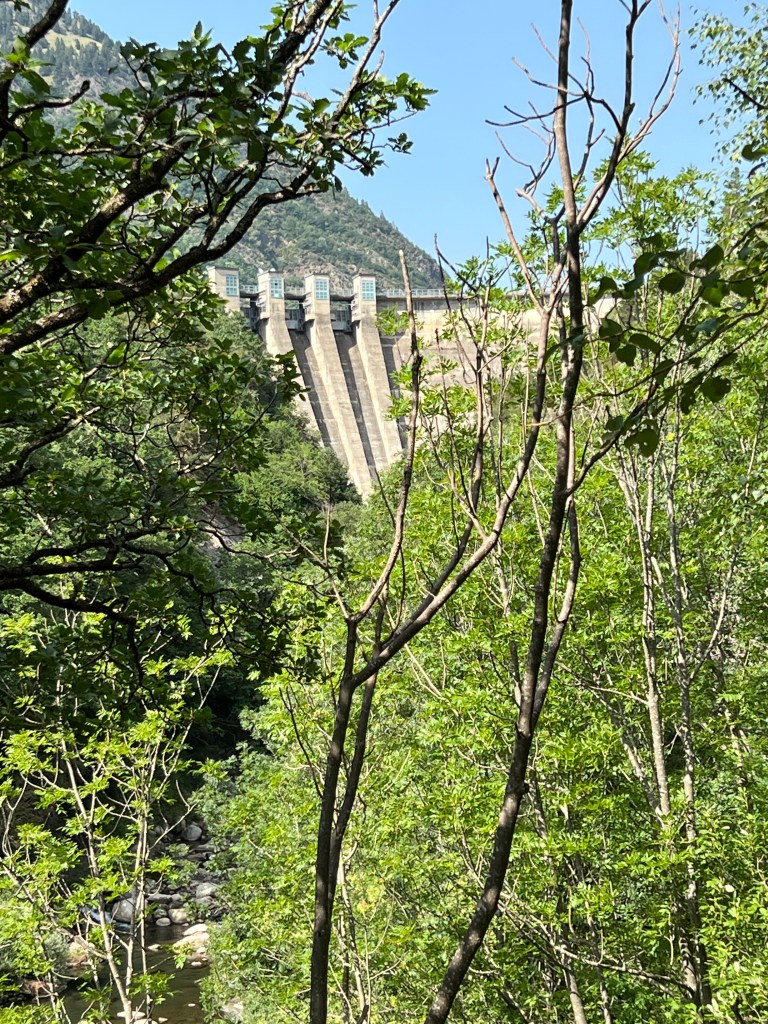
dam of Lac d’ Arrémoulit In the Refuge d’ Arrémoulit I not only get advice on a camp spot (just behind the hut is the only reasonably flat and dry spot of grass), info on the route (no snow left on tomorow’s col – yeah!) and the weather (sun, sun, sun from tomorrow morning), but also a lovely local bio-beer: Sarriat.

Sarriat beer at Refuge d’ Arrémoulit After having put up my tent I get invited by my tent neighbours (that I already met and spoke to earlier down the trail) to their mushroom soup (that they could’t finish) – mmh, free calories 😉
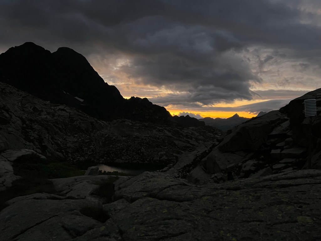
sunset promising nicer weather(?) approx. 6,5h incl. breaks;
16,4km, 1315m ascent, 1130m descent
- PYRENEES – DAY 03
From Refuge d’ Arrémoulit to near Refuge Wallon
22-07-07
I have quite a good night’s sleep, although it’s a bit windy and I wake up several times from my and my neighbous’ tents flapping. But the morning view with blue sky and sun rising into the bowl of Lac d’ Arrémoulit totally makes up for it.
sunrise at Refuge d’ Arrémoulit 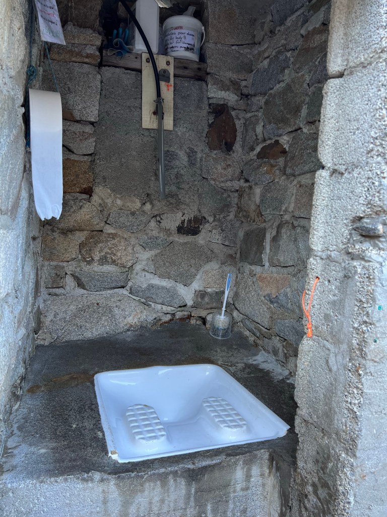
super functional toilet facilities at Refuge d’ Arrémoulit I run through my morning routine and quickly break camp; then start climbing steeply almost right away.

view back towards Lac d’ Arrémoulit Not long before I reach Col d’ Arrémoulit (2448m asl) and once more cross over and even more steeply down into Spain.
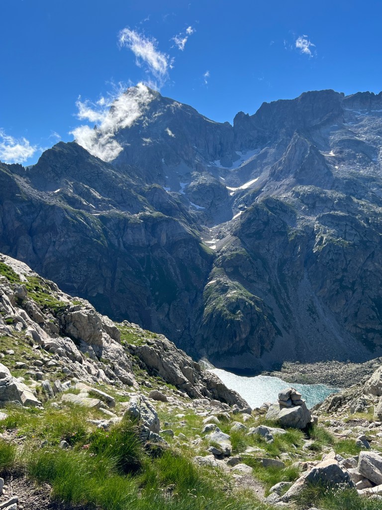
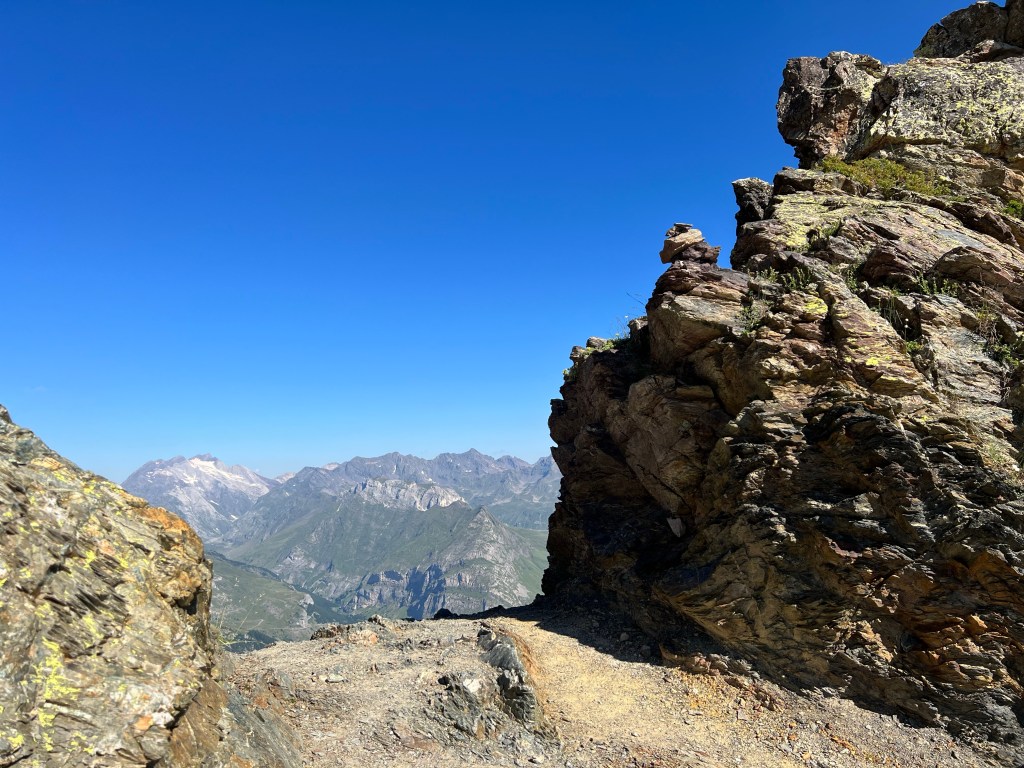
view onwards from Col d’ Arrémoulit But it’s a good path and no problem; soon I’m down at beautiful Ibon de Arriel Alto.

Ibon de Arriel Alto The path snakes along some more lakes, and then along the mountainside.

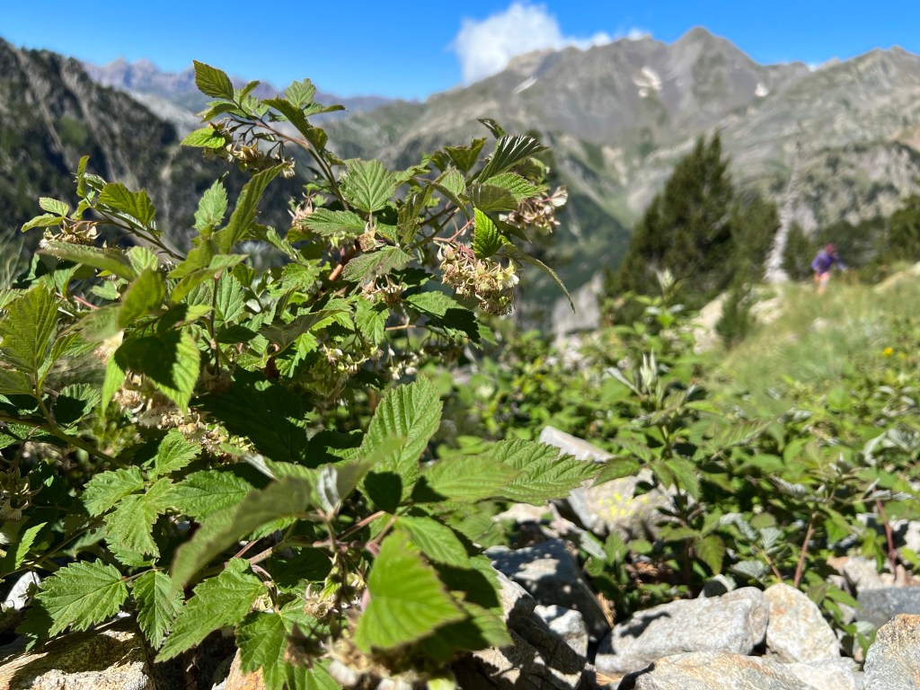
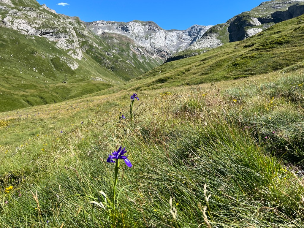
There are -again- beautiful flowers, some crooked pine trees, and a lot of not-ready-to-eat-yet rasberries; and gorgeous views all around.
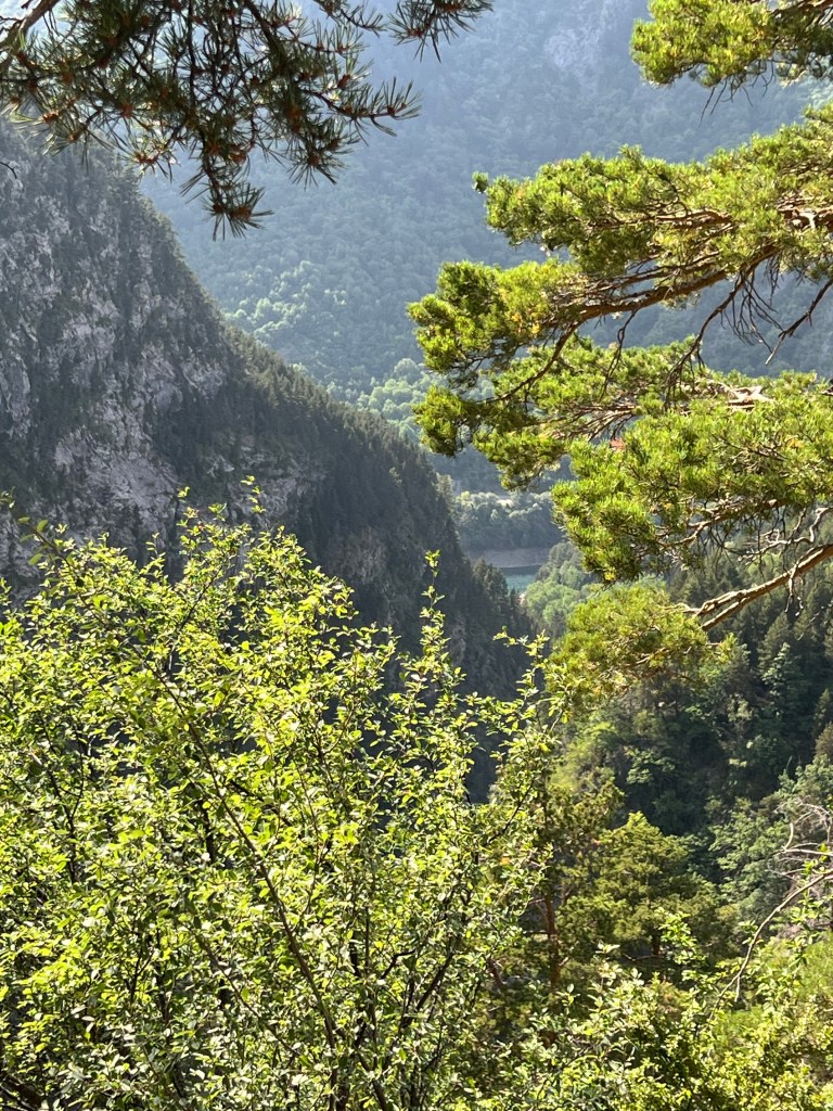
views and rasberries Before long I can see the reservoir Embalse de Respomuse in the distance.
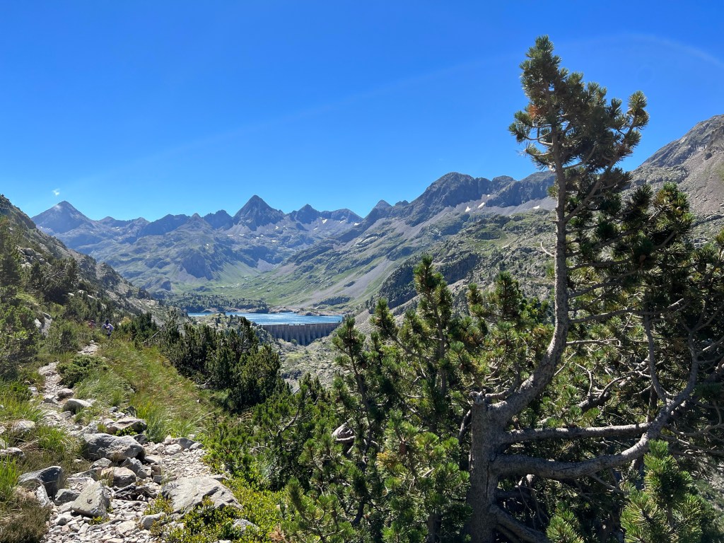
Embalse de Respomuse in the distance Pretty much exactly at 12 o’clock I reach the reservoir and have a lunch break in sight of the Refugio de Respomuso.
Just as I pass by the refuge a guardia civil helicopter comes in and lands (at second try 😉 – not sure if they’re guarding the border, or having a training flight to enjoy some windy mountain air and visit the refuge staff?
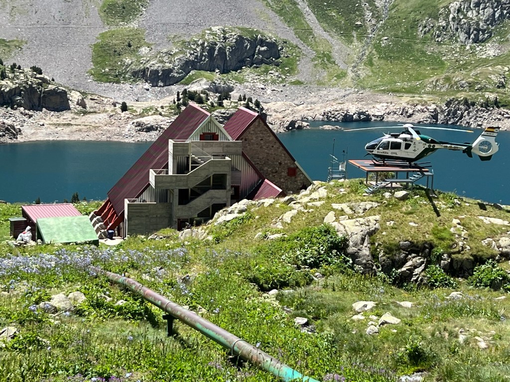
Refugio de Respomuso My path takes me further up the valley across a beautiful flat meadow, and then up along a canyon.

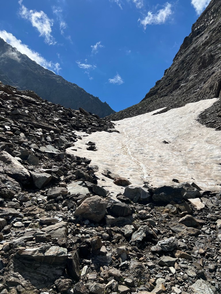
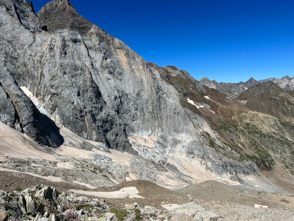
Campo Plano It gets steeper and I get higher and higher. Finally I get to the lake almost at the top, and there is a semi-sketchy snow field to cross… I hesitate for a moment and consider to walk around the other side of the lake instead, but the snow is soft and great for making stable steps, so I risk it; and all is fine.

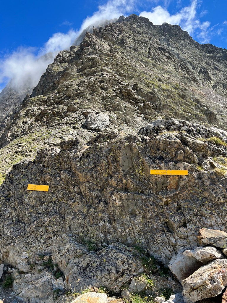
snow field above Ibones de ra Facha Then there is a last push up to Col de la Fâche (or ‘La Facha’) at about 2660m asl, and back into France.
Col de la Fâche After a short, well earned break, it’s a loooong descent down…
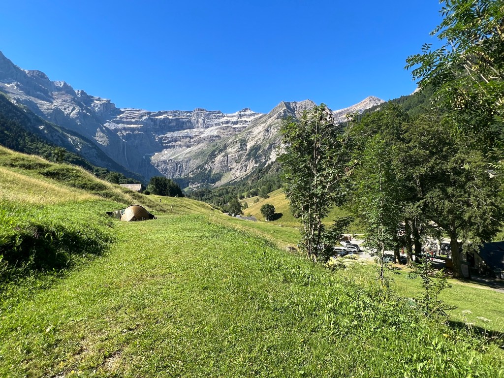
having fun with a snowslide on the way down I decide to camp before I reach Refuge Wallon (1865m) – about 15mins walk upstream there seems to be a really nice windsheltered spot, with no cattle – at least for now.

campsite near Refuge Wallon approx. 8,5h incl. long breaks;
15,7km, 925m ascent, 1245m descent
- PYRENEES – DAY 04
From near Refuge Wallon to Refuge des Oulettes de Gaube
22-07-08
No cow-attack during the night, just super restful sleep due to the river’s constant noise. Wake up to totally clear sky again, and make my way to do some sightseeing of Refuge Wallon and the nearby Chapelle du Marcadau.

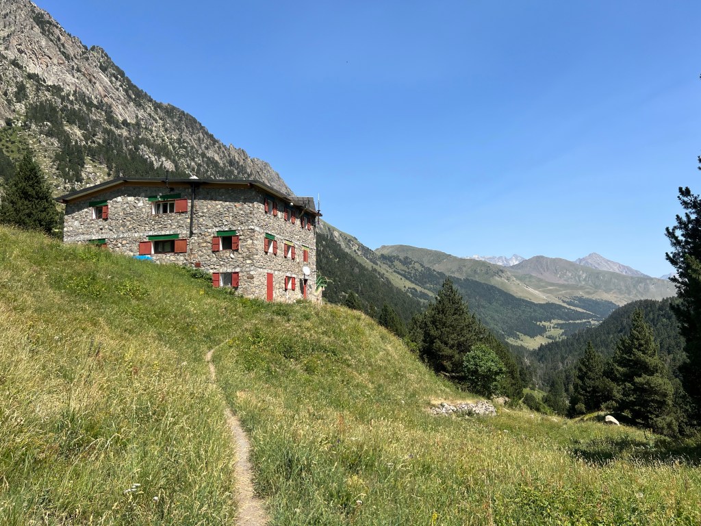
brand new Refuge Wallon The refuge is completely new and should have opened end of 2021… but still isn’t.
Chapelle du Marcadau Then it’s across the river and up the next valley, on a nice, constantly climbing path. It’s getting hot today!

bridge just before Lac d’Arratille After a while I reach Lac d’Arratille where I have my first break (second breakfast).

Lac d’Arratille Then it’s steeper and steeper up to Lac du Col d’Arratille, which is -as the name implies- just below Col d’Arratille (2528m asl).

Lac du Col d’Arratille From there I have another dip into Spain, starting with a bit of sketchy scrambling. But it’s not really dangerous and I manage to keep my surfacing fear of heights under control.
scrambling into Spain Along the scree mountainside, and then up back to France via Col des Mulets (2591m asl).
view back onto the scree traversing path From there it’s another quite steep scree slope down – but far less scary to me; and luckily there’s no snow left in the path.

view back up the scree slope of Col des Mulets That’s where I meet a flock of what I believe to be izards; not that shy, but stupidly running down along the path some 10meters in front of me, instead of heading out to the side and letting ‘dangerous’ me pass…

izards – pyrenean mountain goats (?) After some toe-hurting downward zig-zags I arrive in the basin of the Gave des Oulettes de Gaube and Refuge des Oulettes de Gaube.

glacier and Gave des Oulettes de Gaube It’s 3 o’clock and I finally have my proper lunch break, and check the map and my spreadsheet for the plan. That’s when I realise that I’m actually a day ahead of schedule! And the 700 or so meters up in baking afternoon sun to the next refuge and it’s poor bivouac site does not look too enticing… also it’s really nice to chill in the sun by the river; and there is some phantastic bivouac spots! And I should still be able to make it to Gavarnie by tomorrow evening (that is: according to plan). So, the decision is easy: I stay here for the night and call it a ‘rest’ day 😉
camp near Refuge des Oulettes de Gaube. approx. 5,5h incl. breaks;
9,96km, 880m ascent, 660m descent
- PYRENEES – DAY 05
From Refuge des Oulettes de Gaube to Gavarnie
22-07-09
It’s another lovely sunny morning, and by the time I leave the tent almost all of the other 10-12 tents in the area are gone… early starters to reach the summit of Petit Vignemale I assume.
Refuge des Oulettes Anyway, for me it’s just passing by the refuge for a toilet break, and then slowly but steadily uphill on the clear serpentine path. Luckily it’s mostly in shadow for now!

looking back down at the serpentines I meet some sheep in the latest fashion haircut – an extreme undercut (or ‘Ola-uku’ as I like to call it 😉 Seems like the is an alltime favourite, I meet several similar ones over the next days.

ola-uku sheep Finally I reach Hourquette d’Ossoue (2734m) where all the ‘summiteers’ have left their big bags.
view back down from Hourquette d’Ossoue I just have a short break, then head on towards the Refuge de Bayssellance.
Refuge de Bayssellance From the refuge it’s more steeply down, but still a good wide path. Have a stop to explore the Grottes Bellevue.

entrance to one of the Grottes Bellevue Then it’s more down down down and knee-aching down. Almost at the bottom there is first a slightly sketchy skrambing bit along the cliffs to the canyony river, that gave me a fright when seen from above but really is no problem; then there is 2 smaller snow fields to cross: supersoft, almost slippery wet, but also no problem.
crossing snow fields 
down, down along the river Ruisseau des Oulettes But after finally having reached the flats of the Barage d’ Ossoue, I’m done… the heat and the exertion of the past days is getting to me. I have a long late lunch break under the bridge – the only place there’s shadow!

under the bridge over the Ruisseau des Oulettes Being refreshed from a foot bath in the cool river and fed, I press on; still about half of today’s distance to Gavarnie left (but luckily more flat). It’s a lovely winding path across pastures and past several Cabanes – but I can hardly enjoy it because I’m so tired.
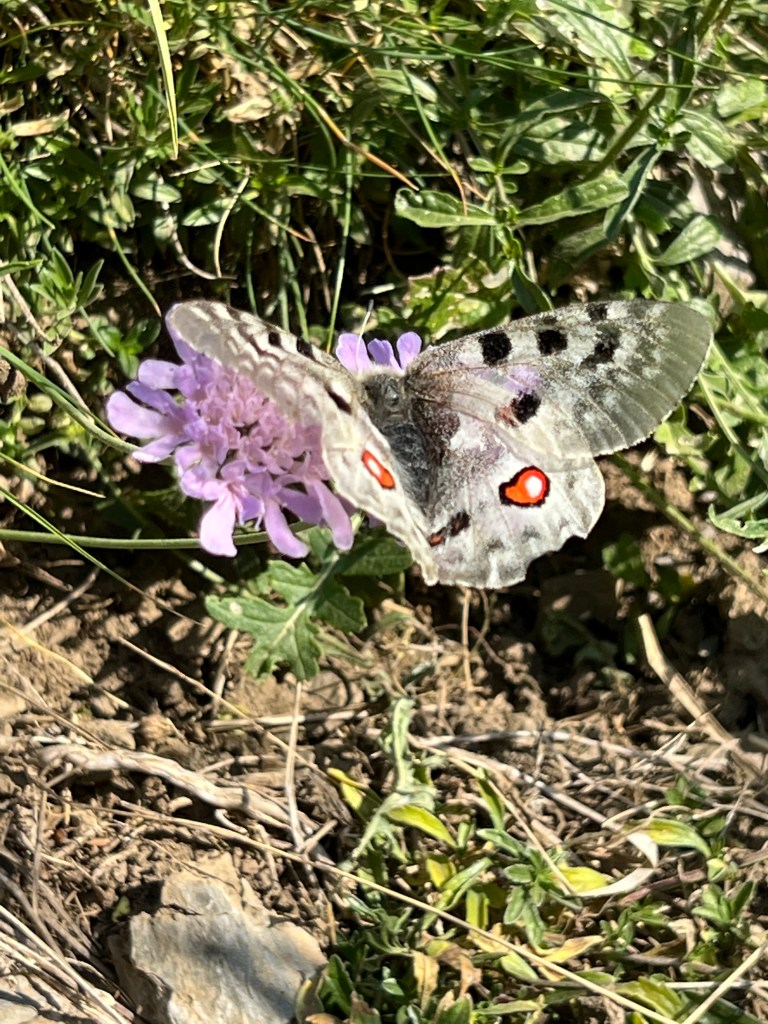
pastures between Cabane de Lourdes and Cabane de Sausse Dessus I have another break by another little river; consider a full swim (but can’t be asked.. too tired), so it’s just footbath, chocolate and watching butterflies for a while.
friendly butterfly Then I press on once more.

endless path And just when I start considering to put up my tent just here and now, I spot another hiker in front of me… so I motivate myself with a little catch-up game; and the thought of a cold coke/beer and internet in Gavarnie. But the trail is endless…

Cabane de Tousaus Finally I catch up with the nice french hiker and we chat while hiking down the last half an hour to Refuge Chalet La Grange de Holle. Then I continue alone another 20mins into Gavarnie, where I just reach the supermarket before closing at 8. Loaded up with my rewards: coke, fanta, beer AND chips – I finally make it to the campsite La Bergerie.
campsite in the ‘mountain goat area’ Very friendly english speaking staff, a hot shower, and a chance to wash clothes.
After what feels like an endlessly long day, I fall asleep pretty exhausted.

moon rising above the sunset in the Cirque the Gavarnie (view from the campsite) approx. 10h incl. all/long breaks;
22,4km, 980m ascent, 1740m descent
- PYRENEES – DAY 06
Rest day in Gavarnie
22-07-10
After the last days’ heat and exhaution, I still feel quite bad in the morning, so I decide to have a proper rest day:
Let my clothes dry and air out, plan ahead and resupply on food, and another few ‘administrational tasks’ (like booking train tickets and paying bills) that require internet.
relaxing in the camping ground Unfortunately it’s again so hot that I don’t have a proper appetite… but I ‘force down’ some actually delicious local cheese and baguette.
Otherwise it’s just laying in the shade and relax, let the body heal itself. 🙂
- PYRENEES – DAY 07
From Gavarnie to Refuge des Espuguette
22-07-11
One might think after a rest day one is rested… but…
I start the day slow; check-out from the campsite is at 11, so I let my tent dry out (that’s the main reason, yes 😉 and then ramble into town to get some more bread and cheese from the shop.
On my way back out I meet the english-danish couple again and we traid stories for a while.
Then I slowly make my way out of Gavarnie and towards the famous Cirque (a half cicle of steep rock cliffs and a very high – the ‘world’s highest’ – waterfall. I share the wide gravel path with millions of day tourists and hordes of rent-for-the-day mules and horses with their riders. It’s already very hot, so I have a long rest in the shade already after 45mins or so.
Finally I arrive at the Hotel du Cirque et de la Cascade.
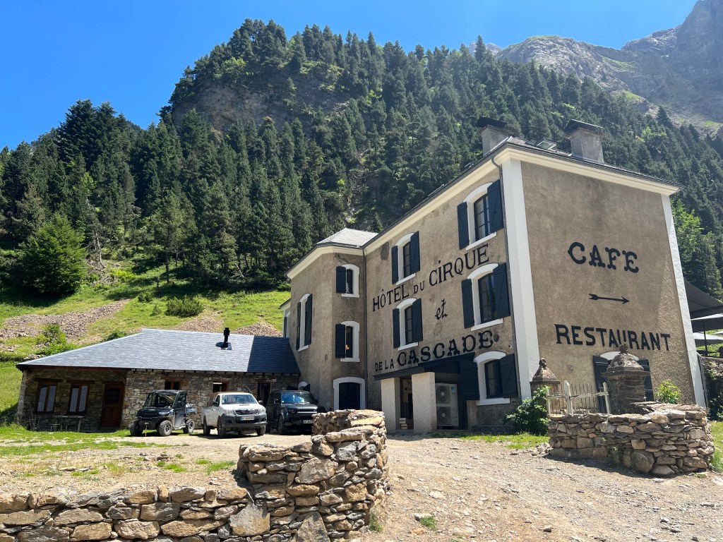
Hotel du Cirque et de la Cascade, Gavarnie After topping up my water, I have a quick look around, and head straight on a lovely, slowly climbing path up along the north-east side of the valley.
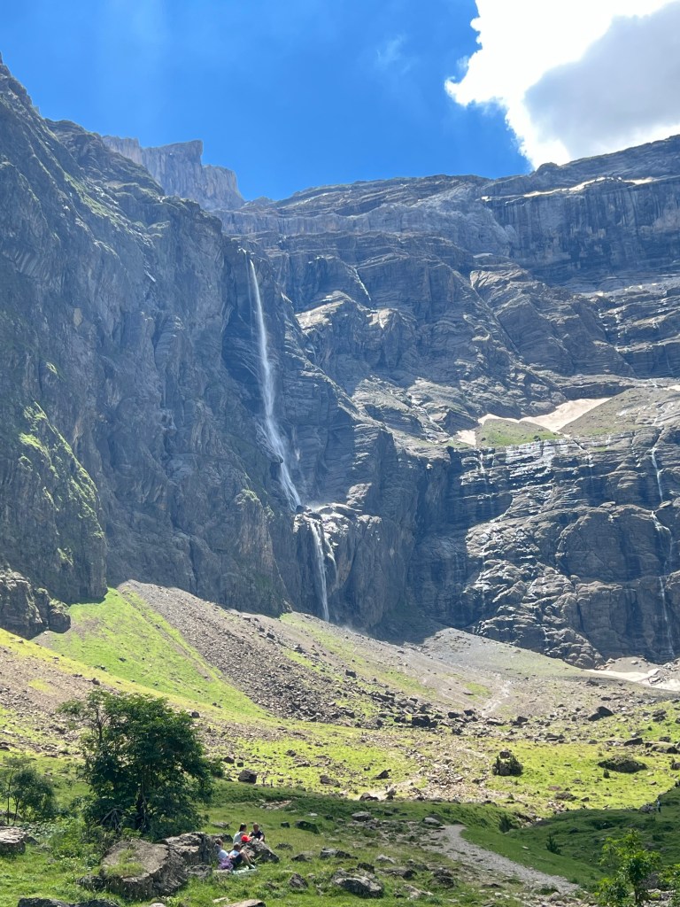
the famous waterfall: La Grande Cascade de Gavarnie Luckily there is quite a bit of shade from trees and the occational spray from small rivers dropping down from the cliffs that I walk along under.


After a while I’m at the first plateau by Chalet du Pailla at 1750m asl.

looking down onto Gavarnie from near Chalet du Pailla I have another long chill in the last shade of trees, and wait for the mid-afternoon heat to wear off a little before tackling the last climb over open meadows up to Refuge des Espuguettes at 2015m asl.
Refuge des Espuguettes And that’s enough for today, with the heat and a heavy backpack after the resupply of food in Gavarnie. I put up my tent together with some others in the Aire de bivouac just by the refuge, wash at the refuge’s nice and cool fountain, watch the sunset, and soon fall asleep to the sound of grazing sheep, cow and the refuge’s very curious and cute mules.

aire de bivouac at Refuge des Espuguettes 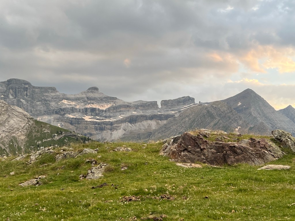
distant Breche de Roland – where I had originally planned to go approx. 3h (this time excluding all my endless breaks, otherwise it would be too embarassing);
7,1km, 700m ascent, 70m descent
- PYRENEES – DAY 08
From Refugio des Espuguettes to Héas (Camping Le Cairn)
22-07-12
I wake up around 6 or so to the bells and (panic-ing?) shouts of cattle. Then I turn around and sleep some more. In hindsight that was probably when the first hikers left and stirred up the sheep and cows, because when I finally have packed up and leave a bit after 9 o’clock, I’m almost the last hiker around.

sunrise seen from Refuge des Espuguettes But the hillside is still partly in shadow, and it makes for a nice climb up to the Hourquette d’ Alan (2430m asl).

towards Hourquette d’ Alan 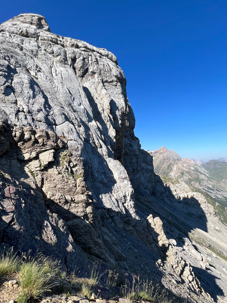
view back from Hourquette d’ Alan Still rested and cool, I press right on down a semi-steep zigg-zagging path into the next valley, the beautiful Cirque d’ Estaubé.
Hourquette d’ Alan Eventually the path flattens out as I reach the river. I have my first real break, cool my feet and eat, drink and rest.
Heading on the river gets nicer and nicer, with some polished stone ‘bathtubs’ (or ‘Gumpen’ as we call them back home ;). I regret having rested just earlier and not waited until here… might even have considered a swim. But now I consider (wrongly) it’s too soon after the last rest, so I just look and enjoy and take pictures, and hike on.
There is quite a lot of people around, obviously just having come up the short stretch from the parking lot to enjoy the cooler air and bathe in the river.
Before long I have reached and rounded the dammed lake of Lac des Gloriettes (also here the water level is really low), and stand in the parking lot.

overflow arrangement (?) in the dam of Lac des Gloriettes From there it gets a bit tedious and boring down serpentines of asphalt road with the occational car passing me. I do get an offer to hop on one of the cars for a ride down, but politely decline. Even though it’s not the nicest part, I do want to hike the full stretch of the section I have chosen to hike.
Finally down at the main valley, I have another break near the road crossing in the shade of some trees by the river. Try to eats some more, but the heat is not doing any favours to my appetite. So I mostly just read and relax and wait for the sun to get a bit lower and the afternoon breeze to pick up a bit.

visit from a butterfly 
leaving the shadow spot by the road crossing Then I tackle the last few kilometers on the road softly rising to Héas and the Auberge de la Munia.
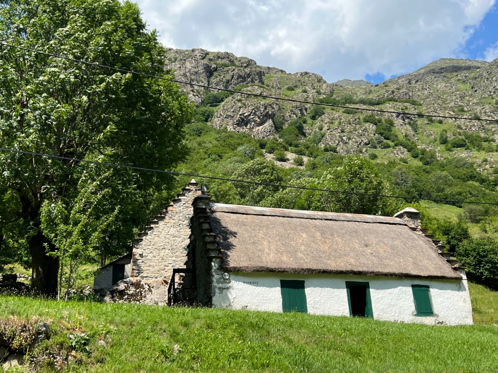
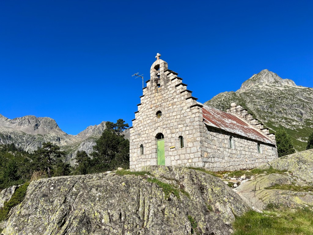
old farm houses along the road to Héas Arrived there I first have a look at the lovely little church Chapelle Notre-Dame. Both altare background murial and stained glass windows depict the scenery around – very fitting.
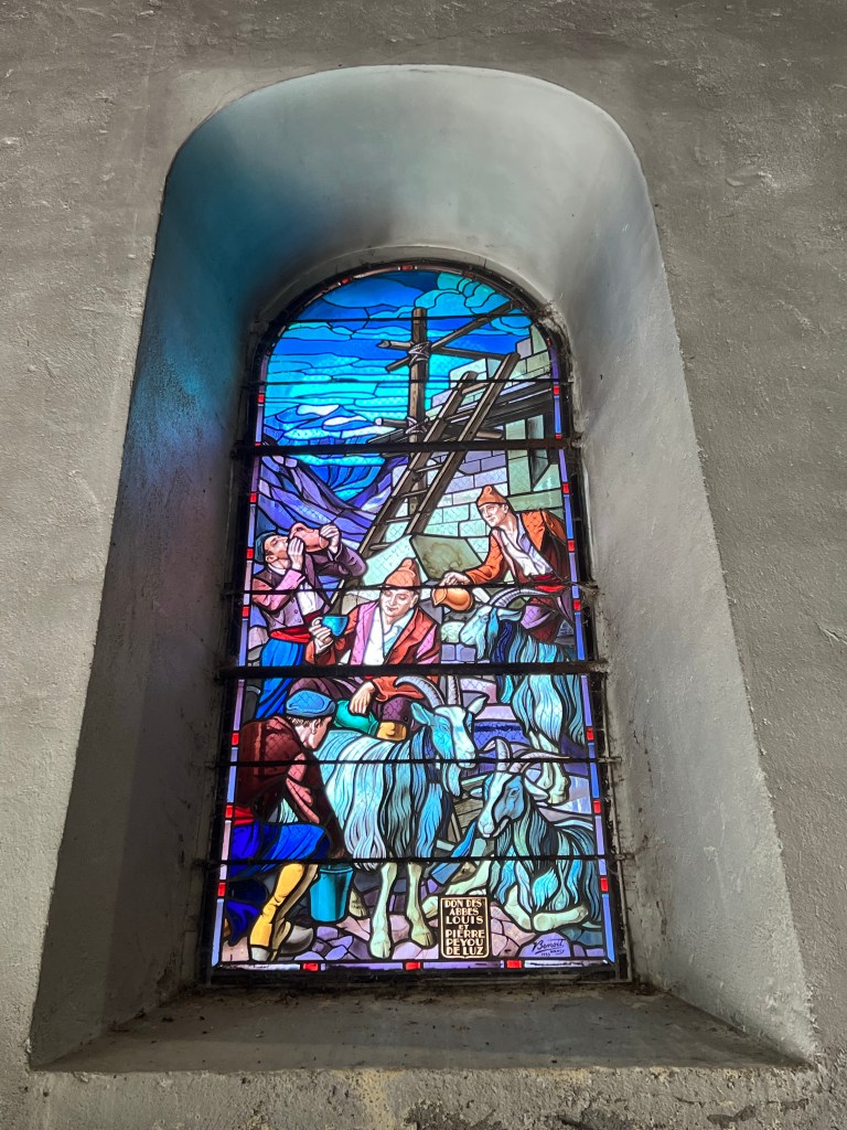
staines glass window at Chapelle Notre-Dame, Héas 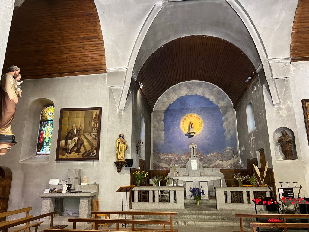
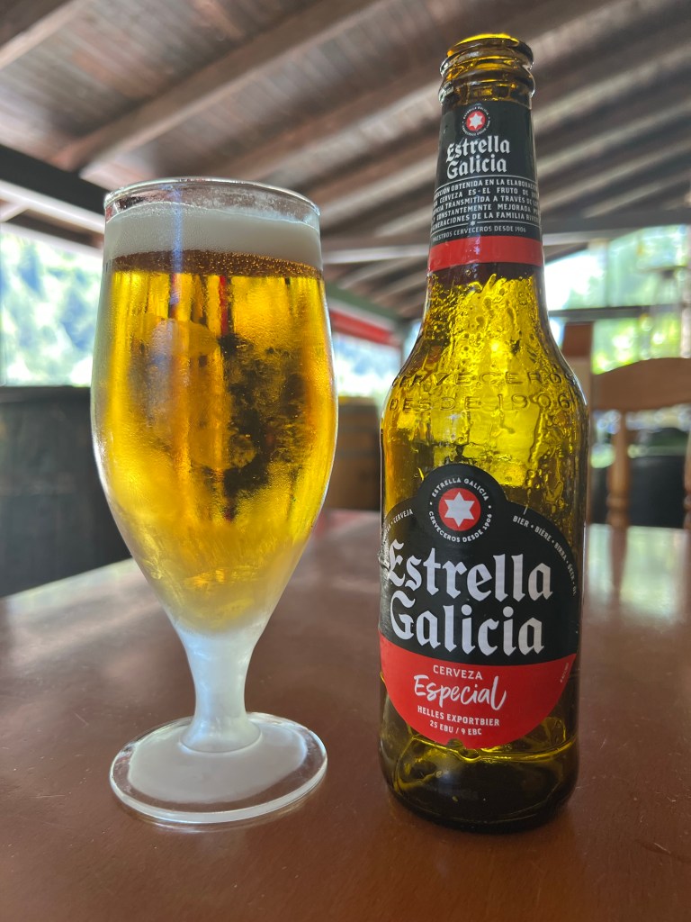
Chapelle Notre-Dame, Héas I refresh at the fountain in front of the church, and the some more with a beer (another local, bio one – Py Toy) and a big caraffe of water in the shady garden of the Auberge’s restaurant.

Auberge de la Munia and the ‘last bistro before Spain’… 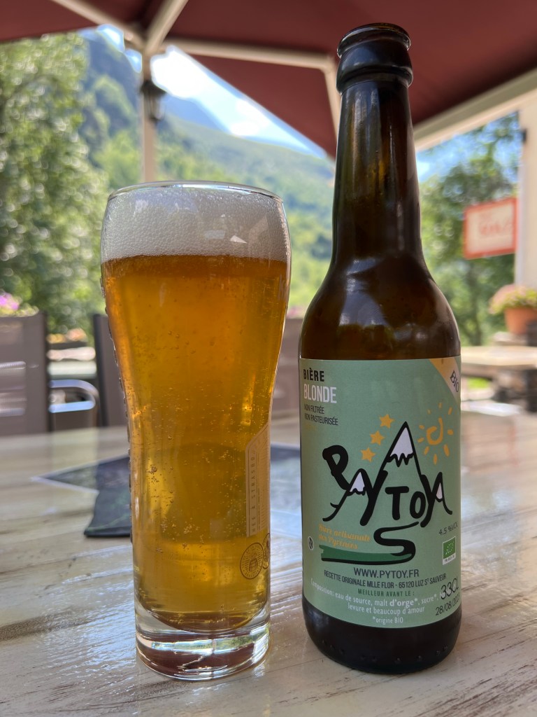
local bio Py Toy beer After having watched several people feast on Crêpes, I can’t resist, and also have a ‘La Poudrée’ (which surprisingly(?) comes with normal crystalized sugar).
Then I check in at the auberge’s campsite ‘ le Cairn’, put up my tent, shower (!!!!), eat some more, and quickly fall asleep.
approx. 8,5h incl. more long breaks;
14,5km, 530m ascent, 1030m descent
- PYRENEES – DAY 09
From Héas to Lacs de Barroude
22-07-13
Pretending to have learned from the last day(s), I aim to leave by 6:30 for the long climb of today (*insert laugh from those who know me*).
leaving the camp ground But by 10 past 7 I’m on my way and climbing the steep serpentines, as the sun is raising and bathing the opposite side of the valley in baking light.
impossible light, too big contrast to take photos I get caught up by a nice Irish person who I had aready seen the day before and on the camp site, and we get chatting as we slowly climb on.
With that mental diversion the next hundreds of meters of elevation pass like a breeze, and we -almost- rush past the last water source before the end of the day, by Cabane des Aguilous at 2285m asl.
So we re-descend for some meters and try to find where the river surfaces from underground. After having filled up our water to maximum carrying capacity, D. hikes on while I have a short snack break.

view back, with Vignemale and its glacier in the background Then I also tackle the final ascent to Hourquette de Héas (2608m asl) with some steep serpentines in part slippery scree slopes and partly along under rock faces; although not really dangerous, this is testing my fear of heights. Superglad I brought and switched into my proper hiking boots halfway up from the water point.
Glad at finally having reached the top of the pass, with its worn down but colourful Nepalese-style flags, I turn the last corner, and…

Hourquette de Héas NO WAY, I can’t do THIS!
The path continues along a smooth sloping rock face that drops into nothing, and then turns around a corner and disappears from view due to the steepness!
I -almost- panic, and decide to first just sit down in a safe spot on the warm rock, drink some water, check that I’m really on the right path (yes, I am), and take stock of options: I can turn around (although not looking forward to scramble down what I just fought my nerves to come up; that’s boring but possible) and hike on elsewhere; maybe hitchhike and take a bus to hop over some section?

panoramic views from the Hourquette Or -just maybe- I could do this, if it’s just this little short bit?? Having calmed down and gotten used to the situation from my ‘safe spot’, I manage to get myself to venture out (without the big backpack, just my little fanny pack and -of course- my Garmin mini, just in case) and millimeter by millimeter nudge along the rock those 10m until another ‘safe spot’ where the continuation of the path is visible… and: YES! this I CAN do: from here on it’s basically just steep scree slope with clear path and no further cliffs. So, I turn around, cross the ‘crux’ 10m once more (already a bit easier) to get my backpack. Then, still centimetre by centimetre and clinging on to the rock with my hands, but already a lot easier, I cross a third time, and then shout out (almost silently) in joy over my ‘achievement’ – I have done it!!
(And, just to get this right: in dry conditions I would not consider this little section really risky or technically too difficult; but completely freaking me out mentally.)

down into saver ‘fields’ From there it’s still slow and careful going, but without any further freaking out or problems; down a good part and then back up on the grassy slopes of the next pass – Hourquette de Chermentas (2439m asl).

Hourquette de Chermentas It’s only half past 12, I feel like I’ve done a full day’s hike already but am still not too tired, and there is glorious views all around – couldn’t feel better! (honestly, I’m probably still on an adrenaline high 😉
The path continues traversing more steep-ish slopes (nothing can stop me now, though).
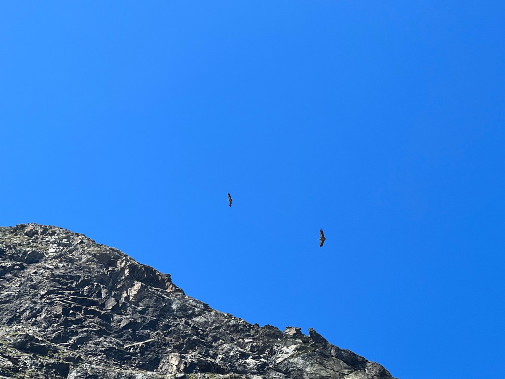
traversing I find a rare spot where some rocks provide shade and have a break, and watch a bunch of huge birds (eagles?) sailing in the afternoon uphill breeze. When they’re closer they sound like a small sailing airplane!
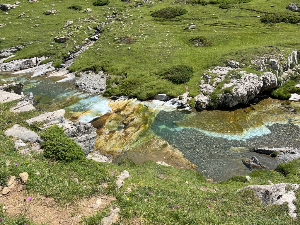
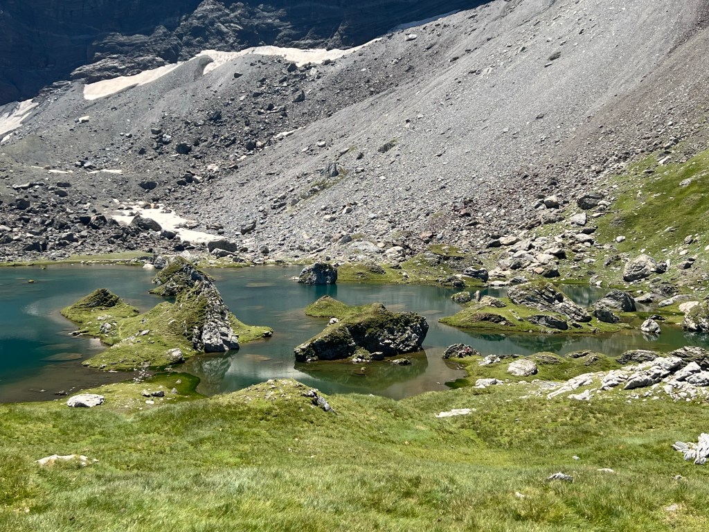
eagles (?) The the trail reaches a grassy plateau and I pass some smaller, stale lakes. And few hundred meters on I reach the magic Lac de Barroude: spotted with small rocks and islands and carved into by half-islands and rocks, it lays like fairytale-land under the tall cliffs and the Glacier de Barroude.
Lac de Barroude I drop my bag, undress and ‘jump’ into the lake (it’s too warm and all muddy ground that stirs up… so a bit of a downer); then spend the rest of the afternoon under my towel-and-hiking-poles shade contraption, read and watch the herders do their thing with their sheep on the other side of the lake.

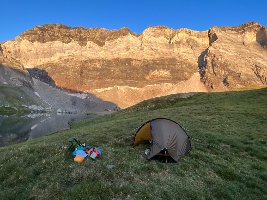
chill’n As sun is starting to disappear behind the rockface at 18:30, I find a tent spot by the outlet of the lake, have my well deserved and long awaited freeze dried mac’n’cheese, and go to sleep.

stepping stones across the outlet of the lake, near my bivouac-site approx. 7h incl. breaks;
13,6km, 1420m ascent, 570m descent
- PYRENEES – DAY 10
From Lacs de Barroude to Parzán …and on… to past Central di Urdiceto
22-07-14
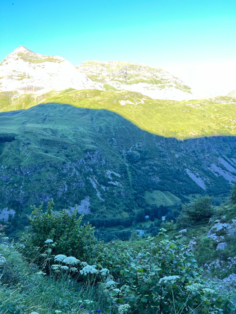
Sunrise across the Lacs de Barroude (approx. 2360m asl) is described as magic in the guide book… and it’s: nice. Maybe the sky is too clear, so no colouring of the light? Maybe I’m just not in the mood 😉
sunrise at Lac de Barroude I pack up my things while watching the sunlight’s line make its way down the cliffs and finally meet the lake, and enjoy the cool morning breeze.
Again, I manage to start early and am on the way just after 7, even though it’s just a short climb along some curious black gravel slopes (that remind me of the volcanic hills on the Canary Islands) up to Port de Barroude (2534m asl), where I cross into Spain one again.

black gravel slopes near Port de Barroude Then the long downhill starts.
view down into Circo de Barrosa and Plan de la Casa I have a short break, fill up my water and have a footbath in the cool river by Cabaña de Barrosa.
lovely meadows near Cabaña de Barrosa Then continue downhill as the path gets wider and smoother, and there are -luckily- more and more trees providing shade.

ruins of some probably mine-related structures Finally I end up at the road A-138 towards the Bielsa tunnel, and have to follow it down to Parzán in search for some beer, internet, electricity, and food (in that order). It’s faster and less gruel that anticipated; just a constant smooth downhill on a good wider road shoulder.

A-138 to Parzán Parzán is the typical border shopping town, with a gas station, far too big supermarkets and a couple of old houses tucked up the hill away from the road.
I spend a looong time the the lovely cool terrace of Restaurante La Pipeta, have some beer, good food, coffee, more beer and a lot of water while letting the mid-day heat pass, charge my power bank, update the blog and plan ahead.
at the terrace of Restaurante La Pipeta Maybe I can make myself to use the later afternoon to climb back up again, to continue right in nature tomorrow?
I’ve decided to follow the GR11 towards Hospital de Viella from here (and drop the reall challenging next sections of the HRP, in light of yesterday’s experience and the fact that time is running out to go up and then possibly having to turn around…)
Around 16:30 I feel like I can’t occupy space at the restaurant’s terrace any longer; and also it has gotten a bit cooler and a light breeze comes up, so I start back out.
On the way I stop at one of the large border shopping supermarkets to resupply. Here you can get all that you wish for: wine by the litre and haribo by the kilogramm.

shopping… 
…and more border shopping Not that good choice when it comes to backpacking-friendly food (i.e. light, calory-dense and easy & fast to cook)… but I find some stuff and am on the way.
climbing up again, view back onto little Parzán The trail follows mainly a gravel road that goes up to Urdiceto power station; so it’s a bit boring, but on the upside: not too steep and there is still plenty of trees for shadow.

Central di Urdiceto After the power station there is kind of a flat-ish plateau in the terrain, so I start looking for some ‘stealth’ bivouac-site and quickly decide on a spot next to the river.
bivouac-site a bit past the lake of Central di Urdiceto It’s late, so it’s just a short dip in the river to wash off the sweat, food, and the sleep.
approx. 4,5h incl. breaks to Parzán;
15,4km, 170m ascent, 1420m descent (to Parzán)
.
plus: approx. 3,5h incl. some shorter breaks;
9km, 875m ascent, 0m descent
- PYRENEES – DAY 11
From past Central di Urdiceto to Camping El Forcallo
22-07-15
I wake up to another cloudless blue sky with glowing morning sunlight on the mountainside.
Although I ‘have to be’ up early-ish again, I treat myself a little extra and take time for leasurely coffee&cake before packing down.

happy birthday to me! Then it’s further up along the gravel road, which continues to the upper reservoir lake.
leaving the bivouac-site I take the steep shortcutting footpath, and quickly arrive at Paso de los Caballos (2350m asl), where I finally can leave the gravel road.
Just a couple of meters past the ‘paso’ there is a little refugio; I have a quick look around and then quickly head on.

Refugio del Paso de los Caballos Then it’s softly downwards; this wasn’t too high a pass, so it’s all green grassland at first.

and on downwards And then more and more pine trees – the path is basically doing a slalom between them 😉

pine tree slalom After a while I get to the first river crossing. There is a good bridge, but I decide it’s time for the first bath of the day and some rest.
It’s nice and refreshing water, not too cold actually. And I snack on the lovely cheese I bought in Parzán, while drying up on the rocks next to the stream.

river bathing in Barranco Montarruegos After a while I manage to get going again; so nice to just chill in the half-shade by the river!
But there is kilometers to cover also today (although not that many, since I put in a good head-start yesterday evening).
The path takes me through more lovely meadows and lightly forested areas, further and further down towards the valley of Rio Cinqueta.
‘bridge’ Then it’s along the valley upstream for a short while, passing the children’s holiday camp of Virgen Blanca.

holiday camp of Virgen Blanca And before long I arrive at Camping El Forcallo, where I choose a nice spot under a cherry tree. (After having put up the tent, I worried for a moment it would all be covered in cherry splats and/or bird shit in the morning… but it ended up being fine.)
And I also get a cold beer in the campground’s cafeteria – mmh!
Camping El Forcallo It’s still only early afternoon, so I check out the nearby river for some more bathing and chilling (and washing my socks and underwear 😉 )
more river bathing, in a contributary to Rio Cinqueta, just by the campground And then it’s an early night for me, since I want to be up early again to beat the heat.
approx. 6h incl. long bathing break;
11,9km, 490m ascent, 895m descent
- PYRENEES – DAY 12
From Camping El Forcallo to Camping Ixeia
22-07-16
By 8:00 sharp I manage to have had some breakfast and packed down, ready to go. Not too bad I find 😉

packed down my tent from under the cherry tree It’s up some serpentines through the forest, and then out onto the meadows, past the Refugio de Biadós, and then past some old farm buildings, and into the sun.

into the morning sun at the ‘hamlet’ Bordas de Viadós There is loads of lizzards warming themselves in the morning sun; most of them are too shy and disappear before I can eaven reach for the camera. But this little fellow is either a bit bolder or didn’t realise me sneeking up on and ‘capturing’ him:
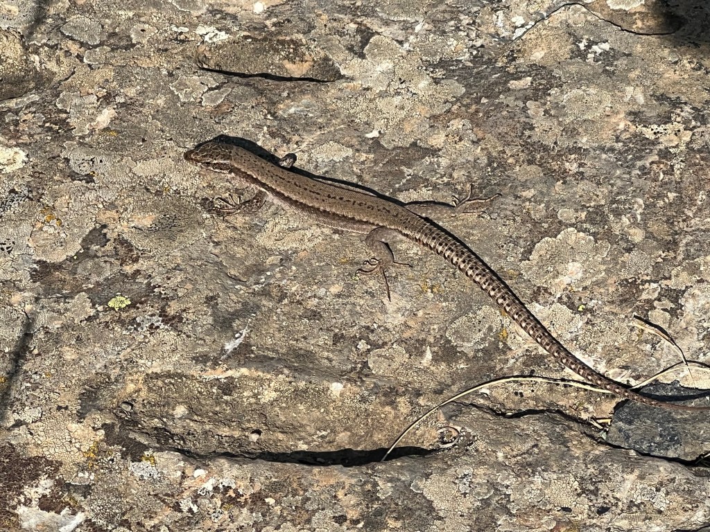
lizzard Having my view mostly down on the path, – well, to see where I’m stepping and to avoid the blinding sunlight – I suddenly realise there is a shoe-twin of mine just ahead on the trail! Fresh ‘footprints’… who might this be?!

shoe-twin ahead! The narrow footpath continues very nicely along the steep slope, high above the river, and up into the valley.
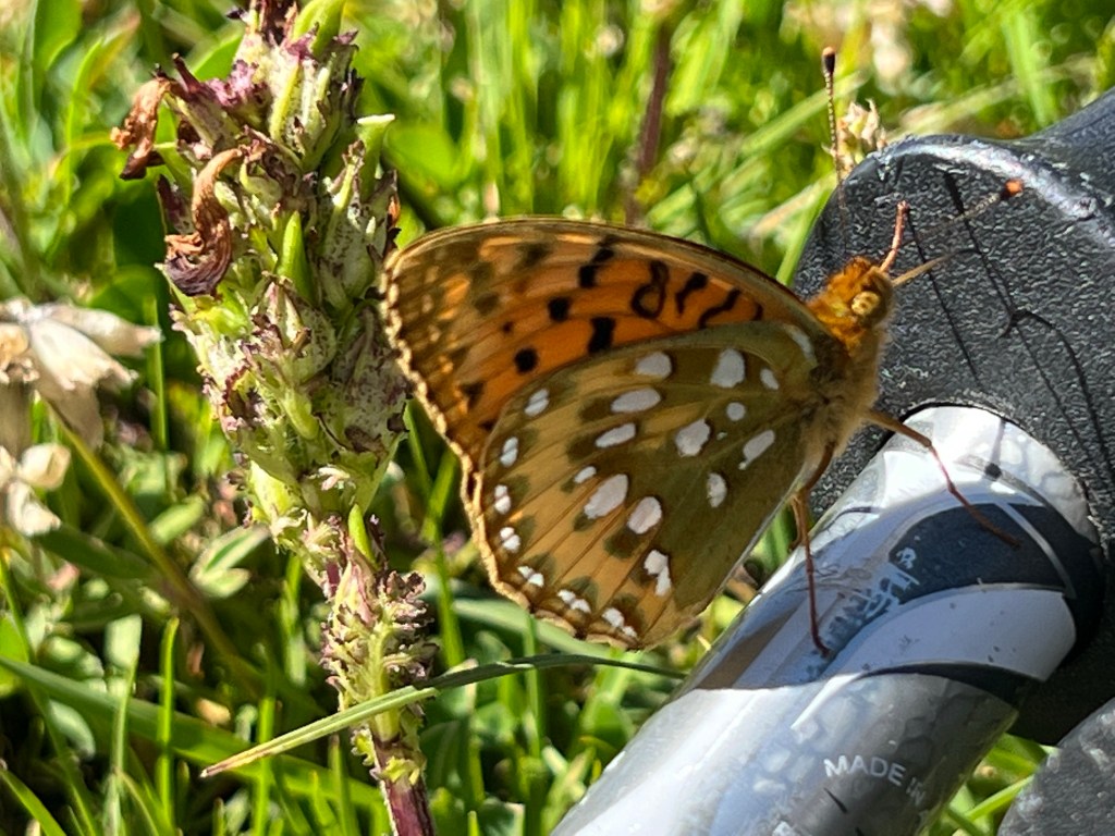
along the river Barranco de Añes Today seems to be me focussing on details, taking time to photograph more butterflies – just had to with this huge beauty!
huge, tame butterfly Then I reach the way split where I have to make the final decision whether to go for the GR11-variant, or to try my luck with continueing on the main HRP anyway… but my mind is set.
So, it’s crossing the river, avoiding this damaged / half-repaired bridge but using stepping stones, and heading up the valley towards east.

broken bridge at the turn-off point of GR11, a short bit after Cabaña de Añes Cruces Again the path gets steeper and stonier and after a while I reach the pass of Puerto de Chistau o de Estós.
up towards Puerto de Chistau o de Estós (2575m asl) From there it’s all downhill for most of the rest of the day.

view down into the valley of Rio Estos There is just a short, steep part with slippery scree; but no problem.

short steep scree part of the trail Then there is more on the wildlife front! I’ve been hearing the shrieks of marmots nearly every day. And also occationally seen them rushing off and disapearing into some hole in the ground. Now I finally manage to capture one with a photo; though only because they had a lame hind leg, so they were limping (I think).

marmot By around lunchtime it has gotten very hot again; and I was a bit low on bringing water up and over the pass – and the little streams, that were supposed to be there, are all dried up.
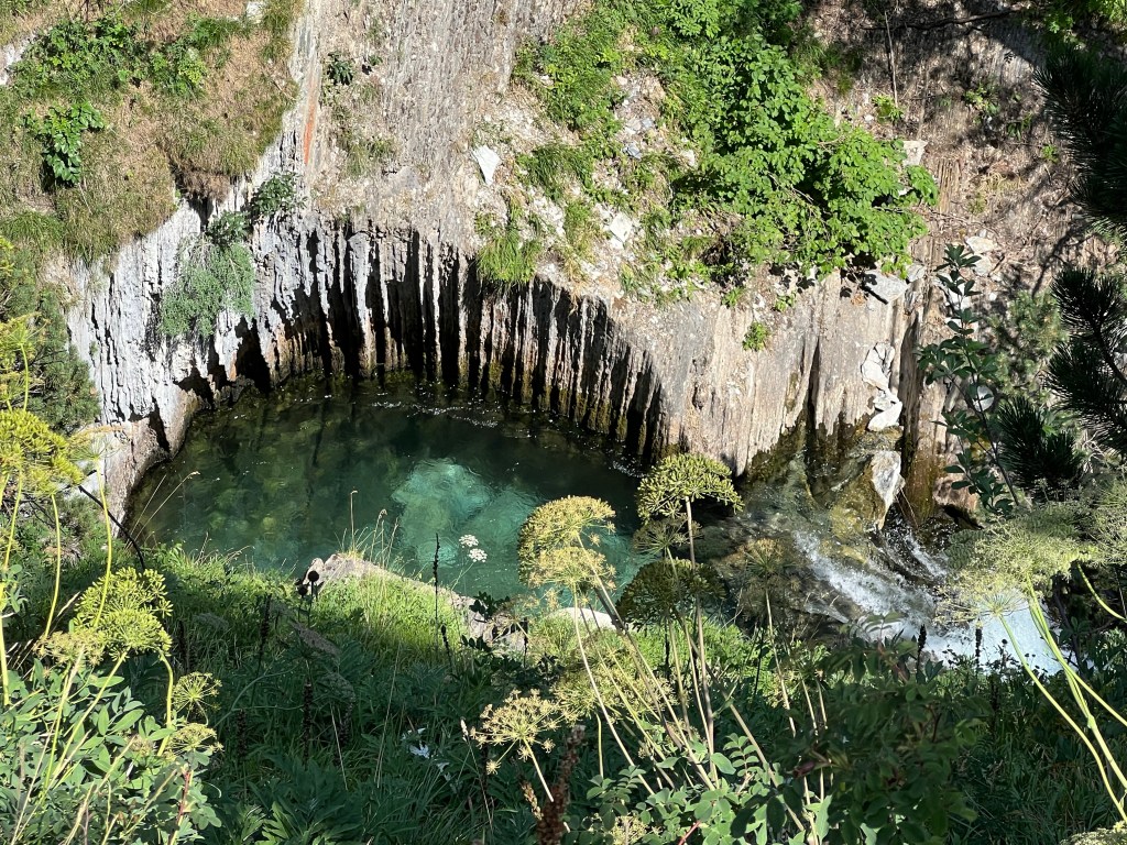
So when I finally get to the first water source, it’s time for a long break! And I’m lucky: I follow the stream just a couple of meters up around a bend and into its canyon – and there is a beautiful shadowy spot, a bathing pool in the river, and a waterfall just slightly further up creating an additional cool breeze. Just perfect for an extended lunch break!
bathing time! 
Cascada de Clarabide After I while I almost get too cold, and therfore hike on. It does not take long before breaking out in a sweat again…
But getting lower there is occational trees giving shade. And it’s not long before I pass by Refugio de Estós. I consider stopping for a beer or maybe cake… but realize that if I stop now I can never motivate myself to get going again; so I press on.
Refugio de Estós From the refugio onwards there is a nice and wide 4-wheel-drive path, which make for a quick but still knee’crushing’ descent.
well built 4-wheel-drive path from the refugio Finally I pass by the Cabaña del Tormo, and the path turns into a ‘normal’ gravel road.
It’s still a good distance to go, but there is some sights with waterfalls and the like in Rio Estós on the way.
Gorgas de los Galantes, not long past Cabaña del Tormo Also there is more forest – so less of a view, but thankfully more shadow!

I have another little water & chocolate bar – break by Cabaña de Santa Ana.
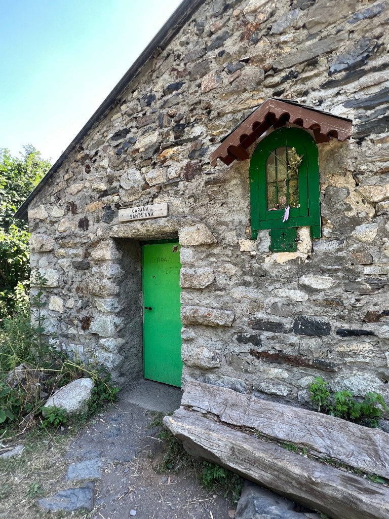
Cabaña de Santa Ana Then I’m met by a ‘conandrum’… the only way on is blocked by a red traffic light!! What to do?
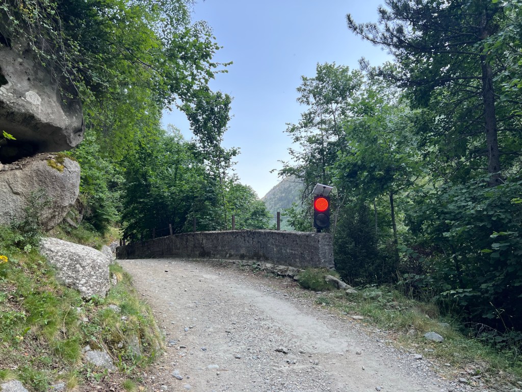
red traffic light! I decide it doesn’t apply to people on foot, and procede along the more narrow road that is carved into the hillside around a reservoir.
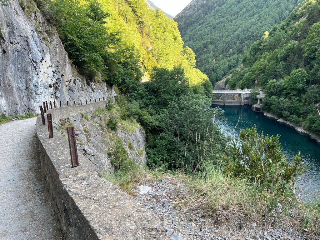
Embalses de Estós Finally I reach the road, and after crossing the river on its bridge, and then a couple of hundred meters distance uphill, I finally reach Camping Ixeia; and an icy beer!

campground, near Rio Esera, approx. 1250m asl approx. 10,5h incl. longer breaks;
22,4km, 1160m ascent, 1485m descent
- PYRENEES – DAY 13
From Camping Ixeia -via Benasque- to Refugio de Coronas
22-07-17
Since resupply options in Parzán were kind of limited, and also I didn’t plan that well / wanted to carry that much, I need to walk into Benasque where there are several good shops. The friendly receptionist at the campground also points me to a sports shop that should have freeze-dried meals.
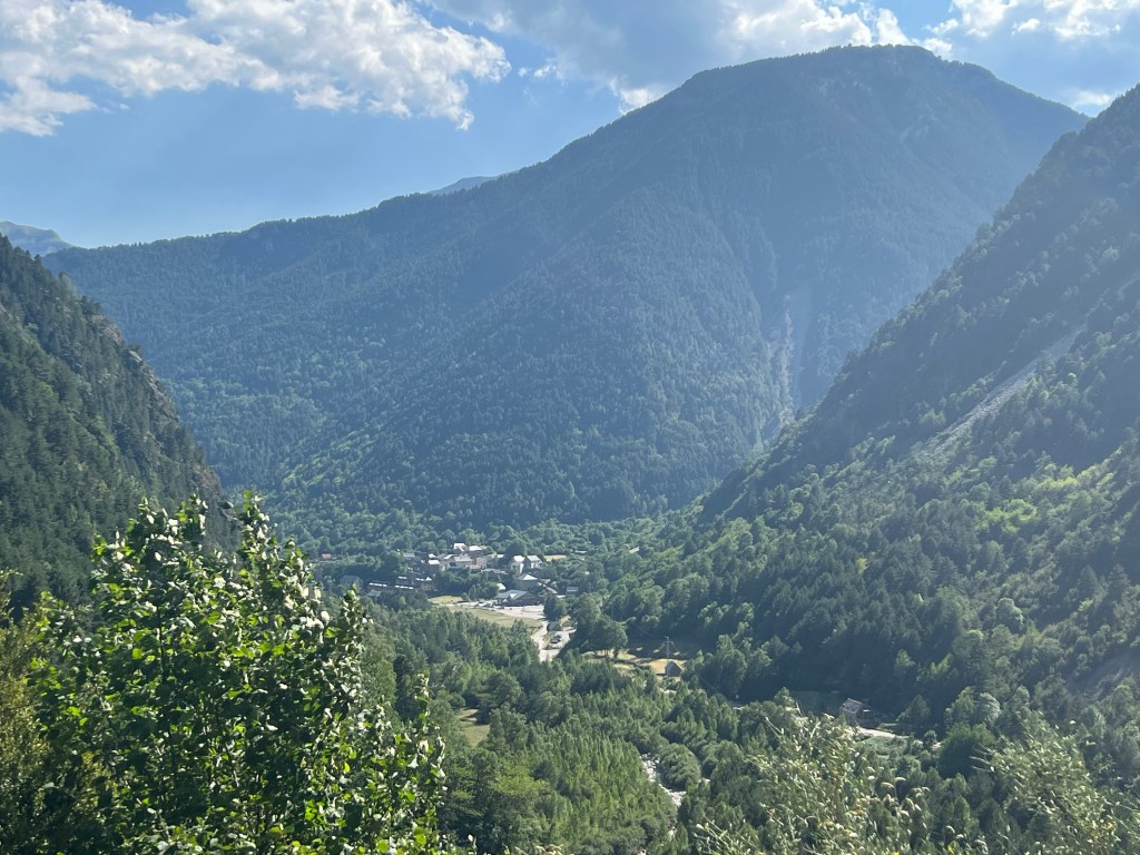
It’s a lovely flatish walk about an hour (good 3km) down along the river, passing by the old stone bridge of San Jaume.
Puente de San Jaume Benasque is quite a lovely compact town; with clearly an old town centre, but also quite touristy based on the number of restaurants and sports shops.

Benasque I do my shopping, and have a light lunch (catering to my vegetables cravings), while enjoying a little 4G for a short while.

vegetable feast 😉 Then it’s back up to the Camping again; I choose the path on the other, western side of the river. Also very nice, but it’s been getting hot and I am thankful for any shade.

back towards Camping Ixeia Back at the campground I just chill for a couple of hours until the worst mid-day heat wears off; and also for my power bank to get some more time to fully charge.
Then, with a light evening breeze coming up, I start out again, at first on a not too steep gravel road.
Soon I can see the imposing dam of Embalse de Paso Nuevo lurking between the trees.
Embalse de Paso Nuevo Then I can take a smaller, steeper path, shortcutting the wide serpentines of the gravel road. It leads me through a strange, dense ‘forest’ of trees unknown to me. They remind me a bit of the laurel forests on Tenerife… but no idea if it’s in any way related plants.
unknown trees… reminiscent of Tenerife’s laurel forest And finally the path starts climbing really steep up the side of the valley, heading east… it’s not long before I get quite dramatic views back down onto the reservoir and the valley bottom.
And suddenly I hear a noise… some kind of larger vehicle coming down the gravel road; park rangers maybe? I cannot believe my eyes when a quite decent sized public transport bus makes its way around the next bend!

Since this is one of the two main ascent routes to Pico Aneto (the highest top in the Pyrenees), there is obviously a lot of hikers, and they have therefore set up this bus route 5 or 6 times a day during the summer months.
Sweet! But I’m still going to hike it.
When I reach Cabana de Quillón at about 1800m asl, I feel I’m done for the day. But there isn’t really any good flat spot, the cabana looks pretty grotty to sleep in, and it’s quite a detour to get water… so after a chocolate bar and some rest, I manage to motivate myself to press on.

Cabana de Quillón The terrain flattens out, and it’s cooler now, so I reach the end of the gravel road and Refugio de Coronas at 1965m asl quite quickly.
I go on for a couple of hundred meters and find a hidden stealth no-trace bivouac spot by the river.
Long day – so: river bath, some food, toothbrush and then right to sleep!

first approx. 8km, 155m descent/ascent to Benasque and back
then: approx. 3,5h incl. breaks;
9,8km, 730m ascent, 45m descent
- PYRENEES – DAY 14
From near Refugio de Coronas to near Refugi d’Angliós
22-07-18
—- more text to come! —-
Again I make a very early start, try to have my tent packed down before the first hikers come up. With the first bus arriving at 6, that’s a bit challenging; but my spot is well hidden, and by 8 I’m gone.
sunrise The path takes me further up the valley, slowly but surely rising; there is a couple of turn-offs to other peaks and destinations, but no problem finding my way. My route coincides with the route of an ultra-trailrun that apparently has been (or is going to be) here: lots of additional flags and signs!

additional signage for an ultra trailrun I take a second breakfast-break in the shade by a bridge. Enjoying the cool air and crisp views while it lasts.
bridge over Barranco de Llosás Then I pass the two Ibónes de Vallibierna, and continue climbing.
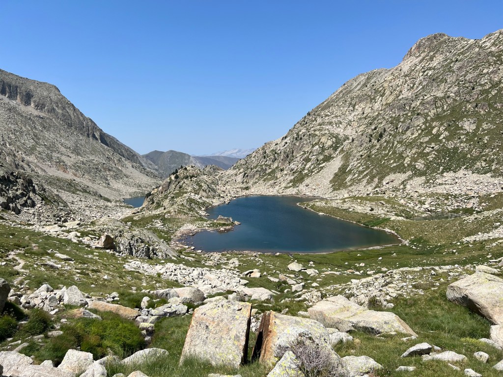
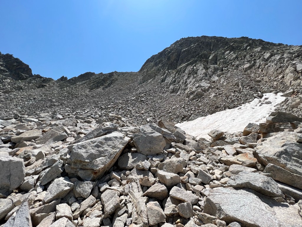
looking back at Ibón Alto de Vallibierna For the way up to Collado de Vallibierna the guide book warns of a large boulder field (✔️) and possibly snow until late into the summer (✔️)… but neither of them create any problems.
large boulders & snow up towards Collado de Vallibierna (approx. 2720m asl) But there is also again nice flowers.
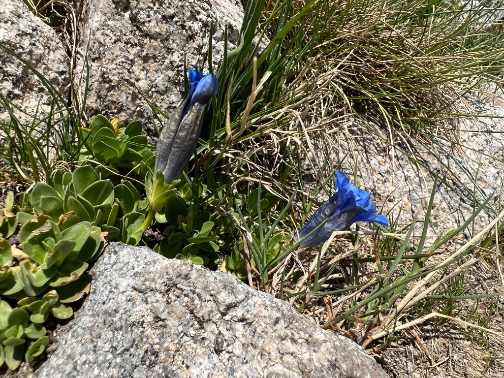
Enzian And after crossing the pass, I’m quickly down by the Refugio Cap de Llauset. They just had a helicopter visiting – hope it was nothing serious.

Refugio Cap de Llauset On the way there is some more large boulders to squeeze through in between – I almost get stuck with my backpack!

narrow path 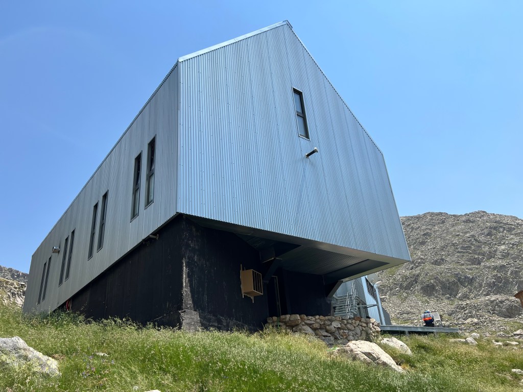
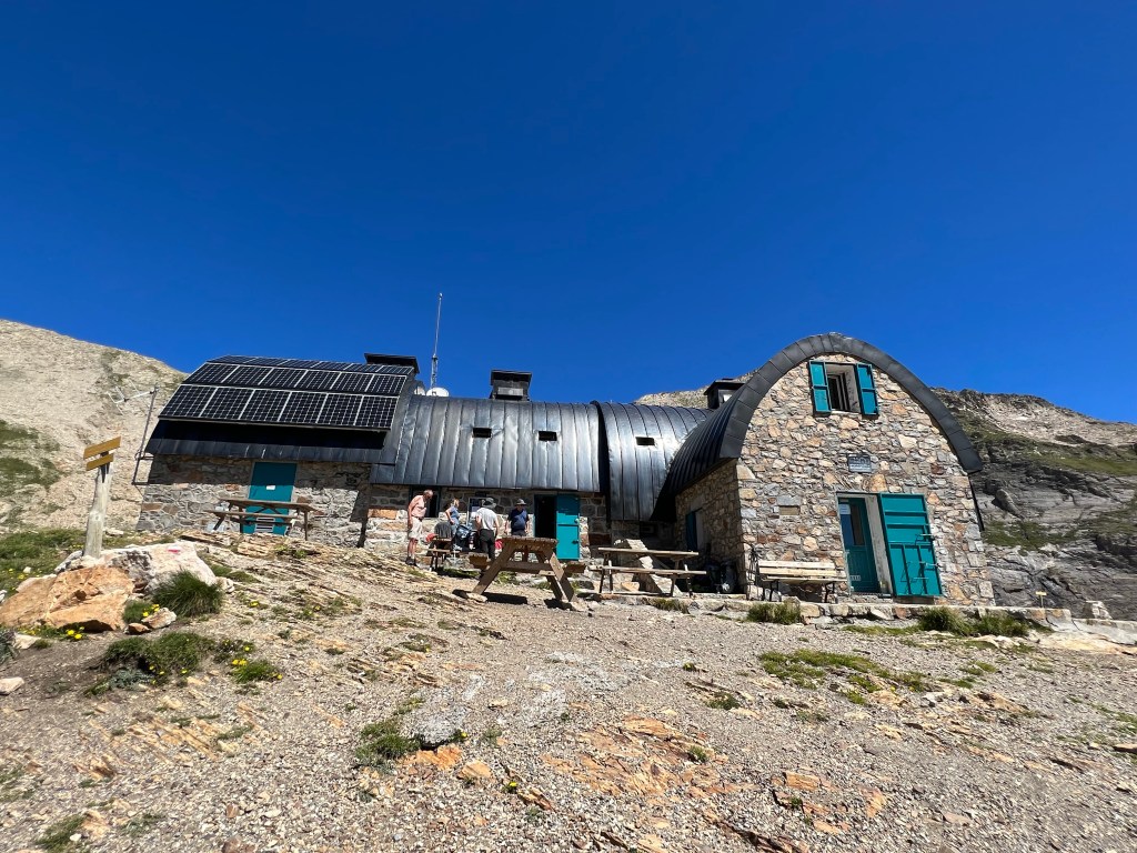
Refugio Cap de Llauset 
view of the Estany Cap de Anglios from Collada de los Ibones 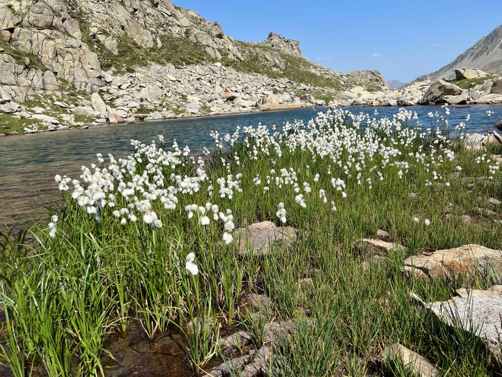
Estany Cap de Anglios 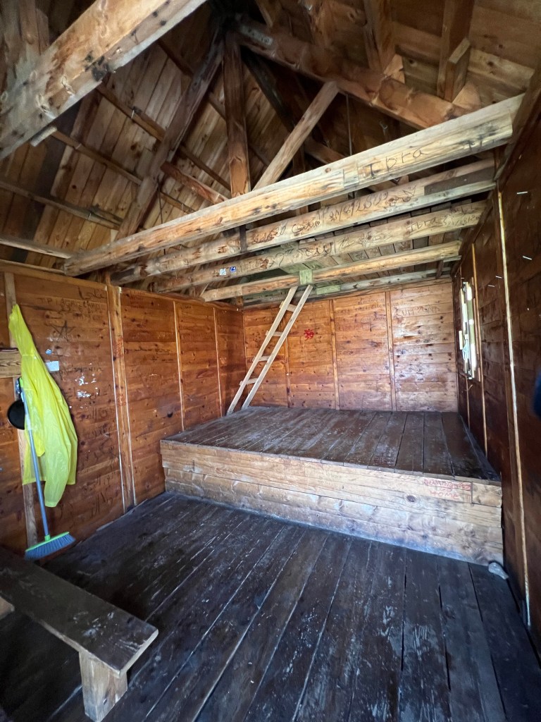
inside of Refugi d’Angliós (2240m asl) 

bivouac by Estany Gran approx. 9h incl. several looong breaks;
9,3km, 905m ascent, 645m descent
- PYRENEES – DAY 15
From near Refugi d’Angliós to somewhere below Pòrt de Vielha
22-07-19
—- more text to come! —-

leaving Estany Gran 
morning view down along Barranco Riueño 
heading steep down into the forest 
water! 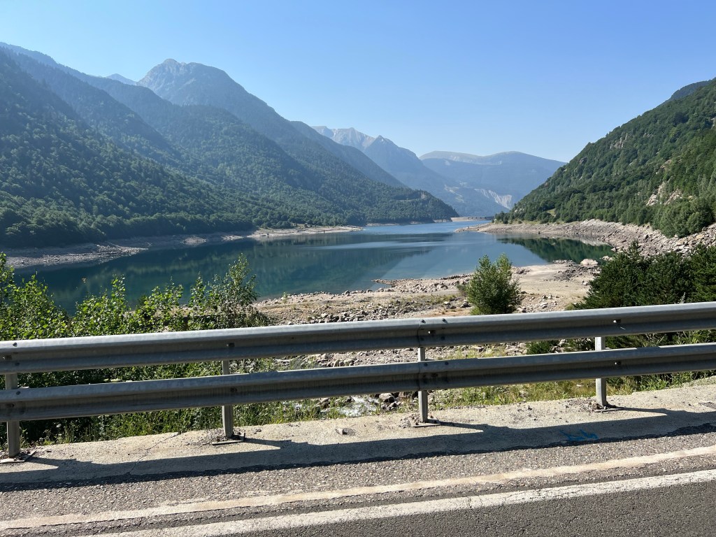
road N-230 by the reservoir Pantà de Baserca 
on the way to Refugi de Conangles 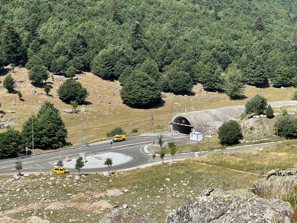
entrance to the Túnel de Vielha (1503m asl), just by Hospital de Vielha 
leaving HRP / GR11 
Saut de Molières 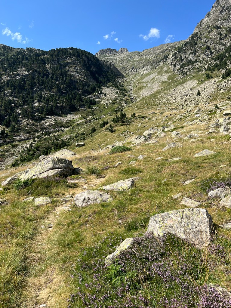
up on the Camino towards Vielha 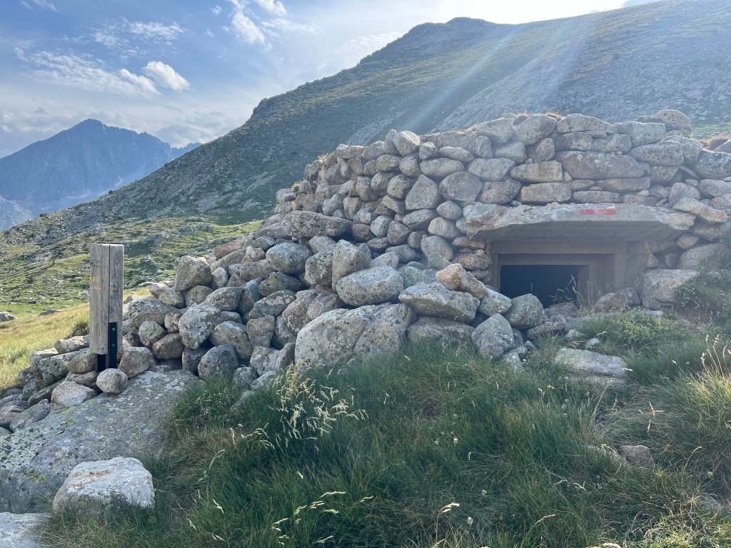
war-time(?) shelter at approx. 2240m asl 
bivouac 
unbidden guest… approx. 9,5h incl. siesta at the waterfalls and other shorter breaks;
14,3km, 865m ascent, 890m descent
- PYRENEES – DAY 16
From somewhere below Pòrt de Vielha to Vielha
22-07-20
——- more text to come! ——-


towards Pòrt de Vielha (approx. 2445m asl) 
view down towards Vielha 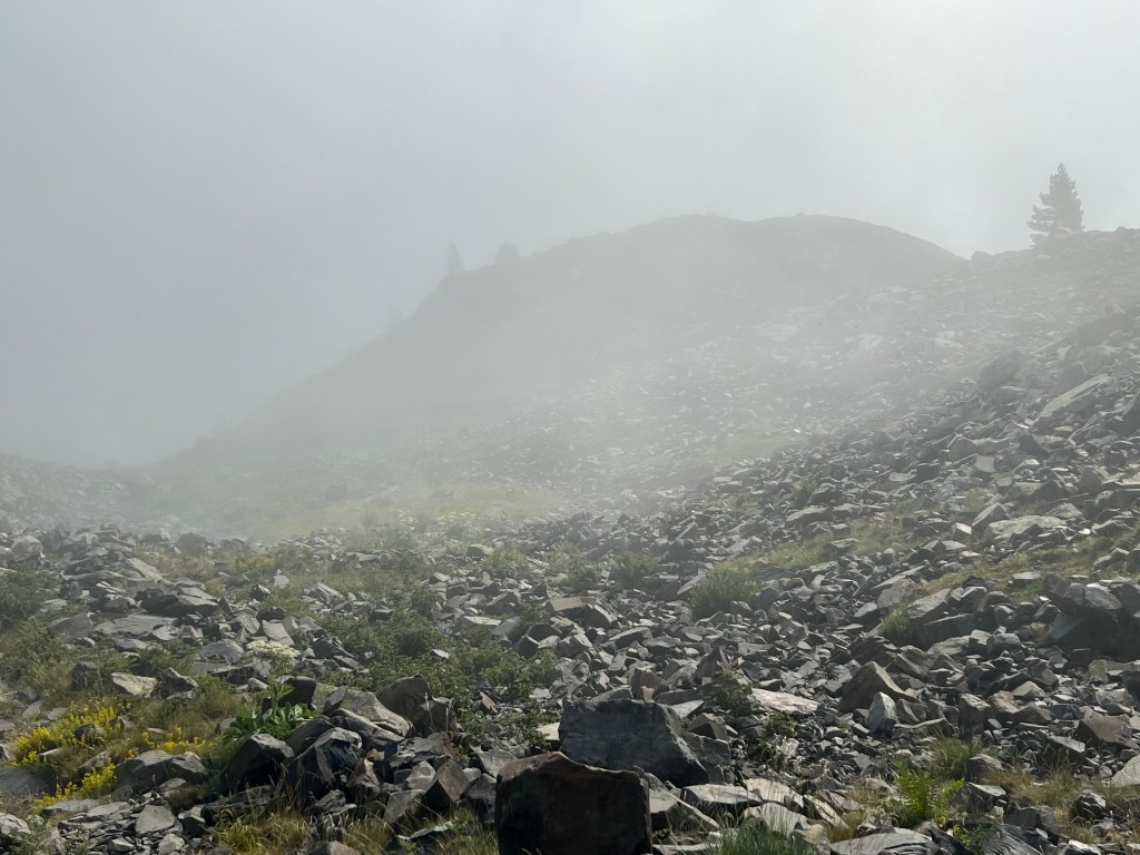
…fog… 
Cabana deth Pontet (1597m asl) 
cows 
viewpoint (of the highway?) 
fancy stepping stones 
Vielha 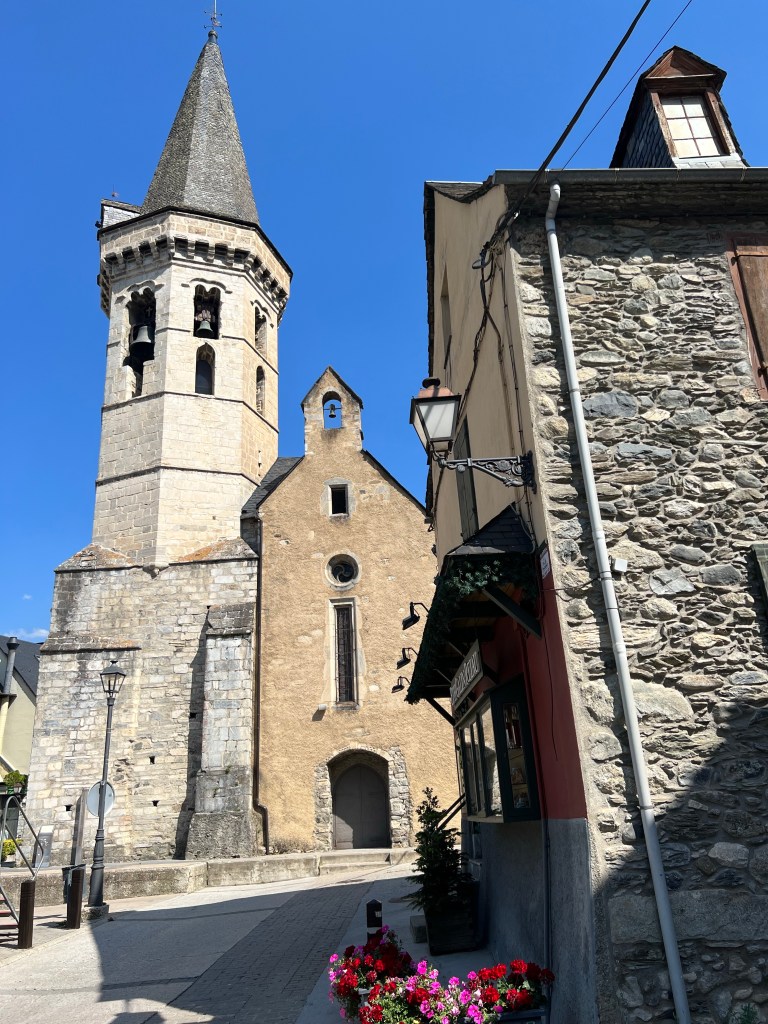
Sant Miquèu, Vielha 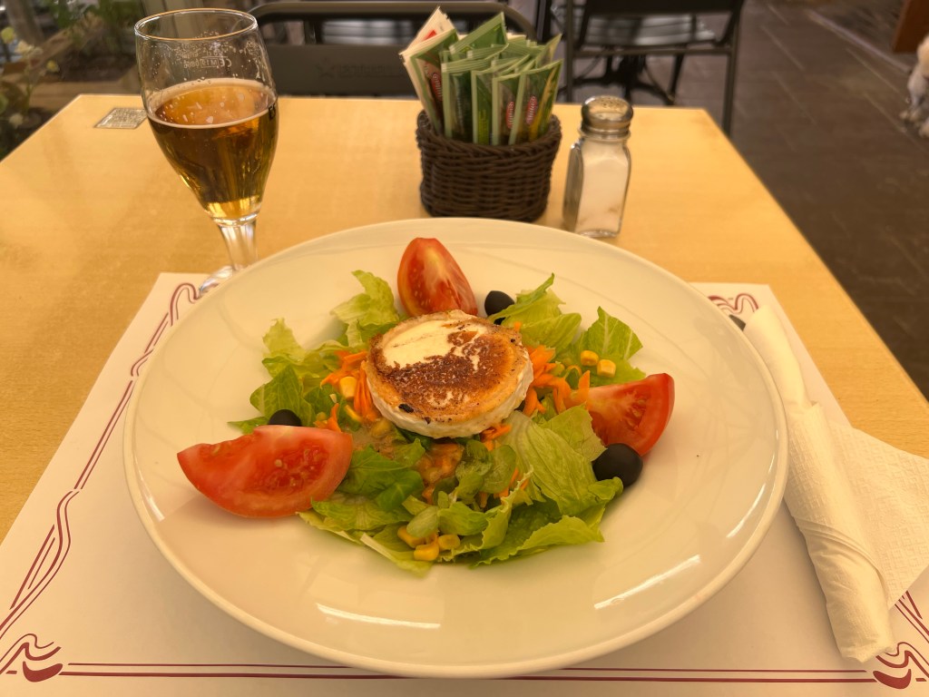
‘lunch’ approx. 6,5h incl. looong breaks;
11km, 240m ascent, 1460m descent
- PYRENEES – DAY 17
Travel day, or: «in 18h 14min across (larger parts of) Europe»
22-07-21
—- more text to come! —-
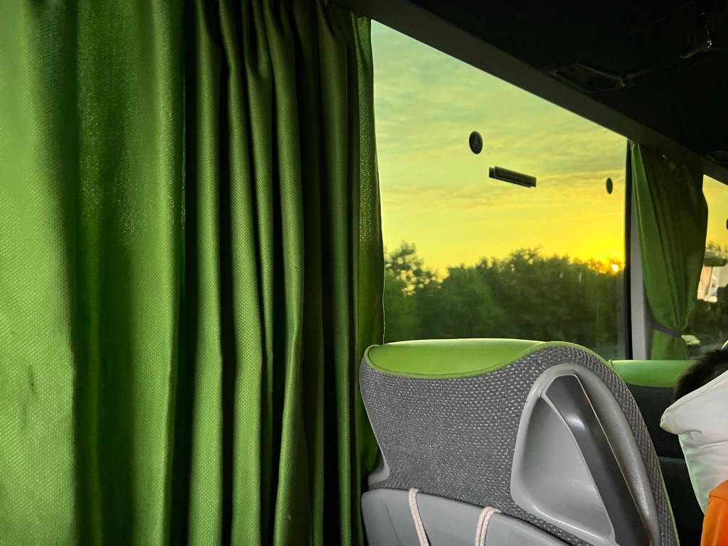
sunrise from a Flixbus 
Toulouse station 
TGV INOUI ready to depart 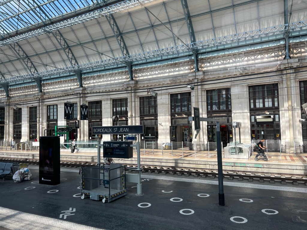
Bordeaux 
Paris Montparnasse
THE ORIGINAL PLAN
As usual I start out with a quite – maybe overly – ambitious plan. But I don’t really know about snow conditions, what the wheater will be like, and most importantly how I’ll feel.
So I have some ‘plan B’s up my sleeve as well. 😉
Generally I want to bivouac with my tent; but I have planned so that most days end up near a (mostly staffed) hut; that way I can top up for food, get some info for the next day, and worst case stay at the hut if weather is cruel – or I just feel like it.
Anyway here is the plan:
Day 1: Urdos – Refuge d´Ayous 9,5km, 1440m ascent, 223m descent
Day 2: Refuge d´Ayous – Refuge de Pombie 11,3km, 734m ascent, 670m descent
Day 3: Refuge de Pombie – Refuge d´Arrémoulit 11,5km, 1027m ascent, 787m descent
Day4: Refuge d´Arrémoulit – Refuge Wallon 16,9km, 1352m ascent, 1760m descent
Day 5: Refuge Wallon – Refuge de Baysellance 13,8km, 1454m ascent, 660m descent
Day 6: Refuge de Baysellance – Gavarnie 17,7km, 384m ascent, 1472m descent
Day 7: Gavarnie – Refugio de Goriz 13,7km, 1616m ascent, 787m descent
Day 8: Refugio de Goriz – Refugio de Pineta 12,6km, 1150m ascent, 2082m descent
Day 9: Refugio de Pineta – Parzán 13,2km, 1045m ascent, 1205m descent
Day 10: Parzán – Camping El Forcallo 20,1km, 1579m ascent, 1011m descent
Day 11: Camping El Forcallo – camp by Lac de Pouchergues (before Refuge de la Soula) 11,3km, 1131m ascent, 595m descent
Day 12: camp by Lac de Pouchergues (before Refuge de la Soula) – Refuge du Portillon 11,8km, 1147m ascent, 701m descent
Day 13: Refuge du Portillon – (Below Refugio de la Renclusa) camp by Lac / Cabana de los Aigualluts 17,1km, 883m ascent, 1348m descent
Day 14: (Below Refugio de la Renclusa) camp by Lac / Cabana de los Aigualluts – Hospital de Viella 12,7km, 941m ascent, 1411m descent
Day 15: Hospital de Viella – Vielha 13,7km, 828m ascent, 1462m descent
back to front page: Ines hiking
