HIKING THE CANARIES ON GR 131
back to front page: Ines hiking
- CANARIES – THE PLAN
My plans will evolve along the way; and may well change completely – for all kinds of reasons.
But for now, here is my sketch of a plan:
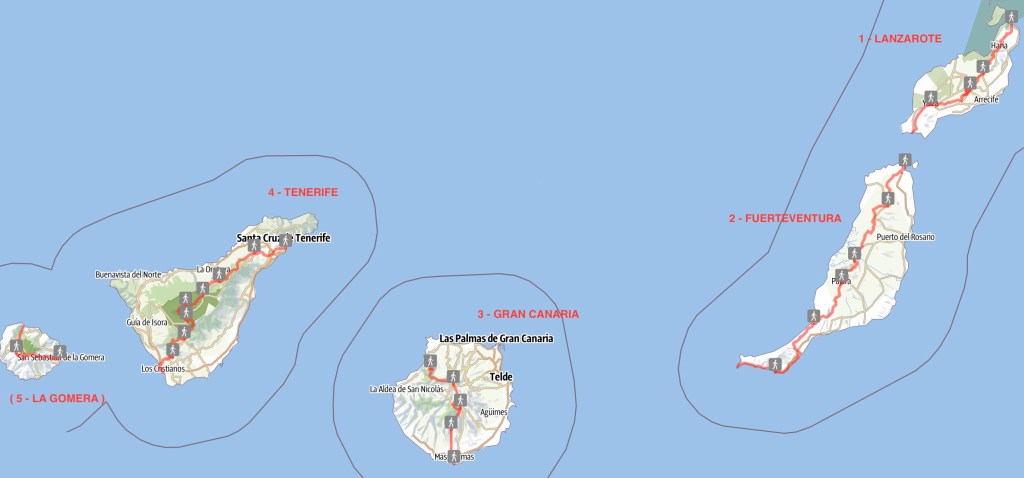
LANZAROTE:Day 1: Órzola -> Máguez 10km (plus detours)
Day 2: -> Teguise 14km -> Montaña Blanca 15.5km
Day 3: -> Yaiza 17km
Day 4: -> Playa Blanca 15,5km
FUERTEVENTURA:Day 5: Corralejo -> La Oliva 25km
Day 6: -> Tefía 17,5km
Day 7: -> Betancuria 17,5km
Day 8: -> Pájara 17km
Day 9: -> La Pared 23km
Day 10: -> Barranco de Pecenescal 16km
Day 11: -> Morro Jable 16,5km
Day 12: -> Faro de Jandia 20,5km
GRAN CANARIA:—poolside break with H.—
Day 13: Faro de Maspalomas -> Ayagaures 18km
Day 14: -> Tunte (=San Bartolomé de Tirajana) 12.5km
Day 15: (? -> Roque Nublo) -> Cruz de Tejeda 15.5km
Day 16: -> Tamadaba 17,5km
Day 17: -> Puerto de las Nieves 10,5km
TENERIFE:(? Day 18: Punta del Hidalgo -> Cruz de Carmen -> San Christóbal de la Laguna )
(? Day 19: -> La Esperanza )
Day 21: -> El Portillo 13,5km
Day 20: La Esperanza -> La Caldera 29.5km
Day 22: -> Refugio Altavista 11,5km
Day 23: -> El Teide (3718m asl) -> Parador 13km
Day 24: -> Vilaflor 15,5km
Day 25: -> Arona 8km -> Los Christianos
LA GOMERA:Day 26: San Sebastián -> Chipude 27km
Day 27: -> Playa de Vallehermoso 18,5km
(? Day 28: -> Agulo )
(? Day 29: buffer day )
- CANARIES – DAY 0
21-11-15
Travel day: flight to Las Palmas de Gran Canaria, night ferry on to Arricife on Lanzarote.

Quite a hunt to find some camping-gas, but finally -after almost having given up- I got some at a tiny little climbing centre. Now all set to go!

Playa de las Canteras, Las Palmas / Gran Canaria
- CANARIES – DAY 1
21-11-16
Early start at 5:55 by being woken with some spanish only anouncement on the ferry.

Arrecife port Bus to my starting point at Punta Mujeres.

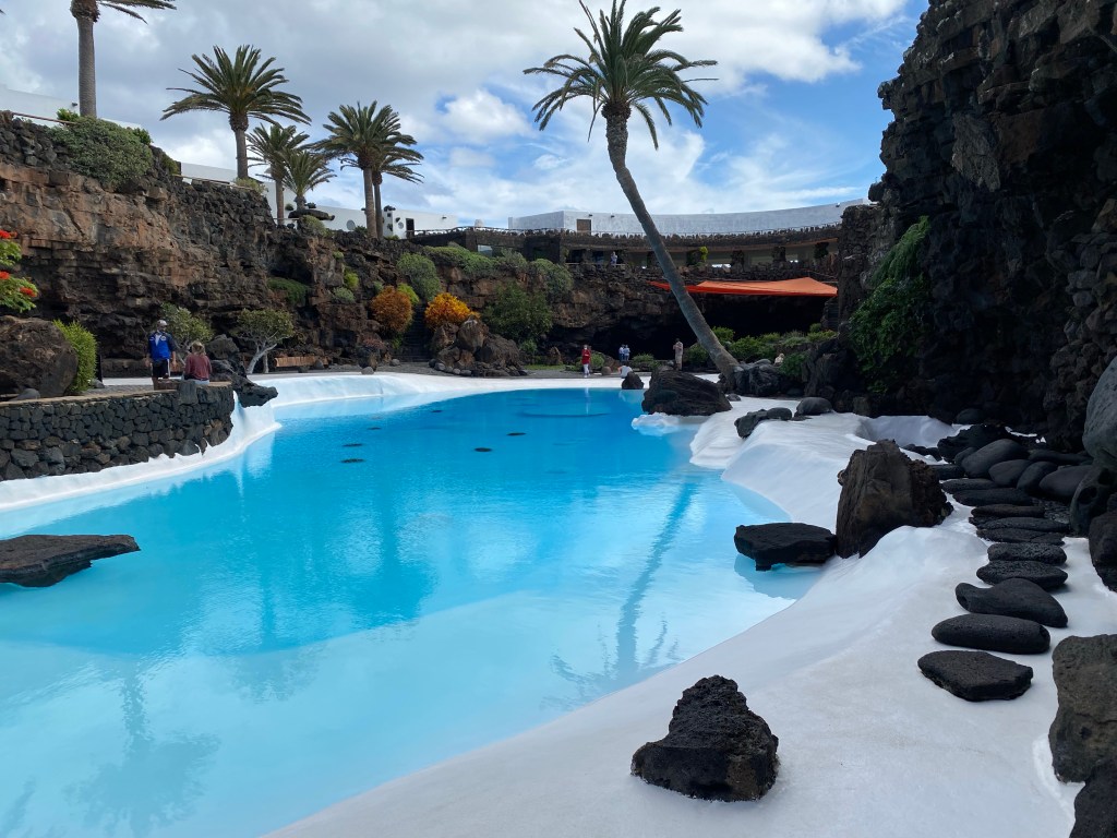
just outside of Punta Mujeres First sightseeing stop: Jameos del Agua
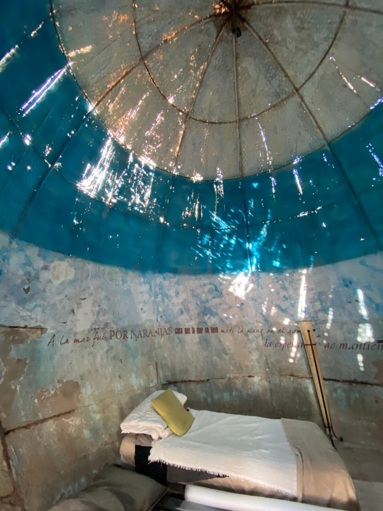
Natural lava flow caves, transformed by César Manrique during the 60ies and 70ies into a weird mix of romantic kitsch and something like a japanese stone garden, with a little bit of a James Bond location feeling.
Jameos del Agua Second sightseeing stop: Cueva de los Verdes
Also this a 3000 year old lava tube, but kept a lot more natural – except for path and lighting.

Cueva de los Verdes Third sightseeing stop: Mirador del Rio
Panoramic viewpoint, designed also by César Manrique. First impression – Hobbit’s home, but really beautiful and simple 60ies details!
stairs to the ‘rooftop’ viewing deck at Mirador del Rio 
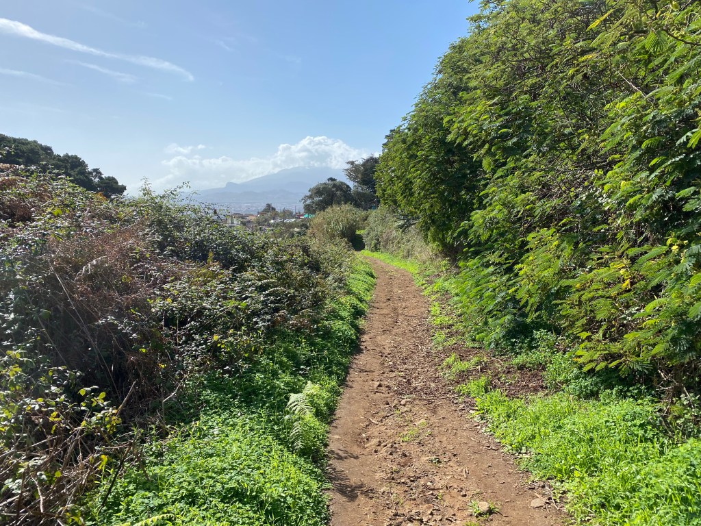
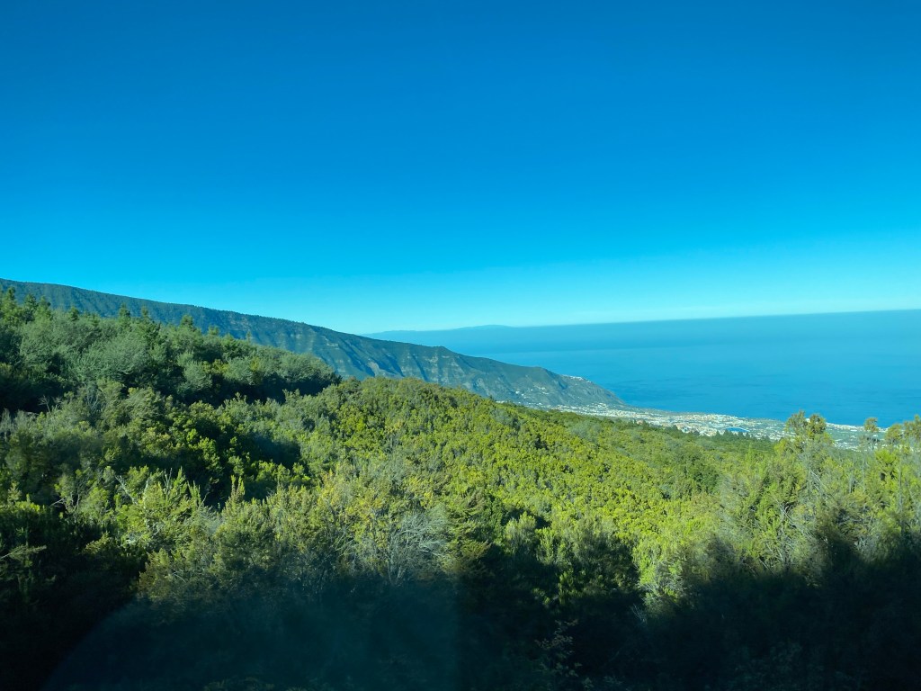
view towards La Graciosa And in total approximately 21km and at least 450m ascent hiked today.
- CANARIES – DAY 2
21-11-17
Good night’s sleep at lovely ‘La Molina’ in Máguez.
Hike avross the hill into Haría, where I get some bread and cheese and visit the Casa Museo Carlos Manrique.

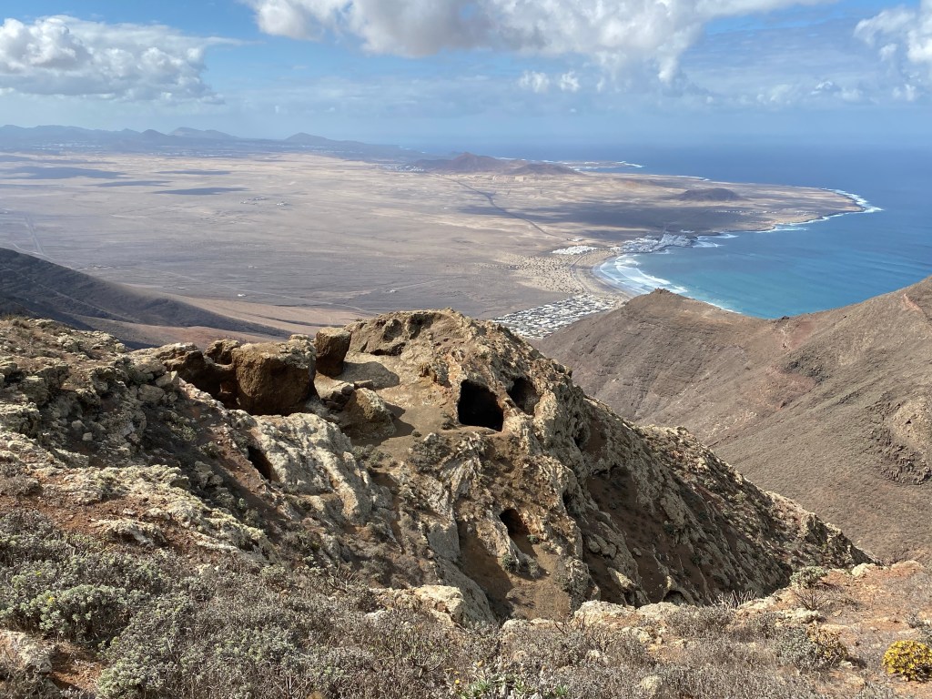
Then up a steep hill, Peñas del Chache – actually the highest point of Lanzarote – for some gorgeos viws and caves.

Then past Eremita de las Nieves and down to the old capital Teguise, for a short rest.
And finally on against the setting sun to San Bartolomé where I catch a bus.
Totalling in at least 23km for today.
- CANARIES – DAY 3
21-11-18
Woke up still very tired and with aching feet, so decided to sleep in and have a rest day. I’m on holiday, so everything is allowed 😉
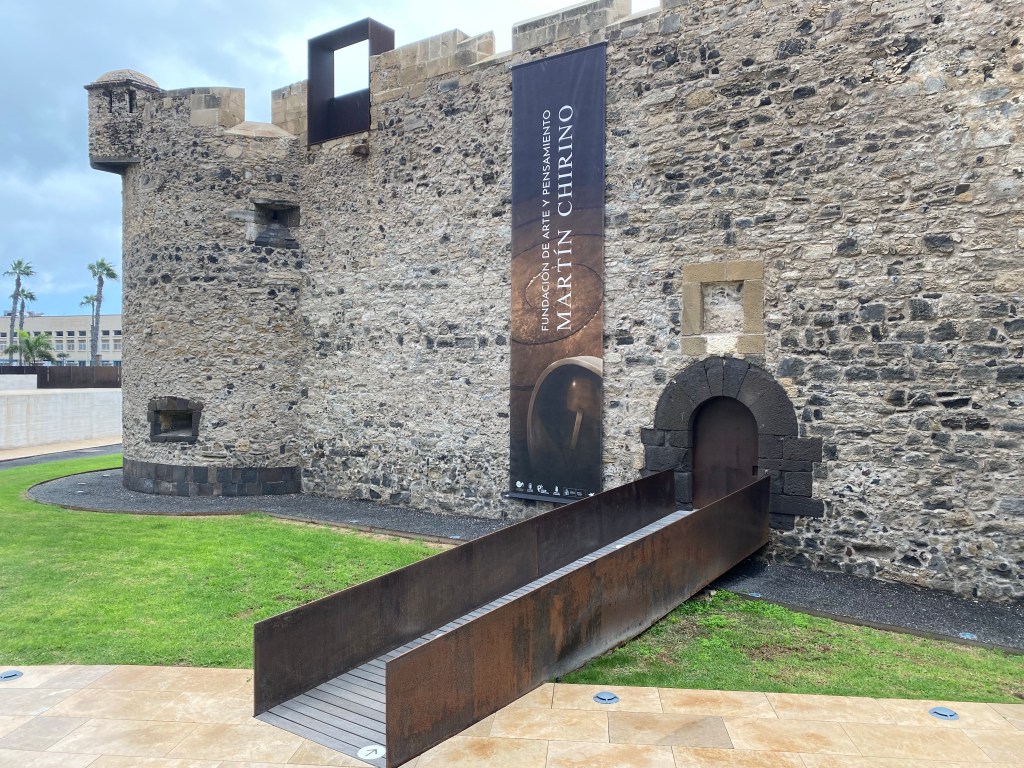
Did a little bit of sightseeing along the quai of Arrecife.

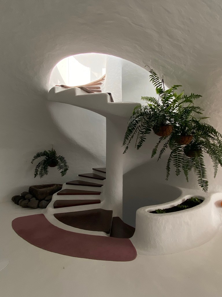
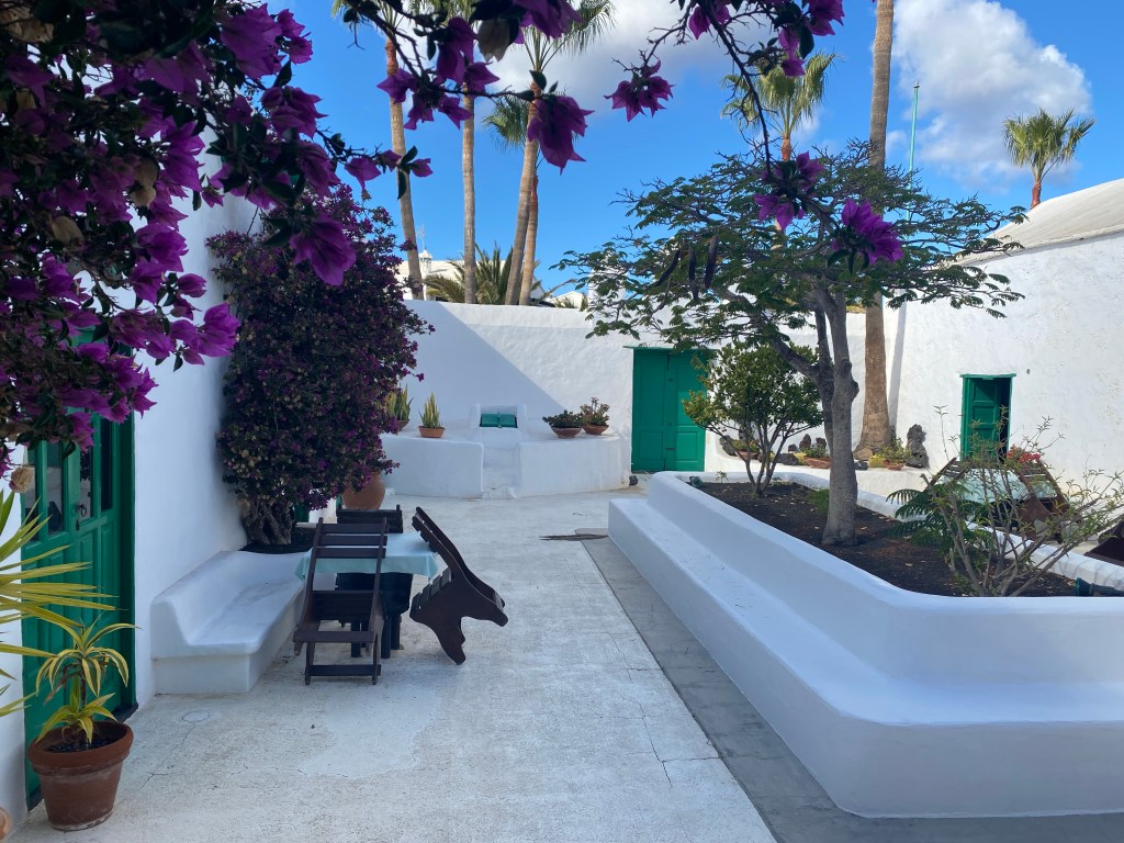
Castillo de San Gabriel, Arrecife Then took the bus to Yaiza, where I had booked for the night in a B&B. Turns out it’s an old building that had been restored and transformed by Cesar Manrique – what a surprising treat!

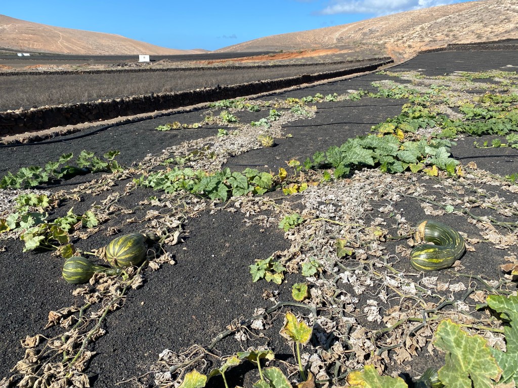
It had cooled down with a bit of clouds, so after having checked in, I went for a little exploratory walk of small Yaiza. Backtracking the GR131 where I would have come from, had I hiked the part as originally planned.
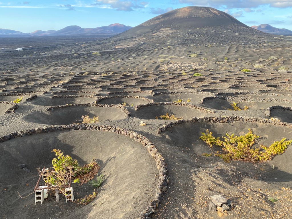
wine fields Along sandy black gravel roads through endless wine plantations, always with a couple of old volcanos in the distance.
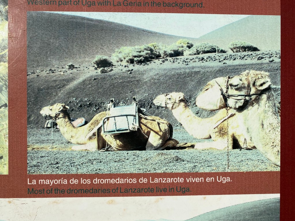
Then through the village of Uga, where all the dromedars live (I learned from a sign, but didn’t see any):
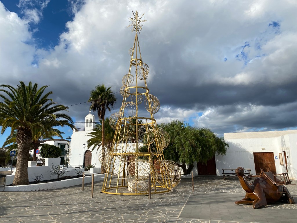
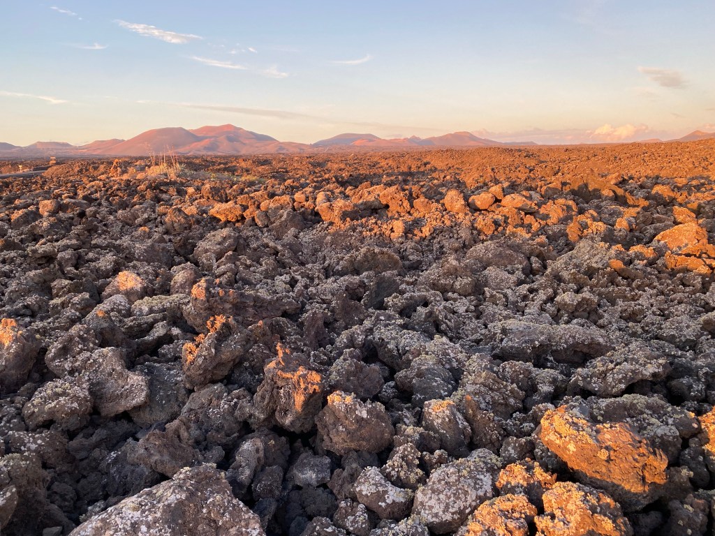
Christmas in Uga And back to Yaiza, at the outskirts of the Timanfaya national park, the region that had the most recent volcanic activity in Lanzarote – in the 18th century.
Lava stones look still pretty fresh.
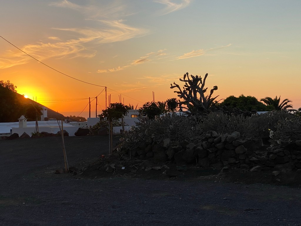
Arriving back at the home for the night at sunset; you can actually see the sea from here!
Totalling in at about 12km roundtrip (cheatingly without backpack).
- CANARIES – DAY 4
21-11-19
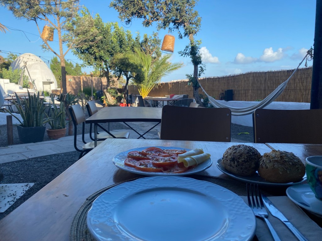
Started the day with breakfast in the beautiful courtyard/garden of Hotelito La Era.
breakfast courtyard of Hotelito La Era Continued hiking west out of Yaiza, on more gravel roads. Similar landscape as yesterday, but no more wine plantations.

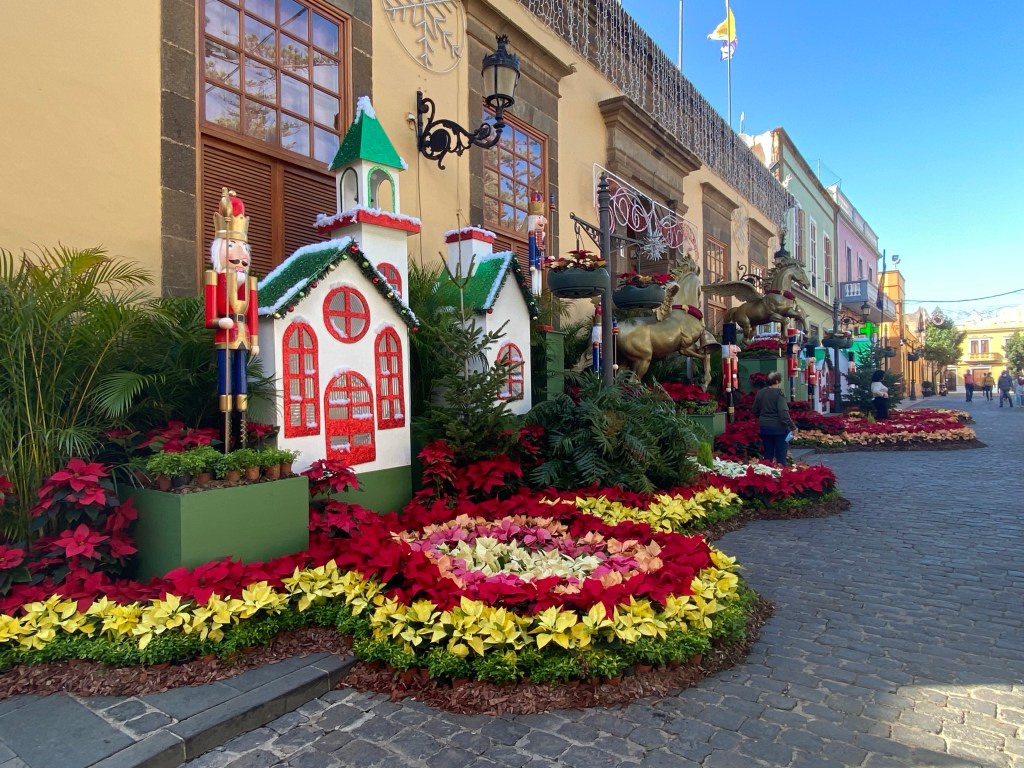
towards the sea and Fuerteventura mountains in the background Short asphalt road intermezzo at Las Breñas, who – for now – gets the award of ‘best’ Christmas decorations…

Christmas at Las Breñas Then more gravel road/path through moon landscape…
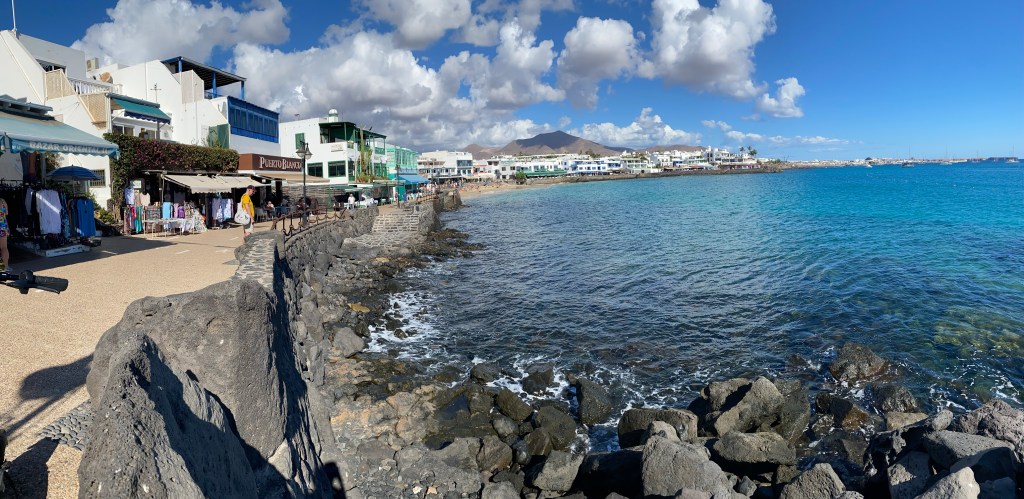
…gravel path… Until finally arriving at the outskirts of Playa Blanca, and making my way down to the bustling beach/port-side promenade.
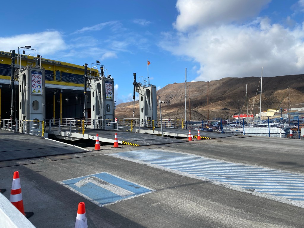
Playa Blanca Quite touristy, so no reason for me to stay; I say my good-byes to Lanzarote, and jump on the ferry.

Fred Olsen express ferry to Fuerteventura 25mins later, I’m in Corralejo – which in a way looks very similar to what I just came from.
Corralejo Check into my hotel and relax by the pool until it gets too dark and cold.
Total hiking today – about 16km.
- CANARIES – DAY 5
21-11-20
Very lazy holiday today, couldn’t face more gravel roads in baking sunshine… 😉
Went for a walk along Corralejo’s dune beaches and into the Parque Natural de Corralejo instead.
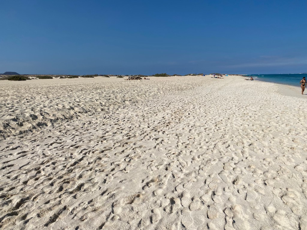


sea ‘popcorn’ And spent the rest of the day on the beach in a shadowy spot reading and relaxing.
Total about 5km beach stroll.
- CANARIES – DAY 6
21-11-21
Back with more energy, I’m back on the trail. But because it’s difficult to find places to stay inland, I have another night booked in Corralejo – which gives me the advantage of a very light backpack.
Starting out from Corralejo, past some ‘fancy’ new holiday houses with far too big road infrastructure; and straight onto…gravel roads – what else?

outskirts of Corralejo 
gravel road towards Lajares Past a little spectacular ‘crater’ and a cave.
crater of volcano Bayuyo 
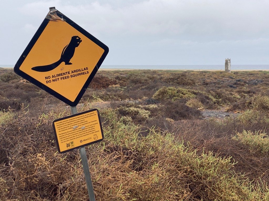
cave entrance, makes for a shadowy rest place (but was already occupied) And then on to today’s highlight: Calderón Hondo.

guarded by very hungry ‘squirrels’ (Nordafrikanische Borstenhörnchen – atlantoxeros getulus, seit 1965 hier ‘heimisch’) 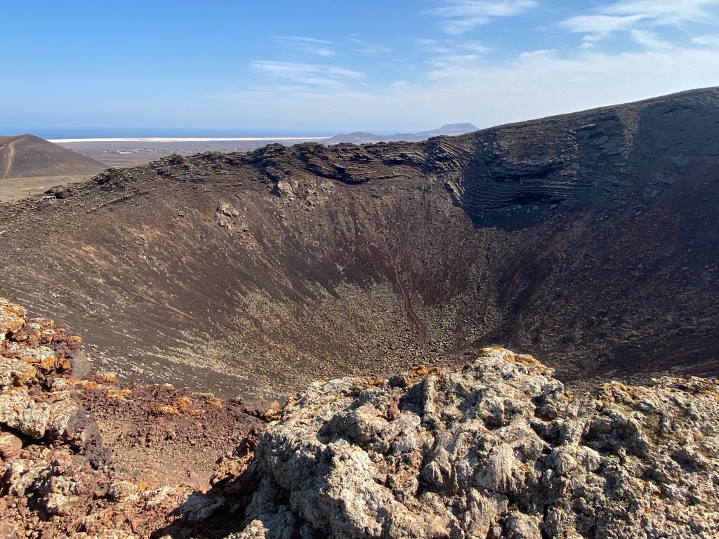
Calderón Hondo (273m asl) and steep down again…
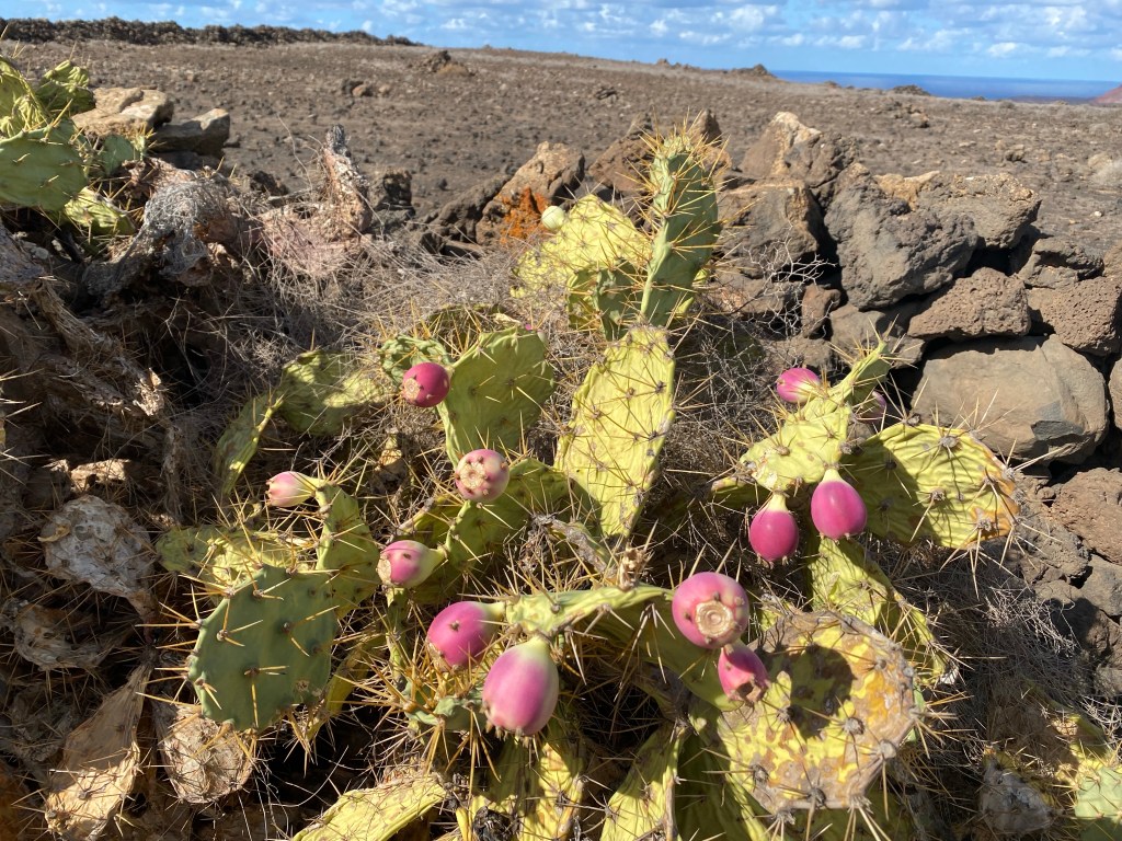
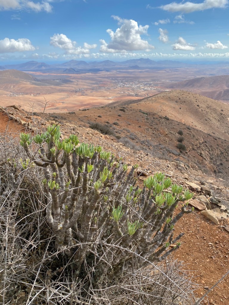
Very little vegetation, and almost never green, and certainly not flowering…. except – sometimes when you look very closely:

Then through Lajares – really just some houses and three surfer bars (inland!! dont’t understand that, but ok), and on towards La Oliva.
They also have so many stones, they try to sell them:


looking back towards Lajares and Calderón Hondo (second from left) Approching La Oliva, I pass by two windmills.
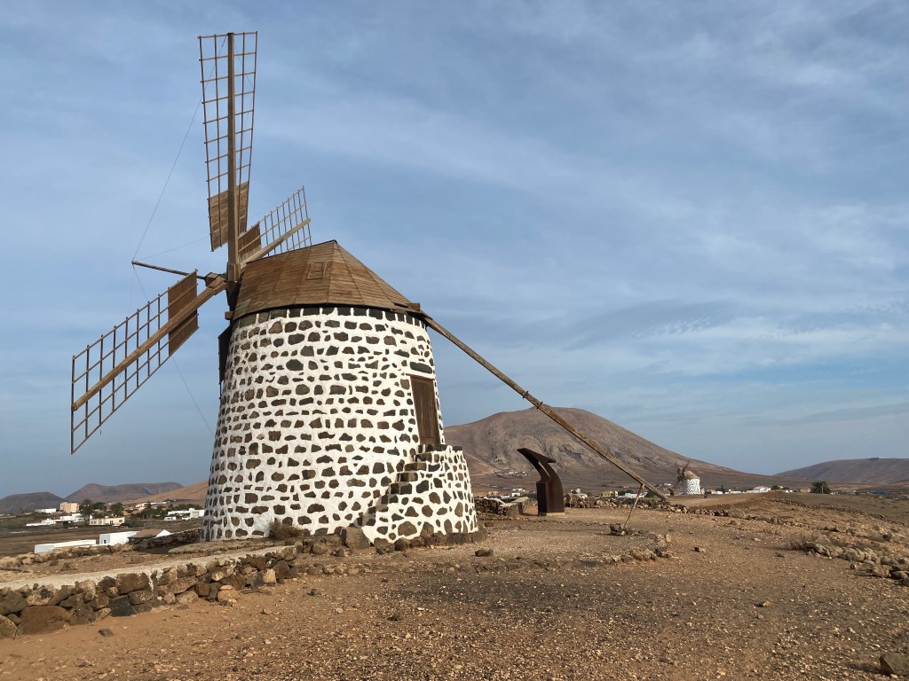
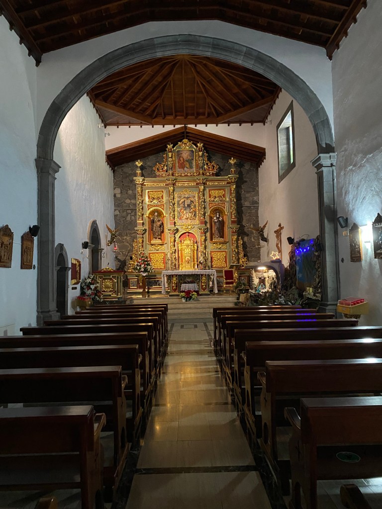
Molino de Villaverde II And because I just miss the bus I also get to experience the church in La Oliva.
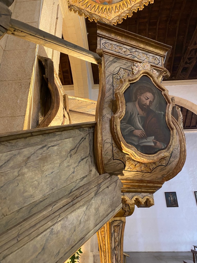
wooden fake-marmor pulprit in beautiful La Oliva church Clocking in a total of something around 22km for today.
- CANARIES – DAY 7
21-11-22
Checking out and saying good-bye to Corralejo, I’m taking the bus back to La Oliva, and then another bus on to Tindaya (jumping over half a day’s gravel road hike).
The plan is to hike to the top of la Montaña de Tindaya – the sacred mountain – to see if I can find the ancient rock carvings that I read about…
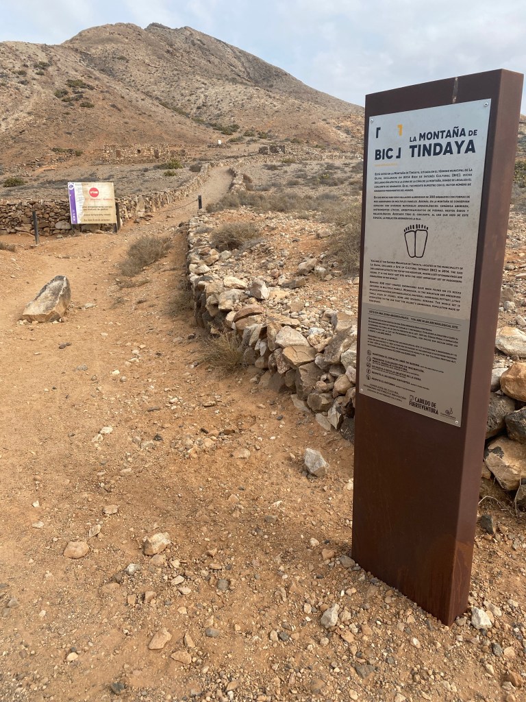
Tindaya …but turns out that access is forbidden, presumably to conserve the carvings. Both bad luck and good luck – saves me climbing some 200m (especially since the weather is quite hazy there probably wasn’t that much of a view anyway).
So I go on hiking towards Tefía.
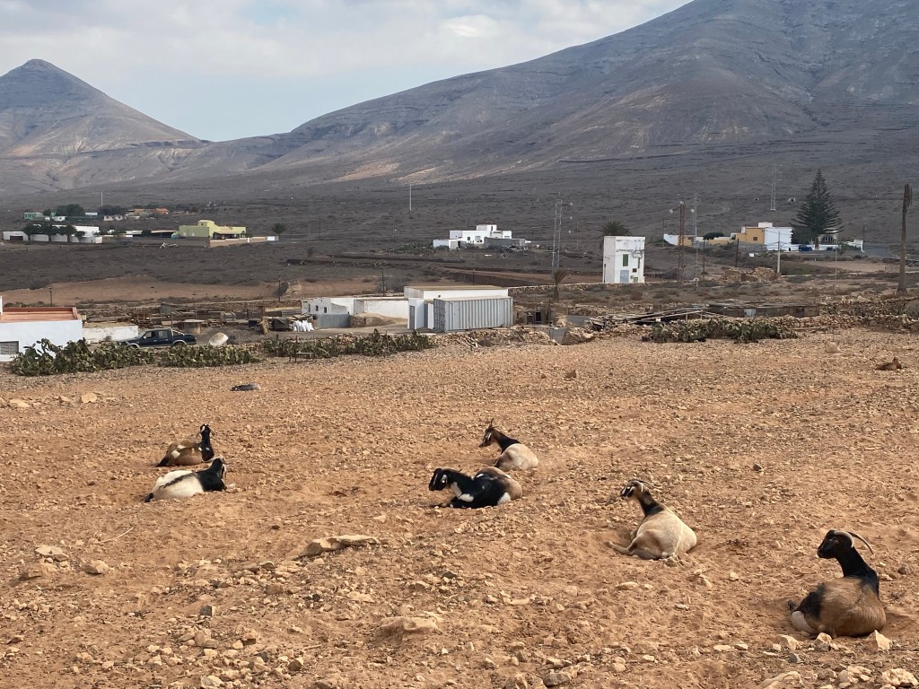
goats near a queseria just outside of Tindaya And then more of this:
Too late I realize I’ve walked past the best viewpoint to see the monument for the Spanish writer Don Miguel de Unamuno, who was exiled to Fuerteventura in 1924.
monumento a Unamuno 
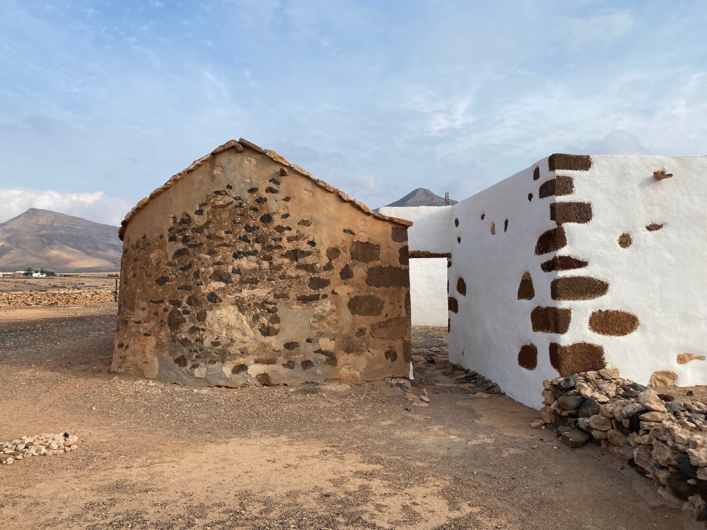
weird ‘dinosaur egg’-like sand(?)stone… seemed natural, made during a volcanic eruption somehow maybe? And relatively quickly I arrive at Tefía, and have a late lunch / rest break by the lovely (but closed) Eremita de San Augustin.
Eremita de San Augustin And since I have quite a bit of time left before catching another bus to today’s hotel, I thought I’ll drop by the Ecomuseo de la Alcogida – a mini version of ‘folkemuseet’ or ‘Höfemuseum’, with several restored traditional farm buildings that aim to show how the Majoreros (the native Canarians) used to live.
But guess what? It’s Monday… and the museum is closed. (closed – seems to be the motto of the day 😉
Anyway, I could still sneak a peek at the outside of some of the buildings:


After that, I call it a day and find my bus stop; totaling approx. 13km (with heavy backpack).
- CANARIES – DAY 8
21-11-23
Took the bus again to get back on trail (and jump over some kilometers of -probably boring- gravel roads). And because of the bus timetable I decided to walk this stretch ‘backwards’ from west to east, starting at Vega de Río Palmas and the lovely Eremita de Nuestra Señora de Peña.

Eremita de Nuestra Señora de Peña Trail starts out walking the actual river bed of Río Palmas – no ‘rio’ in sight, but for onnce vegitation with more than dry bushes including ‘palmas’.
path in Río Palmas Then the path starts to climb, first following a side river / barranco, then onto a gravel road.

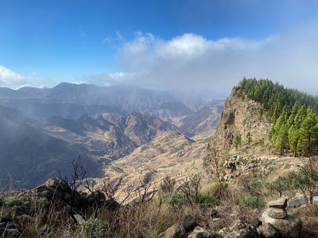
Following the mountainside up, with fantastic views and an actual pine ‘forest’!
Past a very large and well equipped picknick area (with playground, barbeque places, water and toilets!), and further up to the ridge line, where far views on the other, south side open up. Sadly the weather is again quite hazy – but at least it’s not so hot.
After another short climb along the ridge line I reach the top, Morro del Cortijo at 637m asl.

Morro del Cortijo Then it’s back down again via Degollada de Marrubio and towards Betancuria.
Rather than hike more in the heat, I get to spend some time to explore Betancuria – the old capital of Fuerteventura, and still a beautiful and lively (though very touristy) little hamlet.

Betancuria 
Noria de tiro (animal driven water wheel / pump) Now relaxing by the church, and waiting for my bus back to the hotel; only about 9km – but very relaxing and beautiful!
.
PS: With a sad heart, I did not stop at this place below 😉
- CANARIES – DAY 9
21-11-24
After two nights here, it’s time to move on.

my room at Hotel Rural Rugama, Casillas del Ángel 
Tiadhe bus stop at Casillas del Ángel Today started out with a bit of the same as yesterday: took the bus again to Vega de Río Palmas and started to walk from there. But instead of following my planned route on the GR131, I hike south towards Tiscamanita, because unfortunately along the GR there is no (available) accomodation and no reasonable buses.
Again it’s starting up steep-ish on a nice gravel path.

SL FV 31 path from Vega de Río Palmas Quite soon I’m at the pass, where the trail turns and follows the ridge line. Beautiful views on both sides.
path following the ridge line And before I know it, I’m at the highest point (a ‘side top’ to Gran Montaña) at approximately 675m asl (just shy of 400m above Vega de Río Palmas).
views from the top And then it’s down again, and I can already see Tiscamanita at the end.
view towards Tiscamanita I take a short break at a simple picknick shelter. This is actually the forth or so of this type on my way for now; and it’s quite new, not even in the map (yet).

typical shelter / picknick place Then the last 1,5km to the bus stop, where I jump on the bus to Morro Jable.
view from my hotel 
sunset at Morro Jable beach Total again only 8,5km, but with heavy pack this time.
- CANARIES – DAY 10
21-11-25
Today the bus I had planned to take didn’t show up (no idea why); but I decided just in time to go for plan B, and take another bus to Faro Punta de Jandia – and then hike back from there to Morro Jable.
Couldn‘t believe what met my eyes when looking for bus 111 at the bus station… a tiny rugged and dusty, probably four wheel drive ‘bus‘ – and I just got the last free seat.
the bus trip 
view from the bus, after it’s dropped off everyone else in Cofete (on the north side of the tip of Fuerteventura), and is continuing up and back over a mountain pass to go on to Faro Punta de Jandia 
Tiadhe bus line 111, at Faro Punta de Jandia There once seems to have been a museum and a cafe/bar in the lighthouse (Faro), but it seems a while since it’s been open; so there’s nothing much around but nature. – And the end of Fuerteventura’s part of the GR131, which I hiked backwards today.
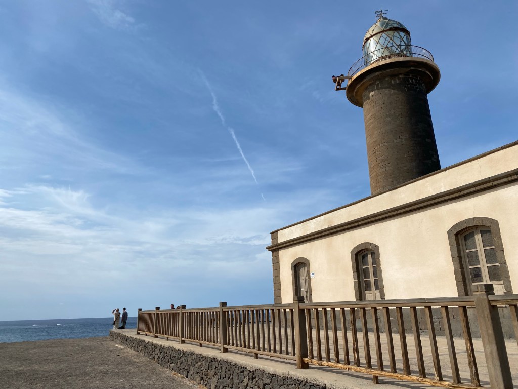
Faro at Punta de Jandia 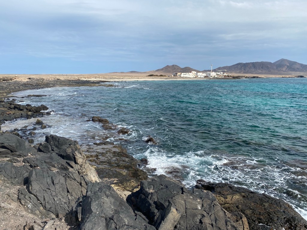
Punta de Jandia, view towards Puerto de la Cruz 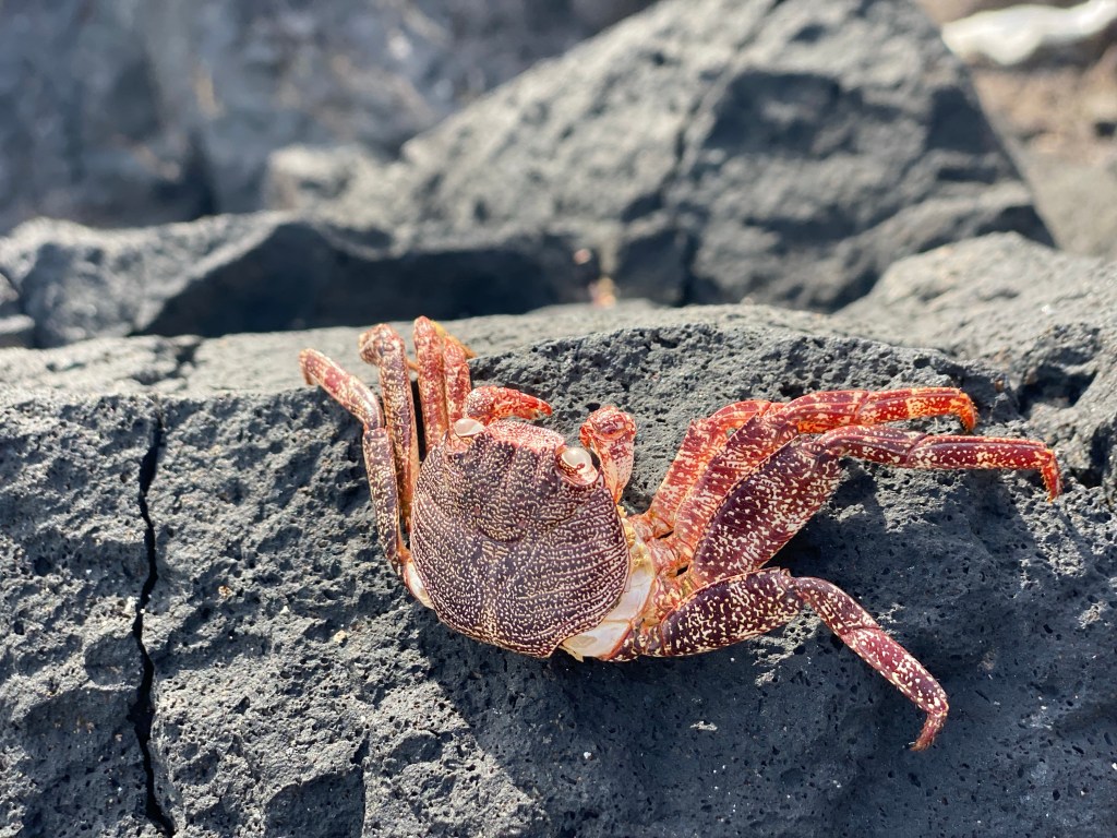
There were a whole bunch of crabs (?) at the water’s edge, some as large as my hand; but all to fast to get a meaningful picture… so their dead cousin will have to do 😉 Starting out the terrain was almost sand dunes, but then quickly got more rocky.

permanent ‘camping’? The path is sneeking along the costline, dipping down through ‘river’ beds and the up and over the next tip constantly. Really quite beautiful and diverse.

Then after about half the distance, the path steers more inland, and becomes a bit more boring. But there is nice views both to the sea and into the mountains; and there is these cuties:
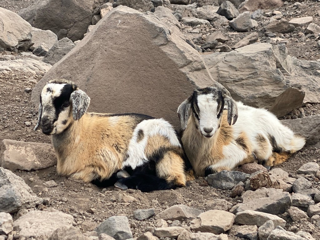
‘Ziegenvieh’ – and not ‘Wollvieh’ (as I learned from the German part of an information sign) Then, just when approaching Morro Jable, the path gets exciting again; running along an old water pipe high up along the steep hillside. Lovely views and cool, differently coloured rock compositions.
Today’s hike was approximately 20km, quite flat and with light pack – so easy 😉
- CANARIES – DAY 11
21-11-26
So today was then consequently yesterday’s plan A – took the bus to La Pared, a tiny little resort on the north coast (with even a golf course, canary style with mostly gravel instead of grass).

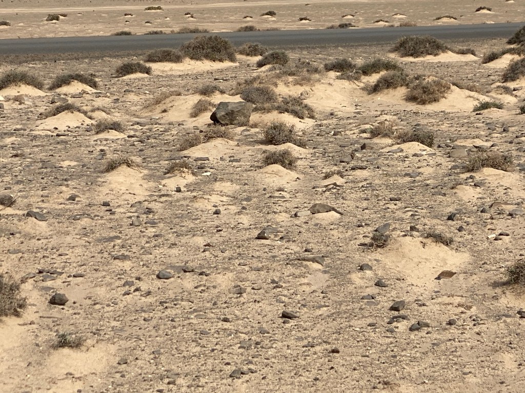
golf course in La Pared From there it was basically straight into the desert; the ‘vultures’ were already waiting for me:

The weather forecast had promised rain – and it actually did rain, a little bit.
after the ‘rain’… Walked past a large wind farm.

Some alive and some dead goats.
And more sand dunes, with beautiful far views because I’m quite high above the sea actually.

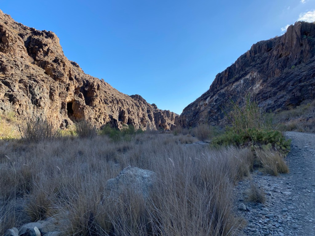
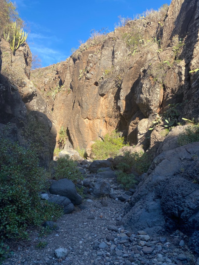
Then the path dips down towards south into the Barrenco de Pecenescal, which forms a strict line between dune-y desert and black rocky mountains.

Barrenco de Pecenescal The path is again in the river bed, but although it had rained a little, there is no water whatsoever. But the bushes seem a lot fresher than earlier – probably just washed off the dust.

The route takes me under the highway and the out to the south coast.


I take a short lunch break in a little shelter (it’s raining some more now), on top of some cliffs with a view out over the sea.
The path follows the coast up onto the cliffs and the down into some barranco canyon, and the up, and down, and…
Until it finally just walks along the beach itself.
Getting close to Morro Jable, there is endless of ugliest resorts and hotels. And more rain.
But also some cool graphity and the salt marsh lagoon.
Solana Matoral salt marsh and the ruins of a tower by the old salines Today was a double-stage of easy and flat-ish 31,5 lightweight kilometers.
- CANARIES – DAY 12
21-11-27
Today is another ‘travel day’, where I say good-bye to Fuerteventura, and move on to the next island.
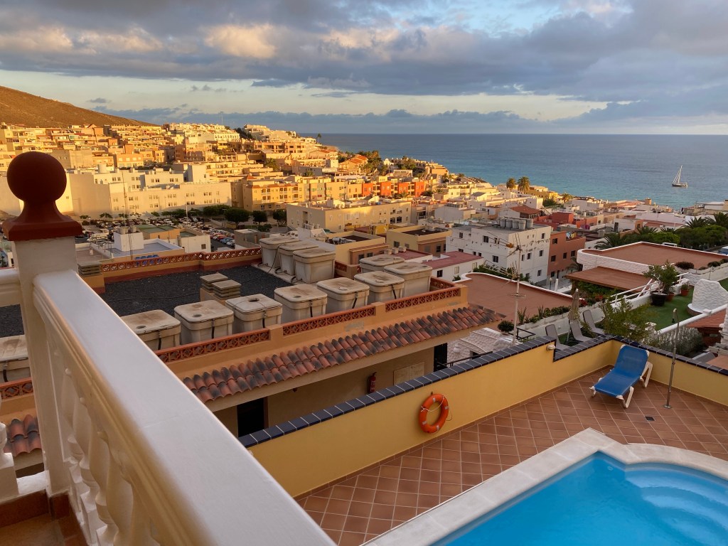
But before that I enjoy another lazy morning on ‘my’ terrace at lovely Hotel Colina on the hill over Morro Jable.
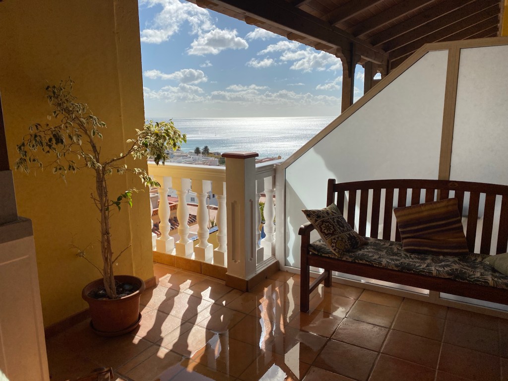
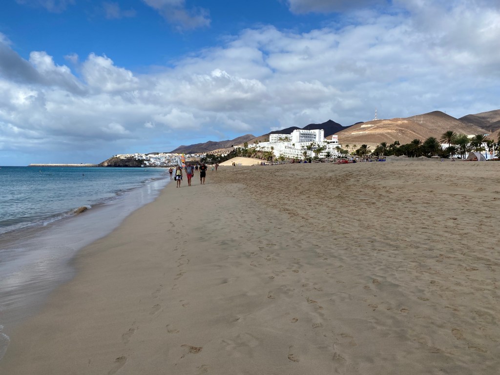
private terazza of room ‘Joros’ in Hotel Colina I spend the day chilling on the beach, quite windy – getting sand EVERYWHERE – but taking almost no photos.
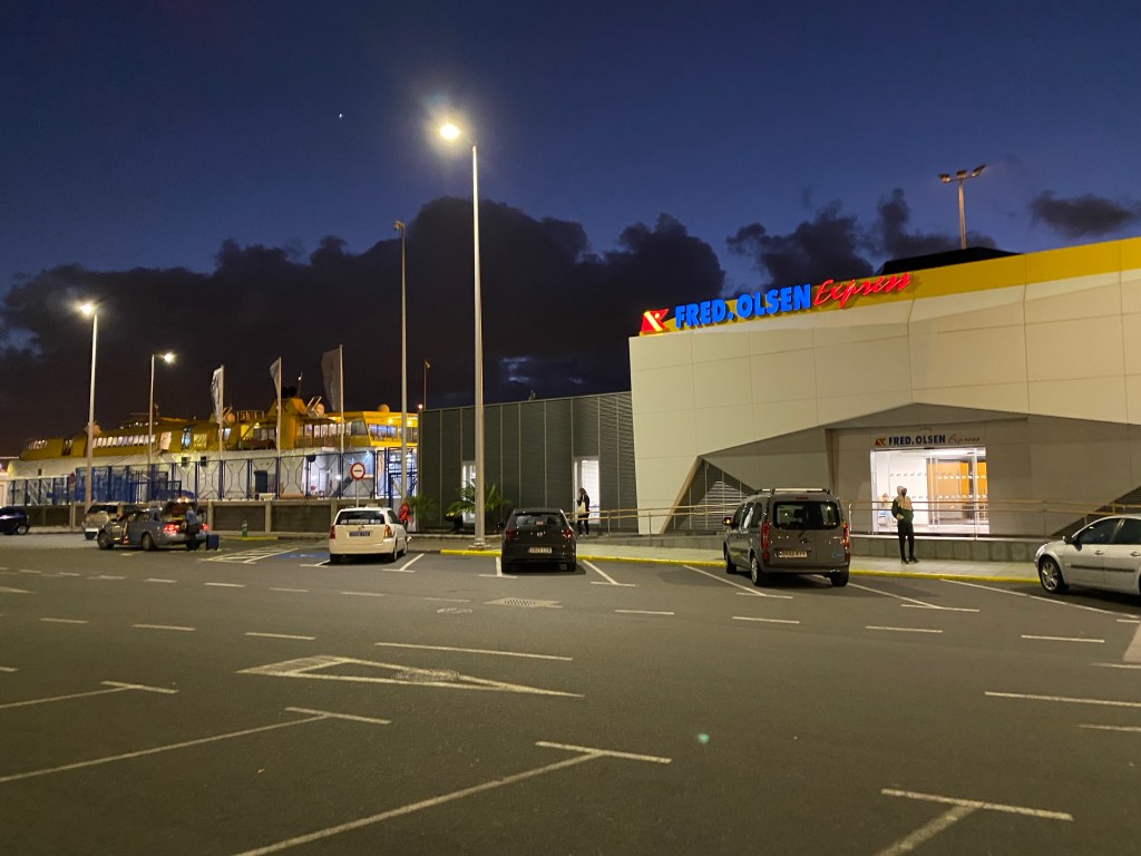
Morro Jable beach Then I make my way to the ferry – Fred Olsen Express.
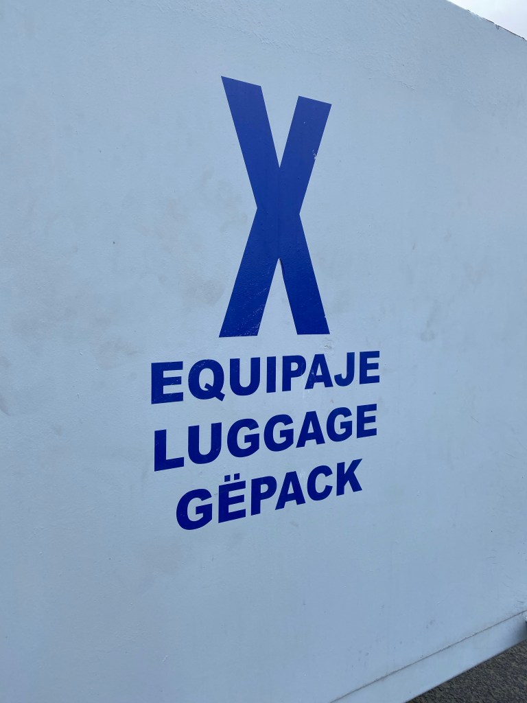
Don’t have any ‘Gëpack’, so quick and easy to get on board.
I find a spot at the front of the boat, but get warned… the sea is really quite choppy today, I might consider move back where the boat is moving slightly less.

ferry out of Puerto de Morro Jable And they are right – 2 hours of roller coaster…
But I survive and arrive at Las Palmas de Gran Canaria just after sunset, where I meet H. for a week of city/pool holiday.
Basically no walked kilometers today 😉
- city/pool break 1
21-11-28
Started the city/pool break with H. today.
Of course the weather has turned to ‘autumn’, with cold wind, 17-18 degrees and short spells of rain. It’s unfortunately but definitely not a day for our rooftop pool terrace.
So we’re walking across Las Palmas, clocking in about 15km in total.

Castillo de la Luz 
Las Palmas copy of Munch museum (or the other way round??)
- city/pool break 2
21-11-29
Continued city break with H.
Again with ‘autumn’ weather, and Mondays being a bad day for museums, we spend the day walking through more of the city of Las Palmas and window shopping.
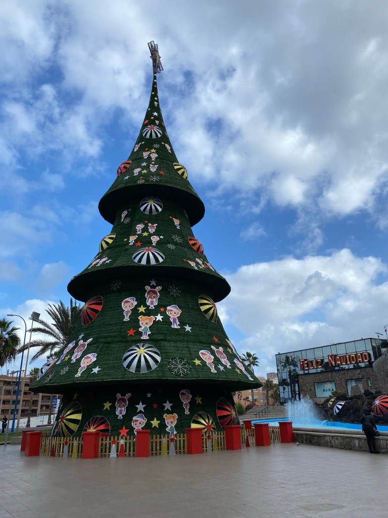
Found a new contender for best Christmas decorations:
Auditorio Alfredo Kraus 
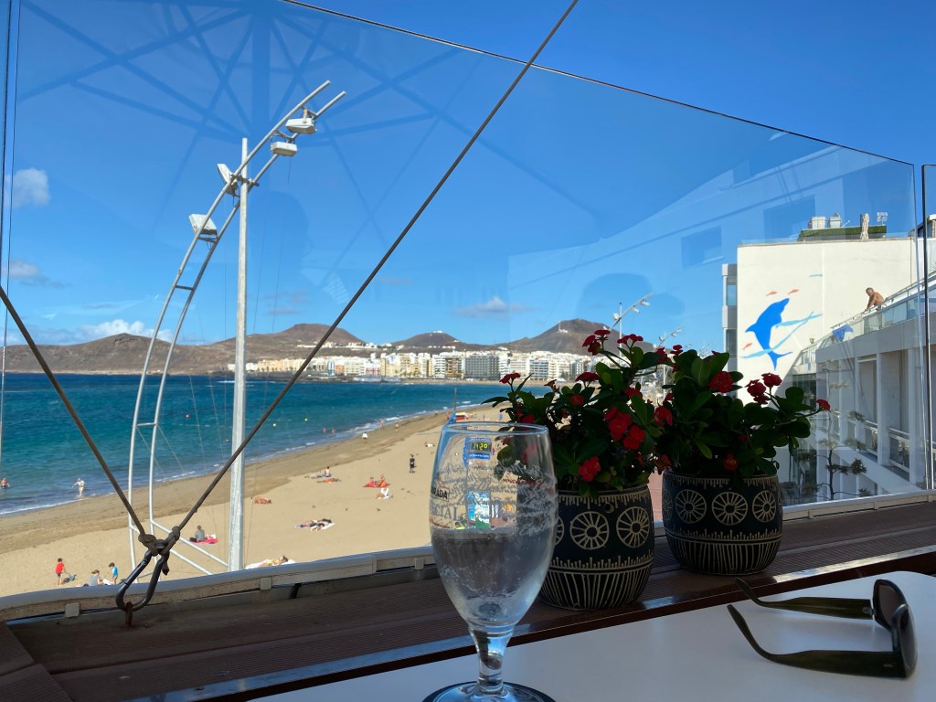
Playa de las Canteras, with city district Santa Catalina in the background And finish off the day with a glass of white wine on the squre of St. Ana.
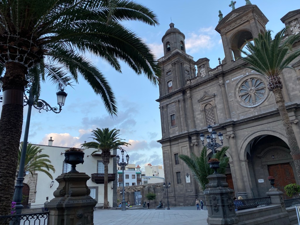
Cathedral Metropolitana de Santa Ana de Canarias Well over 17km of city walking today.
- city/pool break 3
21-11-30
Continued pool/city break with H.
As it‘s finally sunny again, I had my laziest day yet, and did not leave the roof-top pool terrace, except for going for a beer in a bar down the road when the sun got down in the late afternoon.

Exactly 0km of walking or hiking today. 😉
- city/pool break 4
21-12-01
Continued pool/city break with H.
Da capo – see yesterday ;D
Again, 0km of walking or hiking today. Good rest for my feet, ankles and knees for the upcoming two weeks – I hope.
- city/pool break 5
21-12-02
Continued city break with H.
Weather forecast said more rain, but it‘s (mostly) blue sky and sun. Anyway, we‘re up for a city walk again!
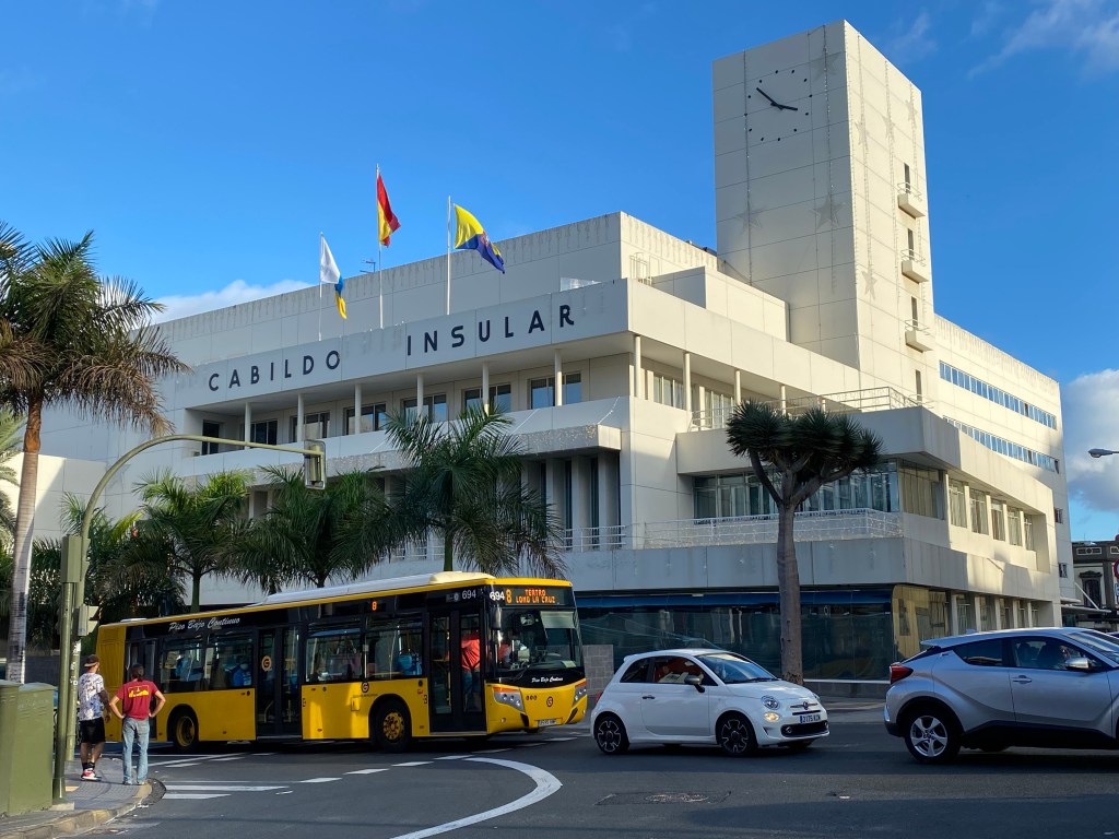
After a nice breakfast in a street café nearby, I first drop in at the Cabildo de Gran Canaria, to pick up a camping permit for my future hikes. Unfortunately one of the camp sites I had planned to stay at, is now closed. But I get my permit for the rest.
Cabildo de Gran Canaria Then it‘s strolling through Las Palmas once again, and having a lunch salad at an italian restaurant with roof top terrace near Playa de las Canteras.
After that we walk back to Castillo de la Luz, to see the interior; H. has already visited this two days ago -when I was too lazy- and convinced me that it‘s an architectural must-see. And that is correct!
Castillo de la Luz Once done with the architecture-nerding, we meet ‘Obelix’ at the harbour Puerto de la Luz, and have a look at all the other various ships.

Then it‘s back to the old town district of Vegueta, where there is lovely light – and so many nice old houses!

Vegueta in evening light 
All in all walking across Las Palmas today: roughly 15-20km.
- city/pool break 6
21-12-03
Continued city/pool break with H.
Travel day! We have decided to spend the last 2 nights in the south of Gran Canaria instead; it’s supposed to be less rainy, H.’s brother should be there by coincidence, and that’s near where I will continue hiking on Sunday.
So we leave our gorgeous room/flat “Silbo” at La Colonial in Las Palmas.

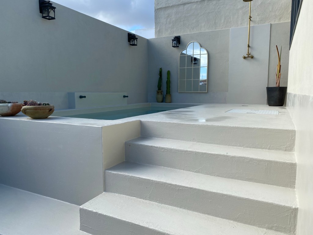
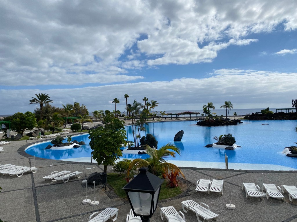
“Silbo” at La Colonial And move to this place in Puerto Rico (de Gran Canaria); what a difference!

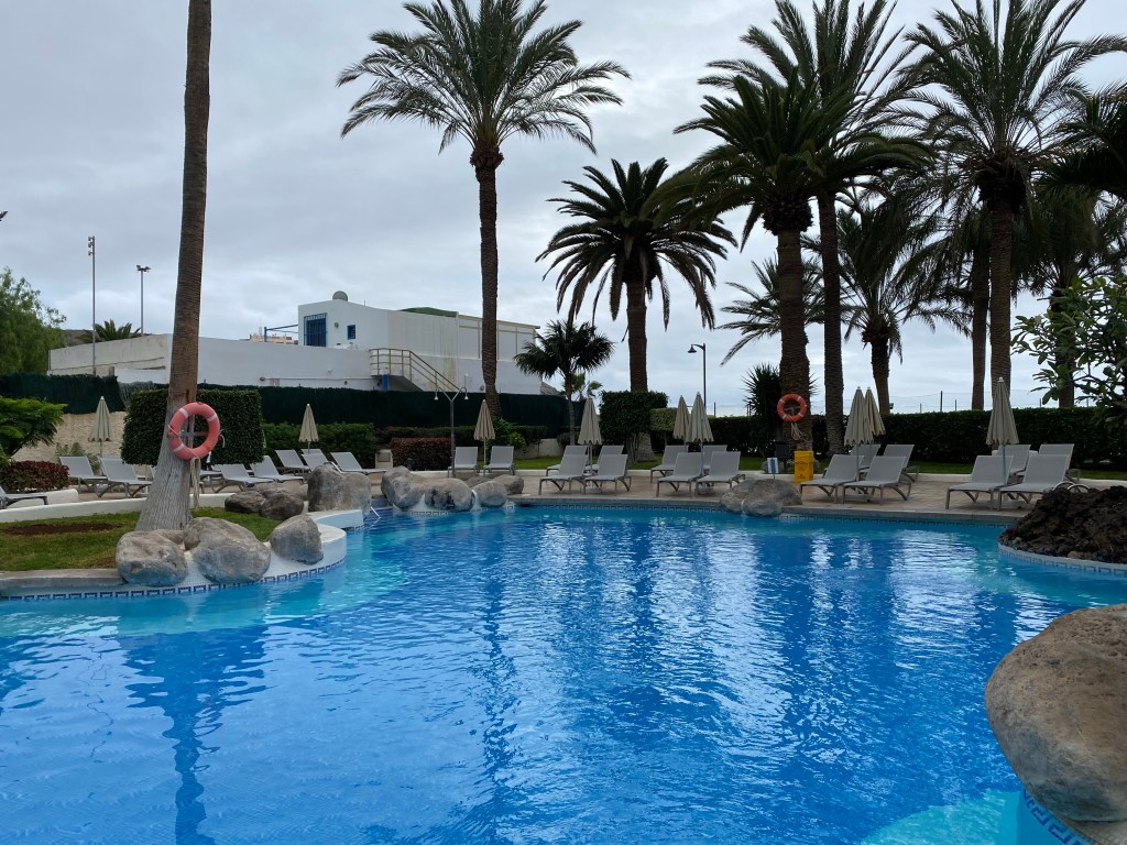
deck access at our hotel in Puerto Rico Well, at least there’s an infinity pool next to the ciffy seaside.
We stroll a bit around the harbour and beach, as well as through tourist heaven/hell.
And then watch the sunset over the harbour from our balcony.

Today’s km-count: hardly mentionable, maybe 5-6km.
- city/pool break 7
21-12-04
Continued pool break with H.
Today was all about enjoying the infinity pool, baking in the sun, and ordering drinks from the pool bar.

In the evening H.’s brother had finally arrived, and we tested his balcony for the sunset view, before going out for dinner and more wine.

Pretty much zero km today; getting well rested for continuing my hiking tomorrow!
- CANARIES – DAY 13
21-12-05
Finally back in my hiking shoes!
Bikinis, ‘proper’ clothes and shoes fly back in H.’s suitcase.
Again due to available accomodation and bus time tables, I choose to hike the first stage on Gran Canaria ‘backwards’. So the day starts – as so often – with a bus ride.
I arrive at Palmitos Park all eager to get hiking; feeling very clever to have spottet this alternative – the plan is to hike the 2 or so kilometers to Ayagaures on a road clearly showing on all maps (as there is no busses to Ayagaures itself it seems).
But….
closed ‘private’ road past Palmitos Park After enqueries at the park ticket booth, where I get a clear and final ‘no’, there seems nothing I can do, but walk back the 8km that I just came into this valley by bus.
But, after 200m a car stops next to me, and a very kind and helpful man offers me to drive me through the ‘closed’ strech; he has access since he works at the hotel further in; and from there it’s public and open paths and roads again!
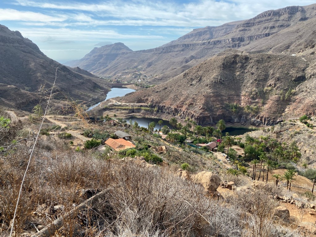
view after climbing the 500m path from the hotel to the ridge line – near Cima Pedro Gonzalez 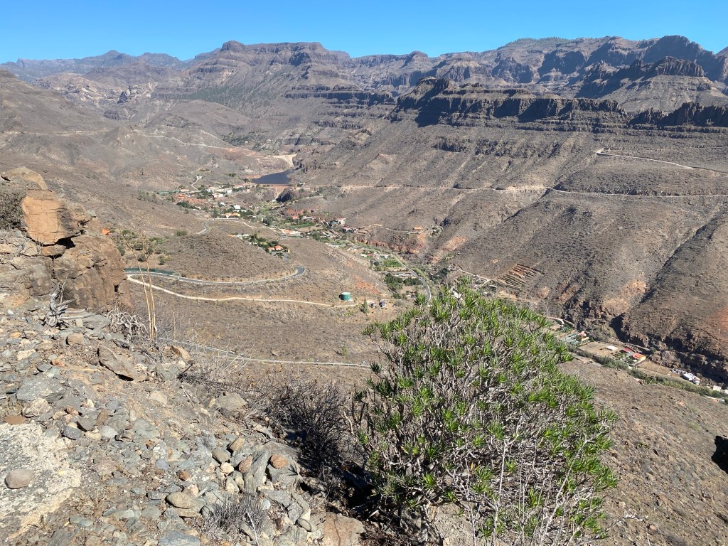
view of Ayagaures and the reservoir lake, from the same place as the picture above Walking through ‘lush’ Ayagaures, with it’s lemon, orange, fig and olive trees. Considering to stop for ice cream at the curch square café – but decide it’s too early for a break.

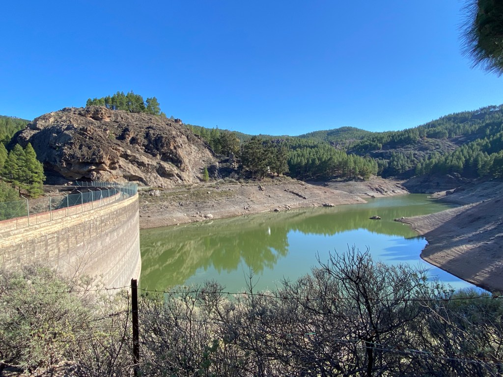
Iglesia de Ayagaures Then it’s across the dam – first time I see open water, that’s not the sea, on any of the islands. Tomorrow’s stage will continue from here and further into this valley.

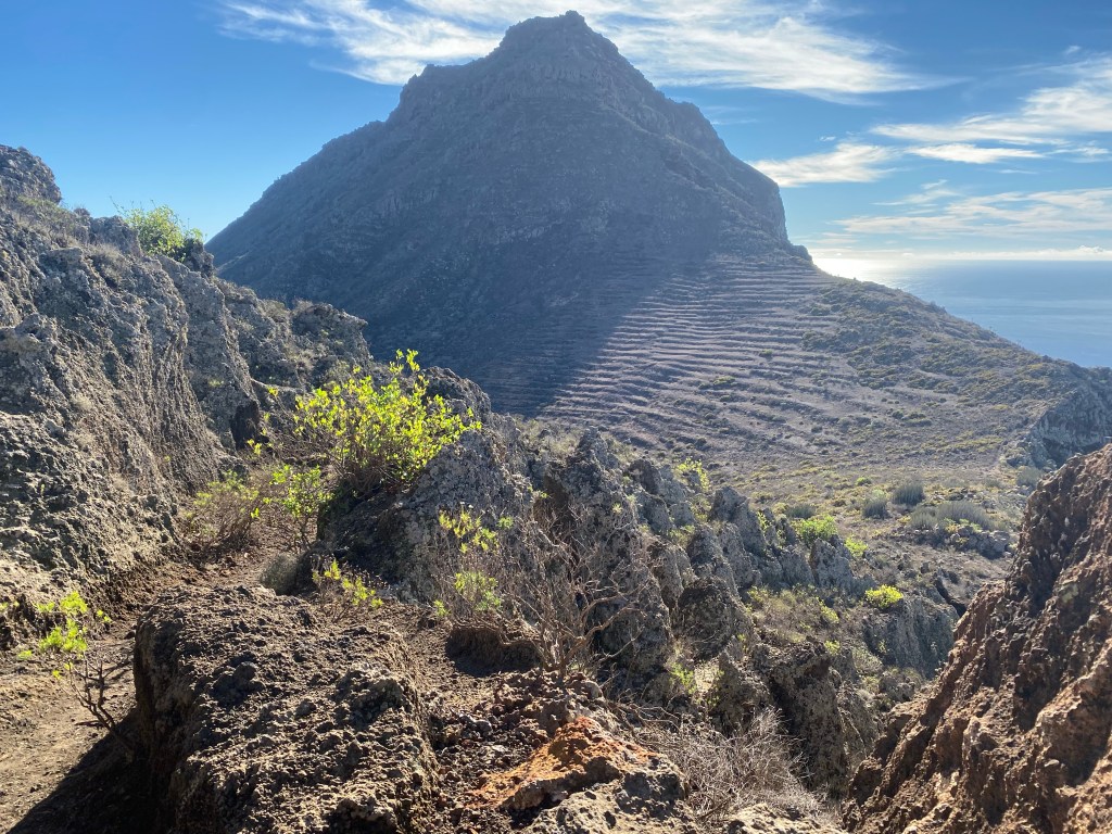
Presa de la Angostura Today I turn around and follow a steep gravel road up, opening up more great views of the valley with it’s canyon-like cliffs and green strip at the bottom.
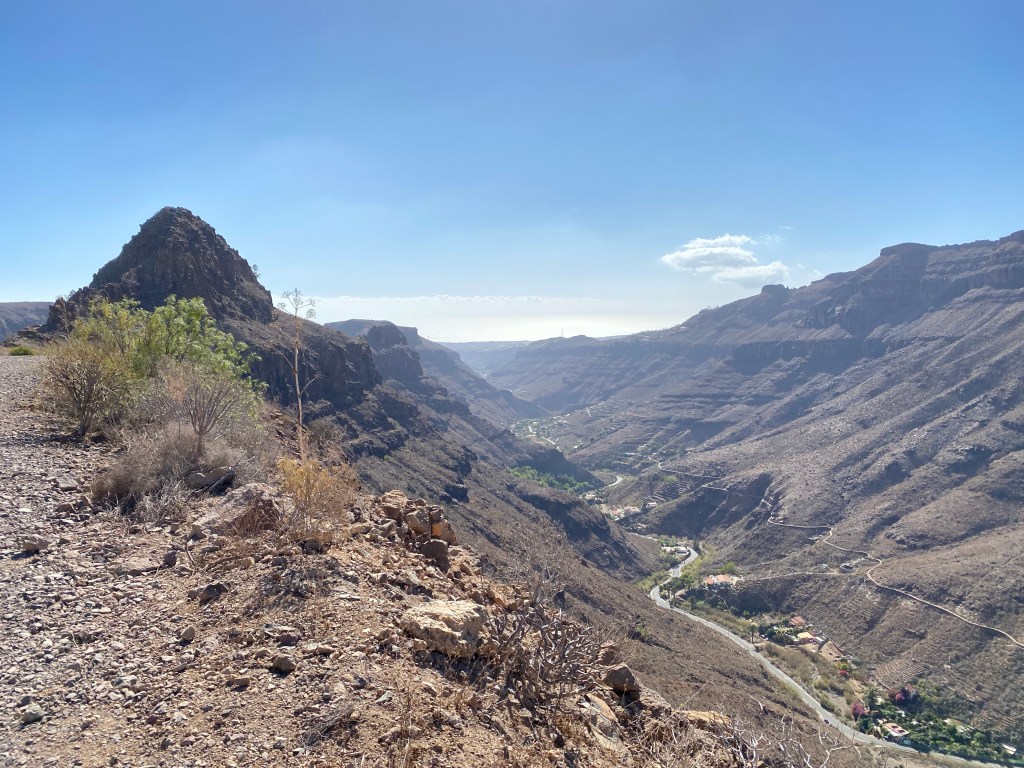
Barranco de Ayagaures Over the next ridge, I continue down into a parallel barranco/valley just east of this.
scenery and path down into Barranco de los Vincentes The -now smaller- path ist zigg-zagging steeply down and then follows the river out towards Maspalomas. And often times the ‘river’ is actually the path.
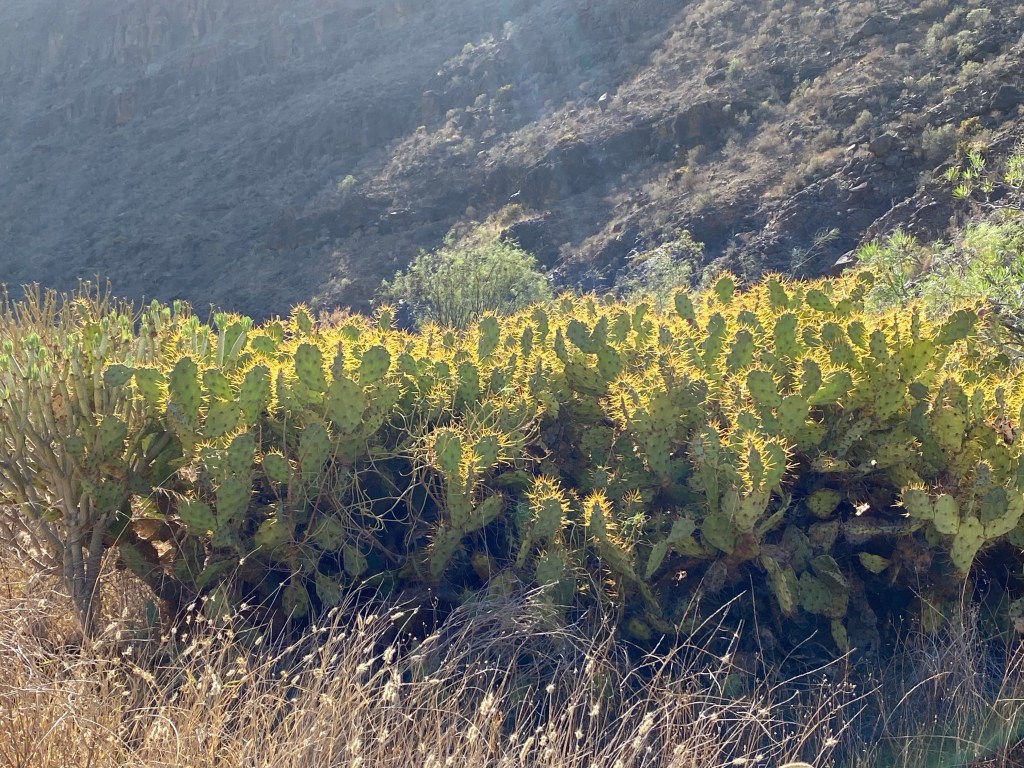
There is gorgeos rocky cliffs on both sides, and dramatically light ‘glowing’ cacti.
(Almost) too soon the path opens up again and leads into the back side of civilisation.

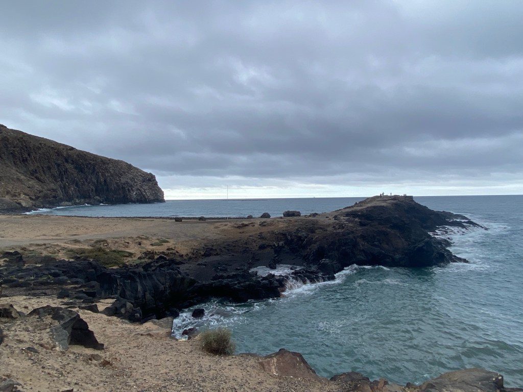
I follow the wide and regulated -but empty- river bed all the way to the coast, where it’s joining the sea just by the Maspalomas lighthouse.

Faro de Maspalomas That’s the end of today’s stage, or rather would have been the start of the GR131 across Gran Canaria.
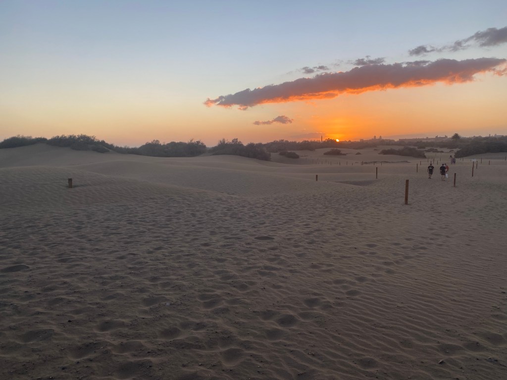
After a snack and sugary drink, I get a bonus hike to find my hotel – across the famous dunes.
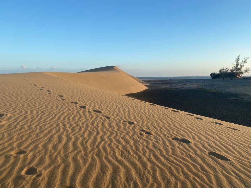
Dunas de Maspalomas It’s quite .. well, very .. windy, so I get properly sandblasted, sand sticking everywhere.
But, I also get to see a super beautiful sunset – perfect end of an exciting start to my part 2 of the hiking adventures!
Approximately 27km hiked today (incl. about 5,5km of ‘bonus’ hike).
- CANARIES – DAY 14
21-12-06
Contrarily to yesterday, today everything worked out even better than planned:
Woke up early and well-rested, got up and found an open grocery shop just around the corner. And open, although it’s a public holiday being Spanish Constitution Day today.
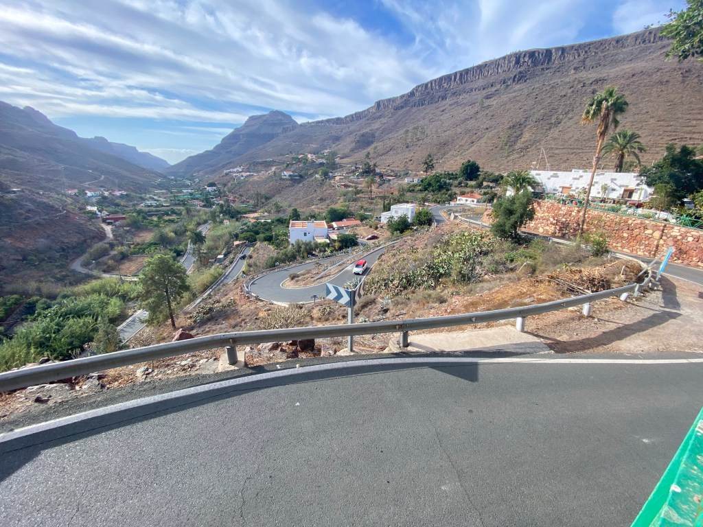
Then walked half a block up to where google thought there might be a taxi stand. It’s there and with one taxi just waiting. Got in with a nice female driver, who told me that she just loves Ayagaures (where she was driving me), because it reminds her of her home – the island of La Palma (at least before the recent volcanic eruptions there).
Shortly after, I stand again on the church square of Ayagaures, looking back out the valley to see my taxi make its way down.
Barranco de Ayagaures seen from Ayagaures church square I start my hike in lovely cool weather (19degrees the taxi driver thought), some few clouds giving shade, and some few other hikers (also locals making use of their holiday).
First strech is along the reservoir lake, and then up and crossing the dam of the second, inner lake.

Presa de Gambuesa Then the route starts climbing steeply, first as a road past some few houses, then reduced to a path.
view back onto Ayagaures Alto and the two reservoirs The path is probably one of the old caminos reales, because it’s really nicely stone lain in several places. And I also read on one of the boards that the people of Ayagaures used this path to bring their dead to the cemetary in San Bartolomé.
There is a lovely light pine forest, for once completely natural and without artificial watering. Great with some shade working myself up the about 900m ascent!

Great views both down and up.
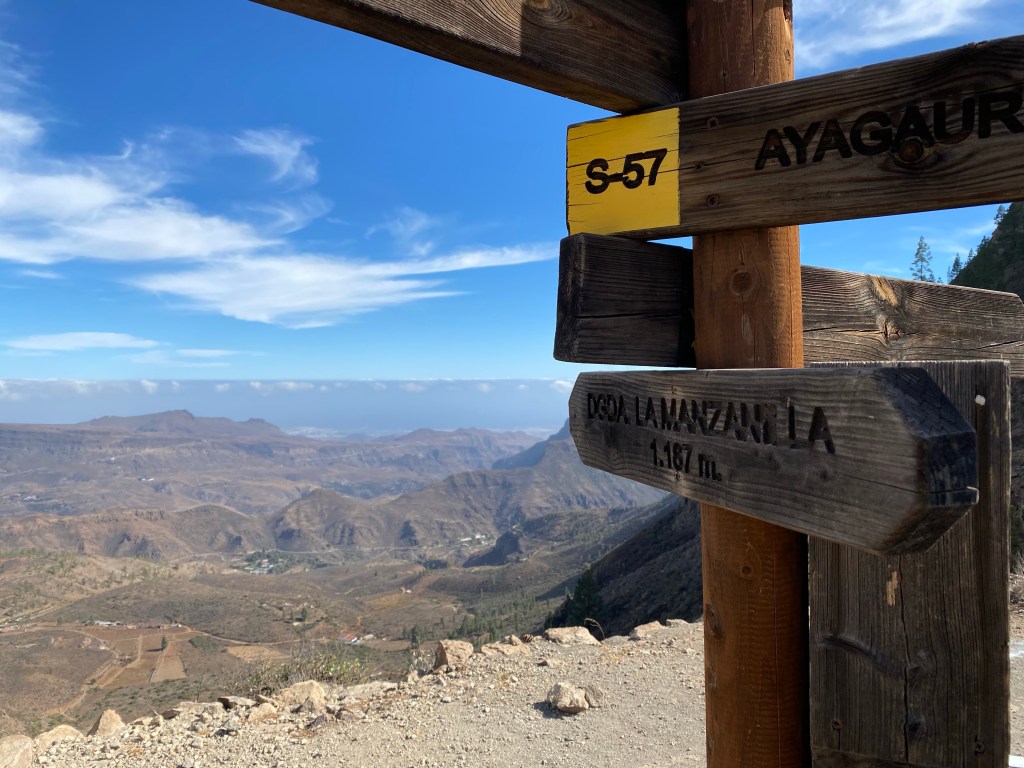
Then finally I’m at 1187m asl at the Degollada de la Manzanilla, and the view opens up towards the east as well. I can even see the sea, although it’s quite hazy.
Degollada de la Mazanilla, with view east After a second lunch break and 20min just lying-in-the-sun (because I can), I start my descent towards Tunte / San Bartholomé de Tirajana.

Before too long I’m entering this lovely little town, with a lively cafe/bar street (that I forgot to take a picture of).
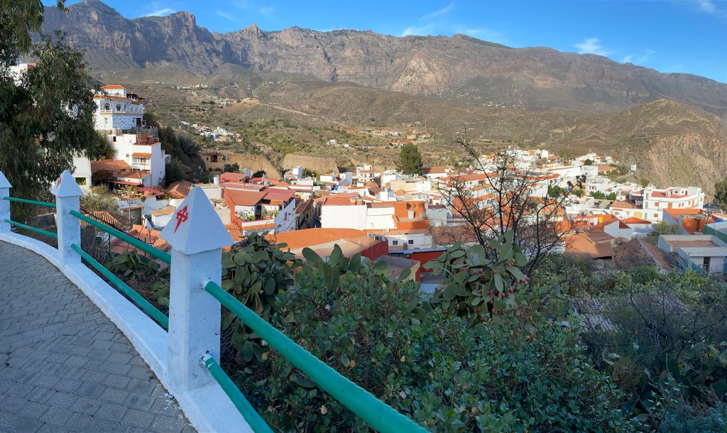
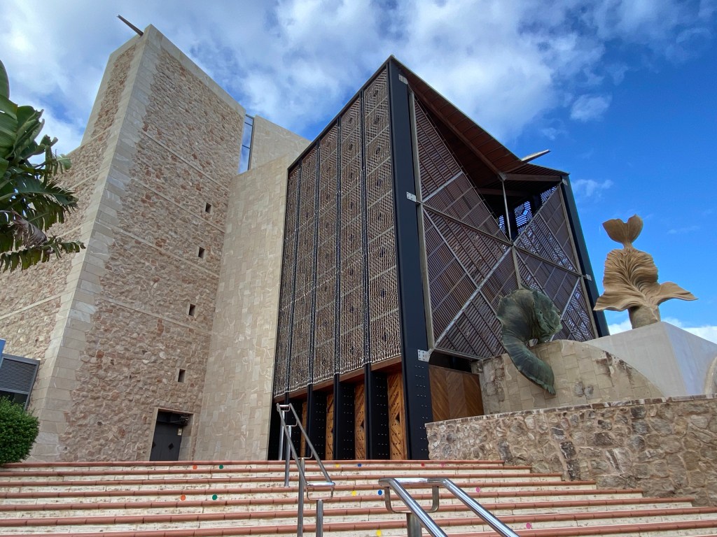
I visit the quite big church; actually I also followed a Camino de Santiago up to here – so it seems to be / have been an important one.
Inside, everyone is already prepped and waiting for X-mas:
nativity scene at Iglesia de San Bartolomé de Tirajana Total for today: approx. 12,5km with just under 900m of ascent and the full heavy pack again.
- CANARIES – DAY 15
21-12-07
Since I have my accomodation in San Bartolomé for 2 nights, I can again speed up with a light backpack only.
I start up getting some canarian croissant from the bakery, and take the path out of town. It’s zigg-zagging up the hill, in good old camino real style.
look back down towards San Bartolomé You can see that this path has been used, also with pack animals, for centuries.

Quite fast I’m at the Degollada de Cruz Grande, where there is a great view back down the huge -originally volcanic- crater that San Bartolomé lies in the centre of.
presumably the big cross of Cruz Grande I can also finally clearly see the Risco Blanco, which is said to be both holy and magical…
Risco Blanco From there the path goes wild – first along a narrow ridge and then snaking up along a huge cliff.

path S-50 from Degollada de Cruz Grande Then it flattens out on a lovely pine tree covered rocky plateau.
And there is an actual real little brook, with water!
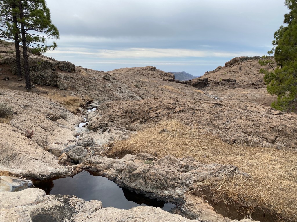
Llanos de Pargana The path stays on the plateau with views into the canyon-like valley of Canadas de las Cuevas de Pargana to the east.
I’ve been so fast that I realise too late that I have passed the crossing that I originally had planned to hike down to a bus stop. But the weather is cool and nice enough, the scenery is gorgeous, and it’s still early. So I change my plans and hike on.
I have a lunch break at Degollada los Hornos, before I turn west towards El Montañón (1762m asl).

El Montañón is the nearer rocky top on the left. What I don’t realise at this point (yet), is that the rocky finger in the background on the right hand side is the famous Roque Nublo!

mini-plateau by El Montañón There is quite a dramatic scramble down from El Montagñón:
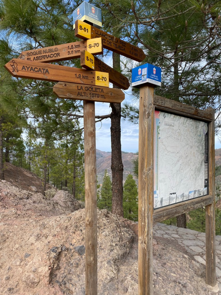
Then the path exits onto a road at La Goleta, and what the filled-to-the brink parking lot, the icecream & snacks van and the number of people strolling around tells me, is confirmed by signs: 1,5km to Roque Nublo!
signs at La Goleta I double check bus times, calculate, and find that I should just about have time to reach it and come back to then ‘run’ down to Ayacata to catch today’s last bus.
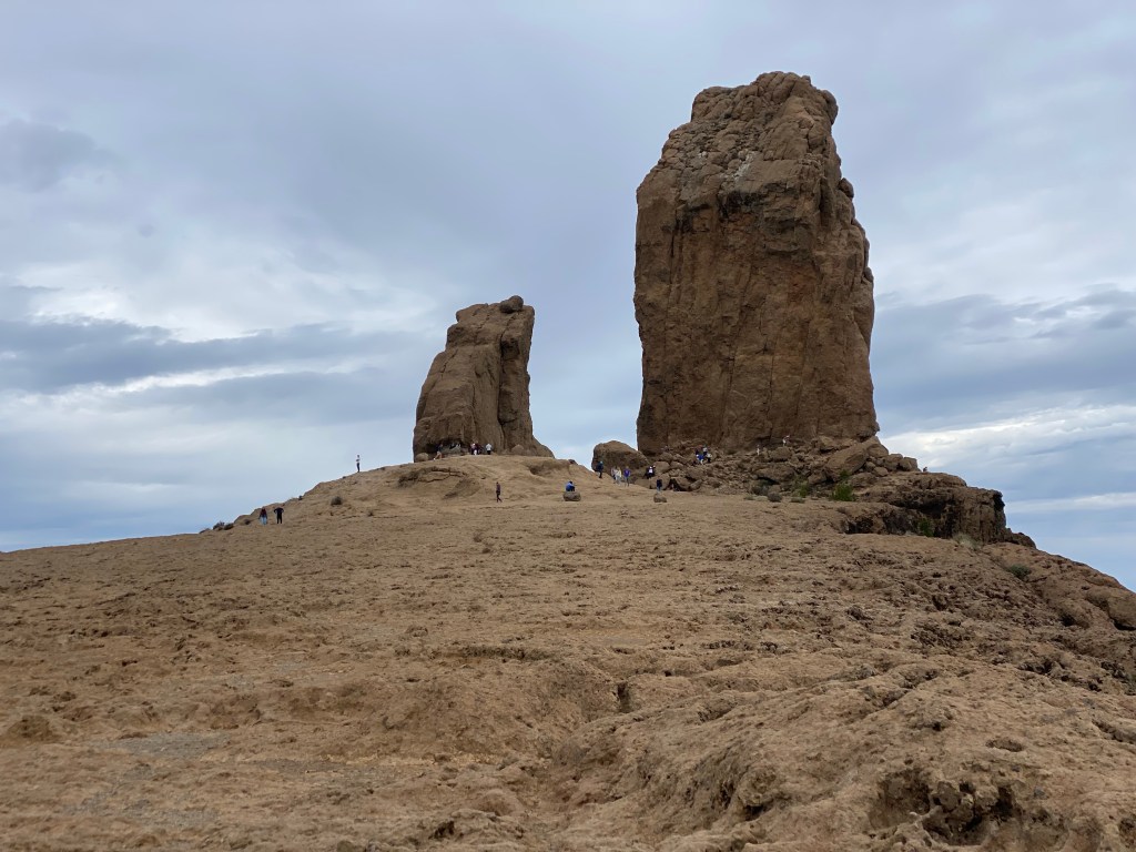
Roque Nublo (plateau at approx. 1740m asl) It’s nice, but with all the people, their trash and wide path, I find it a bit disappointing – compared to the other places I’ve seen just today. But still, it’s a cool rock formation – looking best from a distance 😉
I make it to Ayacata with 40mins to spare – just enough time for a well-deserved cerveza tropical limón at the bar by the bus stop.

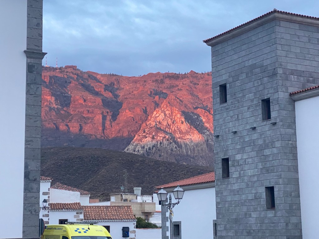
Ayacata When I finally arrive back to San Bartolomé, the magic rock is ‘on fire’ by the sunset light.
Total ca. 16km, with quite some ascent (over 800m) and descent, but light pack.
- CANARIES – DAY 16
21-12-08
Saying good-bye to San Bartolomé, I stop by at the bakery again – but they’re sold out of their delicious croissants. Have to ‘make do’ with another almond-orangey thing, and go for the bus to Tejeda.
On the curvy 45min bus ride, I think I could spot Tenerife! (But was not quick enough to take a picture.)
Tejeda is a lovely well-kept, but a bit touristy, little town. I visit the cemetery and the church, while all the time looking for a grocery shop that’s open despite of 8th december (Marias conception)…

cemetery in Tejeda 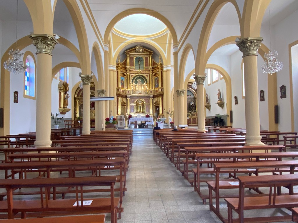
Parroquia De Ntra Sra Del Socorro, Tejeda Finally I spot a tiny little bakery, and get water, bread and cheese, and chips – for 2 days.

side street in historic Tejeda Then I make my way back a couple of 100m along the road – to then start ‘climbing’.

view back out Barranco del Mollino, towards Tejeda I walk through the hamlet of La Culata, which has a lovely simple church (could be protestant in all its scarcemess, but surely isn’t).

Nuestra Senora de Fatima, La Culata Some chicken, and later on some german speaking locals, show me the way.

La Culata locals Then it’s further steep uphill, with the famous ‘El Nuble’, where I was yesterday, now on my right hand side (west of me).
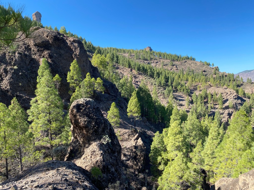
Roque Nuble (the left of the ‘rocks’) There is also more nuble (fog) creeping in over the hills to the north-east. The weather forcast had actually ‘promised’ a lot more of this, but so far it’s nice and sunny.

I take a lunch break at the Mirrador Presa de los Hornos, before I cross the dam of the actual presa.
Presa de los Hornos And after another short climb I’m at my goal for the day, at 1685m asl.
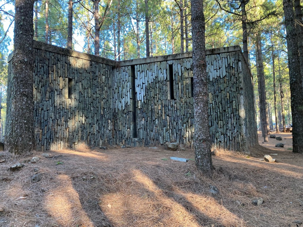
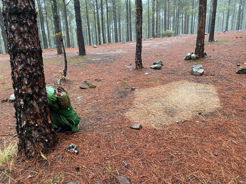
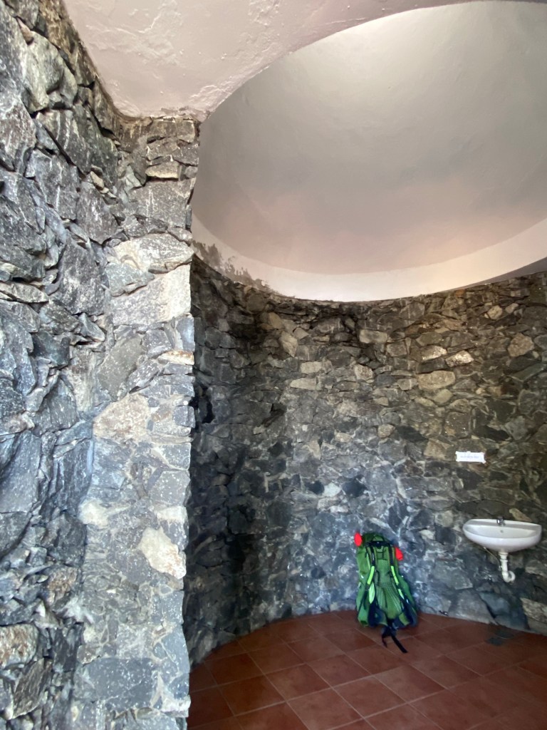
sanitary building at Acampagnada de Llanos de la Pez …and can -for the first time- set up my tent 😀 and then enjoy the evening sun; although it’s getting dark and cold fast!

home for the night After nightfall, it’s a gorgeous sky full of stars, no other disturbing lights.. just trees are in the way (as usual).
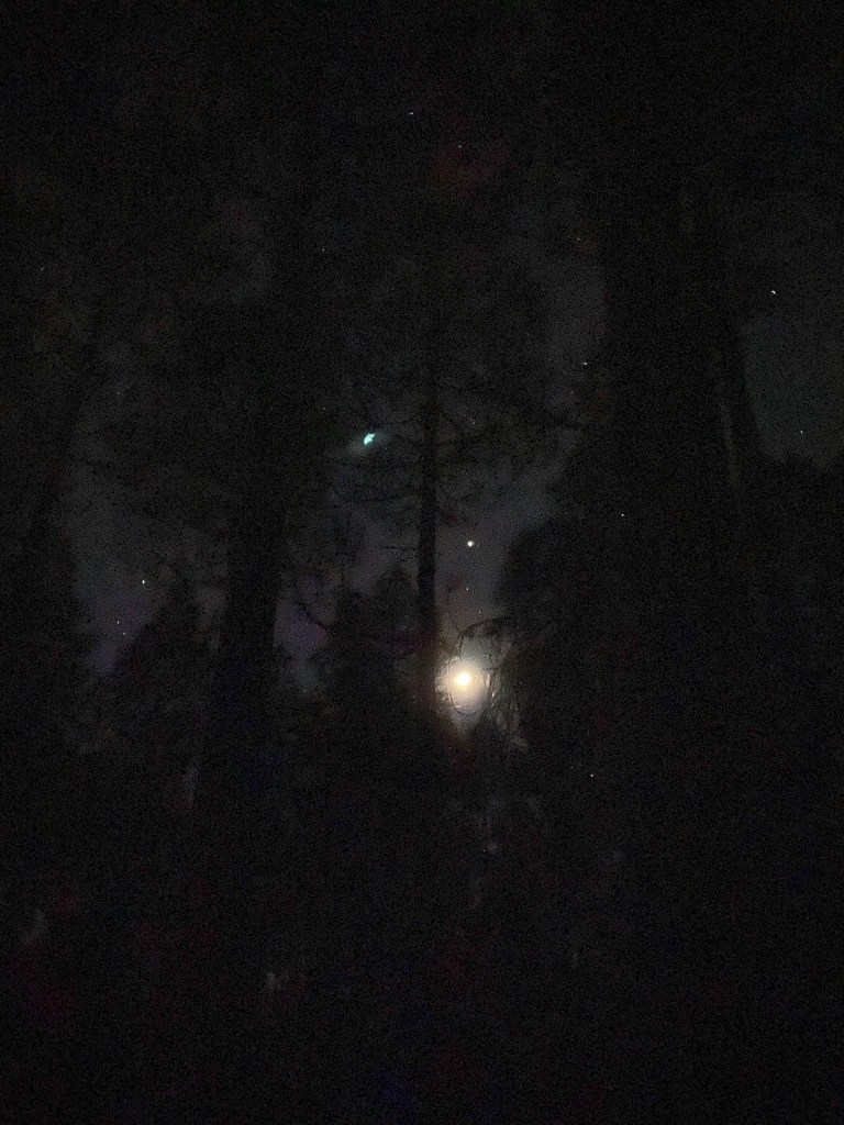
night sky at Llanos de la Pez Total only approx. 8km, but with just under 700m ascent and double-heavy pack (water for 2days!).
- CANARIES – DAY 17
21-12-09
I wake up to this:
can you hear the rain? So, the weather forecast is finally right. Rain all night… promised more rain, with a lot of wind in addition, all day.
But my tent kept me nice and dry, and my sleeping bag was easily warm enough.
packed up and ready to go And there is just a hint of blue sky (and view), to get me going.

2 minutes of ‘blue’ sky So I start out into the fog, sideways ‘scottish mist’, and muddy-slippery paths.
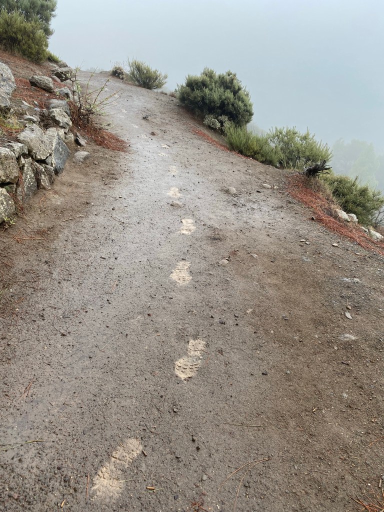
Luckily the path is wide enough, so I don’t get blown off down into ‘nothing’.
Touch the road again at Mirrador Degollada de Becerra.
Degollada de Becerra And then make it to Cruz de Tejeda.
Normally this cluster of buildings and tourist shops should be bustling with people speaking in all languages and sipping coffee in the sun and fresh mountain air…
…but:

Cruz de Tejeda There is only one shop owner considering to open up, and desperate to help me with «sandwich? umbrella? café? agua??» – which I all decline, I need to keep going not to get cold.
Battle on… there is some really nice and mystic views actually also in this weather!
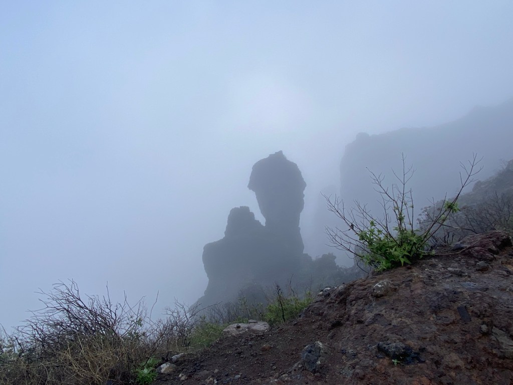
Past some more view points (without views) and caves (that I don’t dare to go to, because the paths leading there is a slippery path next to ‘the abyss’ and it’s full storm).
When suddenly:
another 2mins of blue sky and touch of a rainbow But then I’m already at Artenara, where I stay for the night.
Decide to get all my sightseeing done before getting inside and drying up. Amoung them:
– a fantastic little cave chapel; a real highlight!

Ermita de La Cuevita 
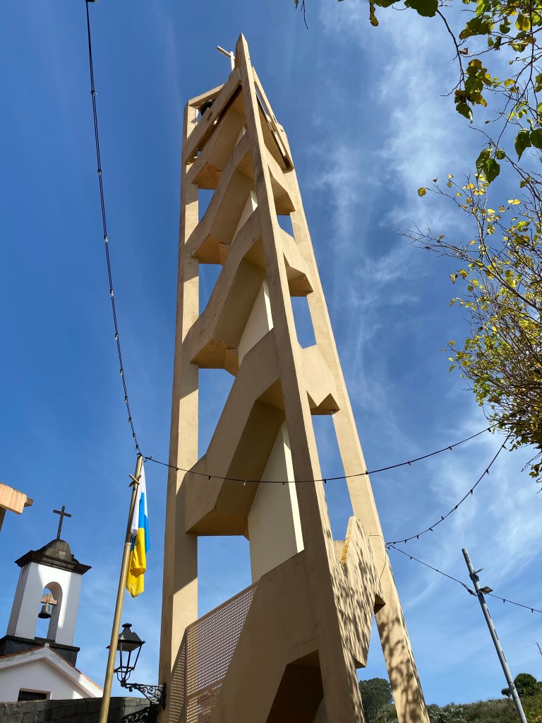
Ermita de La Cuevita – the church, with a modern extension(?) or maybe market place?

Iglesia de San Matías – a dramatically huge Jesus, towering over the village

– and a cave house, whose roof looks somewhat like a glacier
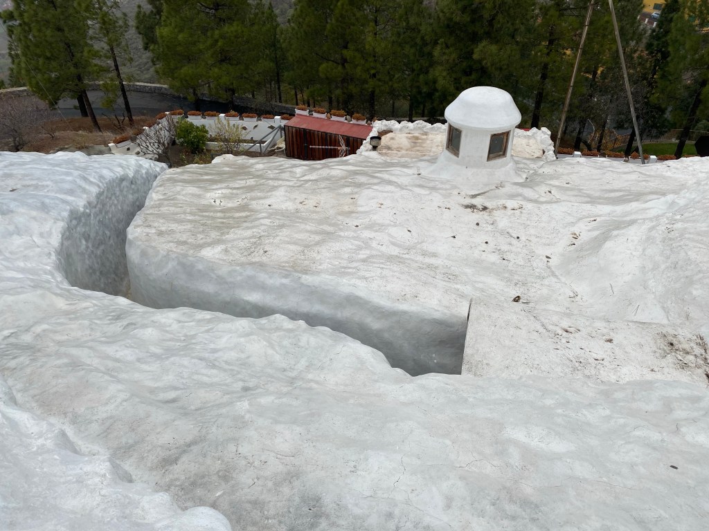
cave house roof Today amounts to roughly 12,5 wet downhill kilometers.
- CANARIES – DAY 18
21-12-10
After one night in my ‘Cueva del Molina’ apartment, I’m moving on – luckily it’s much better weather today, although still quite windy (already dreading the thought of going on the ferry to Tenerife in a couple of days).

my bedroom at Cueva del Molina Stop by the bakery for some breakfast dulces, and then I’m quickly out of Artenara – it’s quite compact and small, but a lovely place.

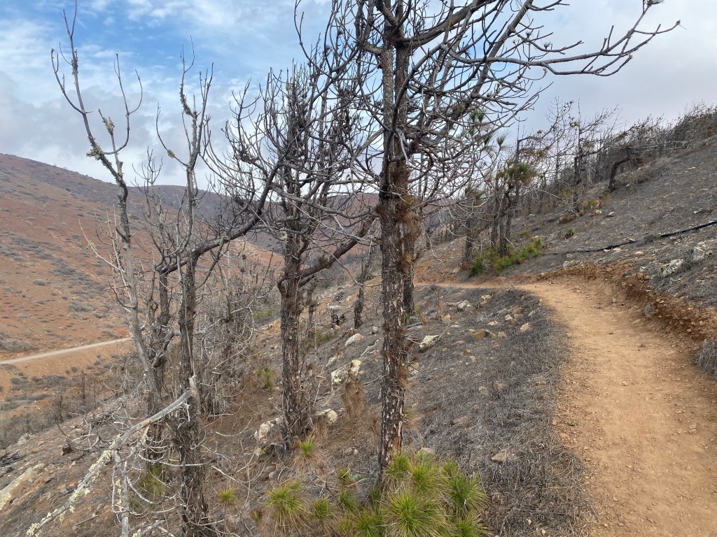
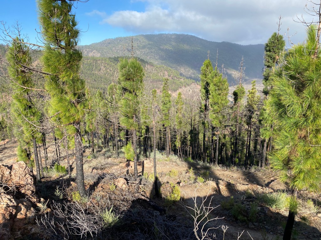
looking back at Artenara The path takes me loosely downhill through some pine forest, that obviously had burned some years back (2019 I heard), but came back to life.
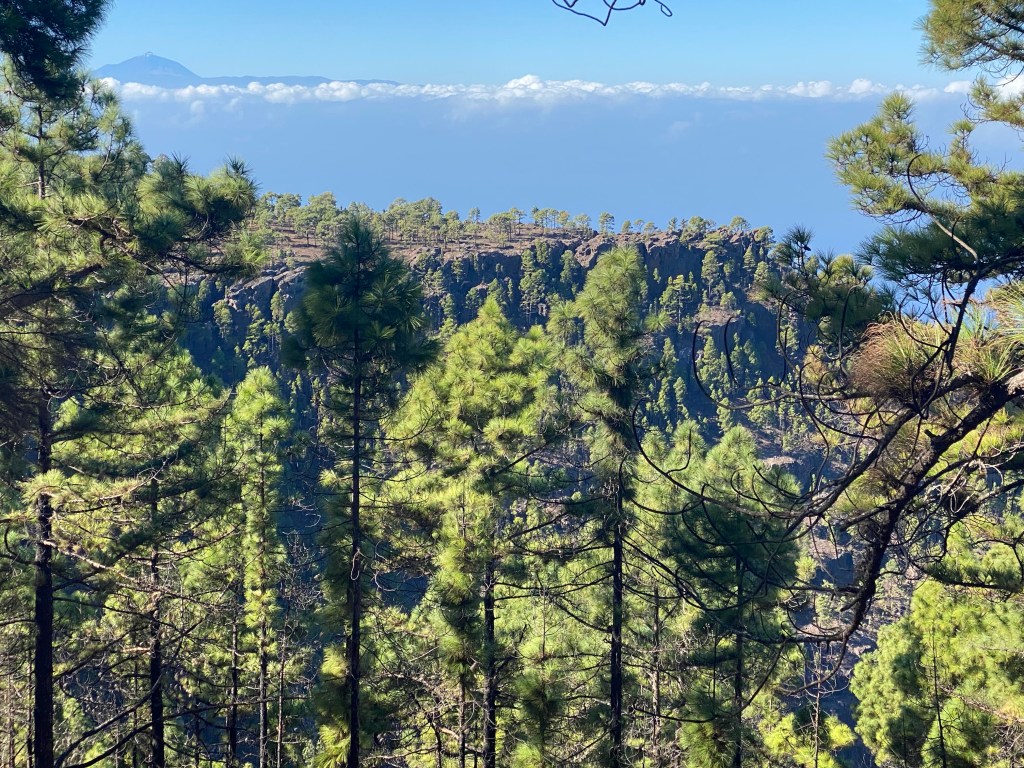
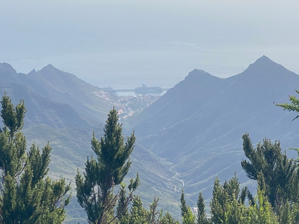
There is also odd views out to the coast already, and across to the next island – or more, to El Teide, the highest volcano.
Seems no snow there so far?! (significant because I’m considering to climb it, the highest mountain of Spain…)
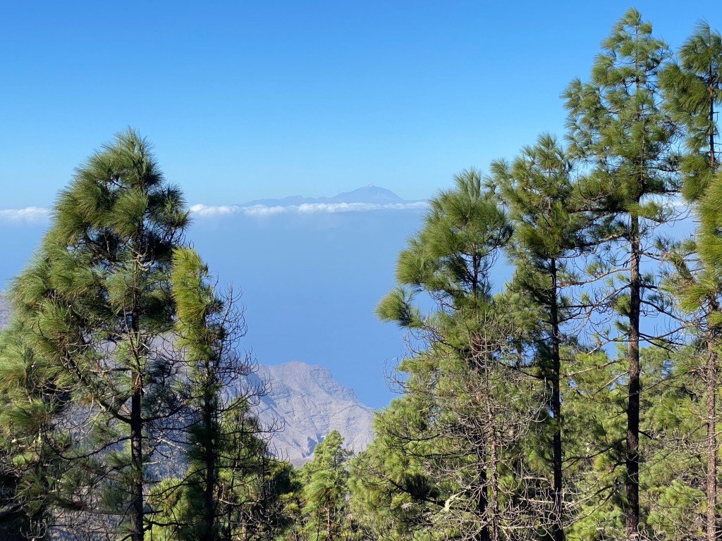
view to the sea and El Teide on Tenerife The vegetation has changed a bit, no more cacti or agave, but ferns instead – there is obviously more humidity here (and not just due to yesterday‘s rain).

And before I know it, I‘m at Tamadaba. It‘s an ‘área recreativa‘ – so picknick benches and barbeques. And another architecturally quite nice sanitary building.
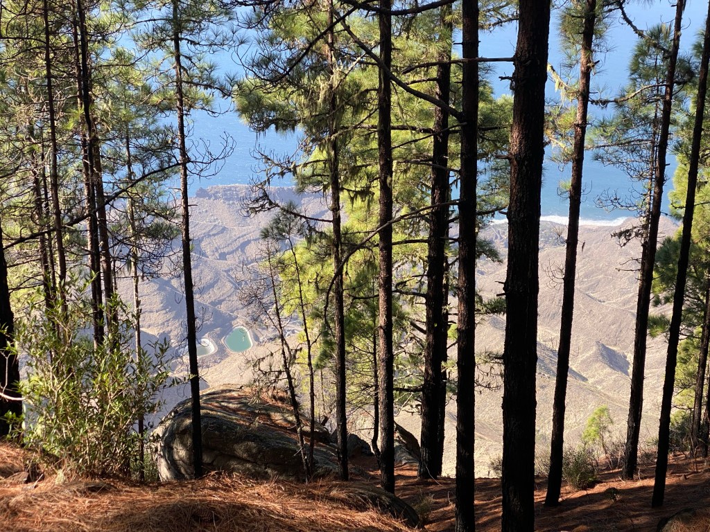
sanitary building at Tamadaba I take my lunch break there, and enjoy the view. Amongst other things out to Llanos de la Mimbre – where I had wanted to camp; but it‘s closed for construction work.
view to the plateau of Llanos de la Mimbre Then the path gets steeper and steeper, the landscape suddenly just drops towards the coast.
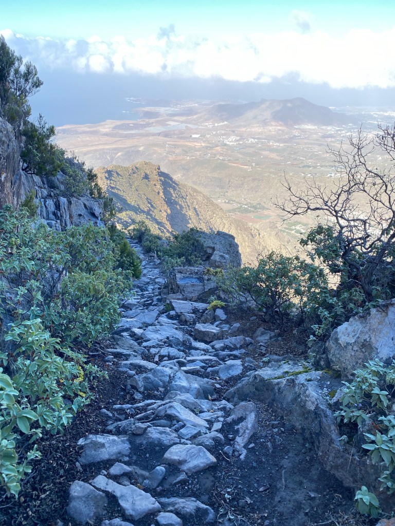

view forward It‘s seemlessly endless downhill, the path snaking back and forth along the hillside – always finding the best possible passage between cliffs.
I bite down on my upcoming fear of heights, and focus on the small things – like this beautiful grass with razor-sharp leaves and the sofest of soft ‚flowers‘.
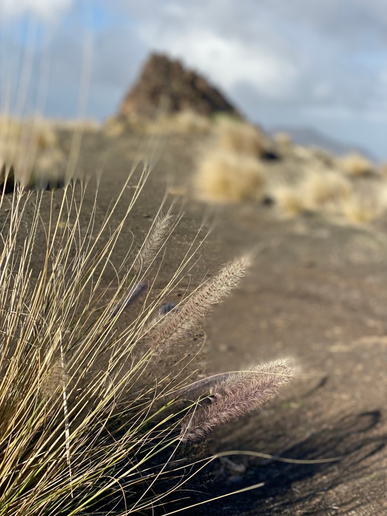

view back And finally it gets flatter; and it seems like I‘m back in milder and dryer climate – back in catcus-land.

Today was approximately 18 km more downhill (from 1240m asl to almost sea level).
- CANARIES – DAY 19
21-12-11
Since I’ve come to the northern end of Gran Canaria, there isn’t really anywhere to hike further (except if I learned to walk on water). Also I deserve minimum one rest day. So it’s town and travel day!
It starts before sunrise when the rooster crows (not sure if he’s still on summertime or whatever… thought they kikeriki at sunrise?). Anyway, he gives up after a few crows, and I get back to sleep.
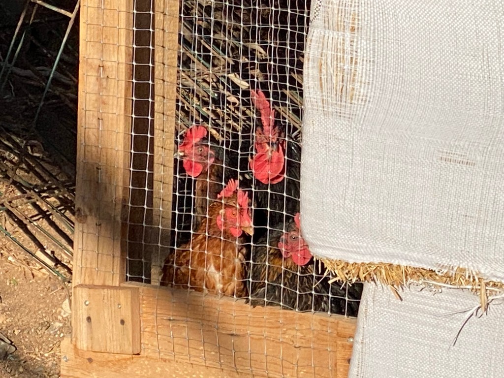
the rooster’s chicks (by the way the browny cake with their eggs, that I had as desert with yesterday’s dinner, was delicious!)
I have a lazy morning spent with breakfast on the terrace of the Gallo Negro restaurant, that belongs to and is run by the same friendly mexican guy who I rented the room from last night.
breakfast at Gallo Negro I also have good company. Couldn’t quite work out if they were here for food-scraps, cuddles or just to see what I’m doing…

Then I get the tour of the place – Julio has been renovating this building complex for the last year. Tells me it was some governmental high-up’s residence in the nineties; lot’s of parties were held here. And it’s got a lot of character!
not my room, but a future one – once it’s fixed and rain-proofed 
collection of ‘tools’ to help with any kind of issue @ Gallo Negro Then it’s time for me to get going, but since I’m not quite ready to leave Gran Canaria just yet, I take the bus to Gáldar.
And it certainly is a new contender for best Christmas decorations – nutcracker, fake snow and all!
X-mas at Gáldar But, I’m mainly here for the archeological museum of the Cueva Pintada.

Museo y Parque Arqueológico Cueva Pintada It’s the remains of a large group of houses, that are halfway dug into the ground. They’re grouped around a cave (a troglodyte complex) with beautiful geometric wall paintings, that was the comunity’s centre for rituals. It’s thought to have been in use up to the 12th century – so used by the aboriginal, pre-spanish people.
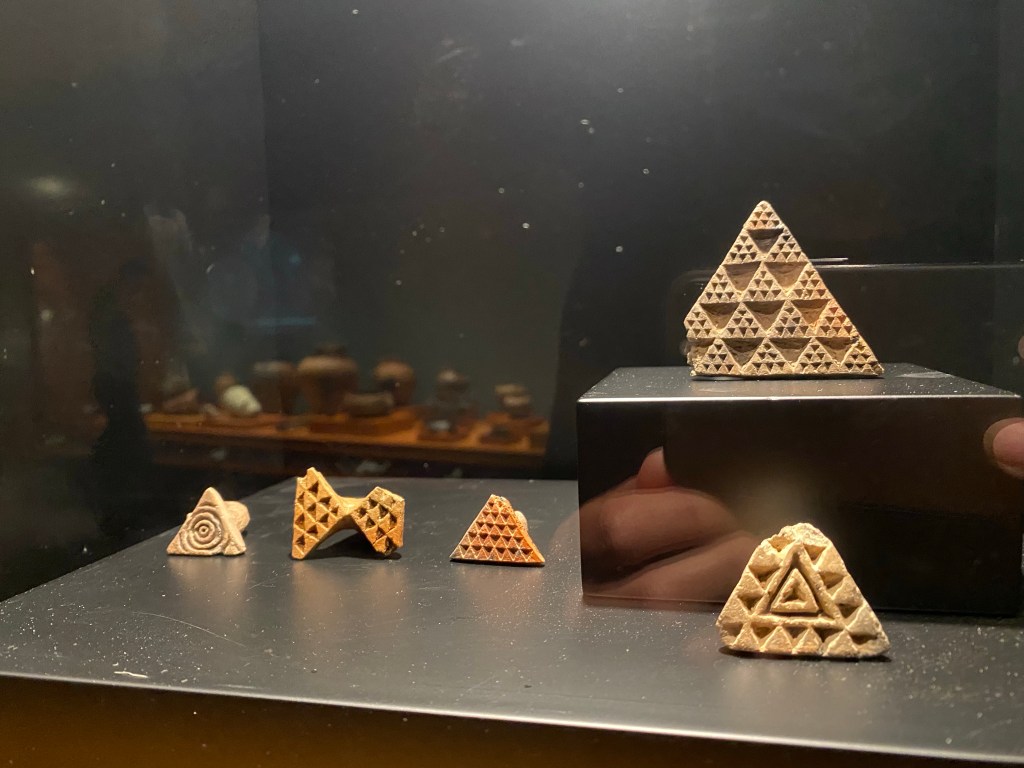
stamps (?) with geometric patterns at the Museo Cueva Pintada Then I make my way back to Puerto de las Nieves, a part of Agaete municipality.

Ermita Nuestra Sra. de las Nieves 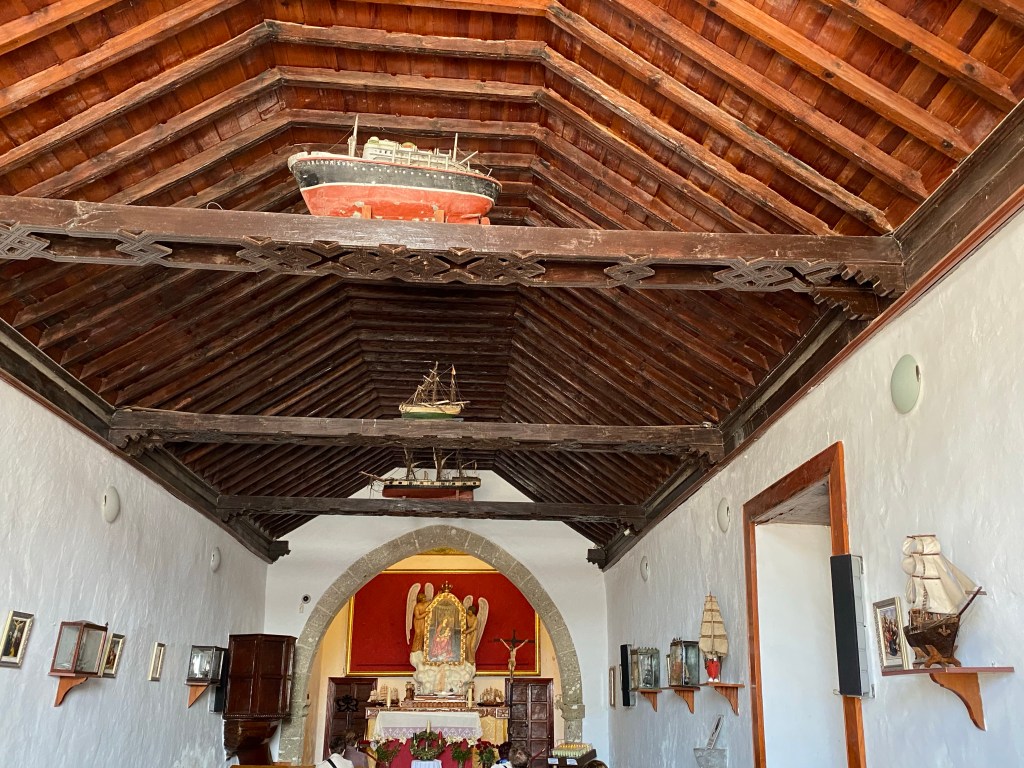
Ermita Nuestra Sra. de las Nieves You can clearly see this has always been a fishing / sea-faring comunity!
Which brings me to the dreaded part – my ferry crossing to Tenerife… It’s still very windy and the waves look pretty high to me, as I stroll along the seaside promenade to the Piscina Natural – saltwater pools.
But this time I’m prepared!
After some pantomime, which has the non-english speaking pharmacist laughing, I get some anti-sea-sick tablets. And I have ordered myself a diet of dry bread for second lunch, and stocked up with cola – just in case, that always helps with any stomach issues, doesn’t it?
Fred Olsen Express ferry arriving at Santa Cruz de Tenerife Although the boat is moving a lot, it’s actually not that bad – maybe it’s the angle of the waves or my preparedness?
Anyway, I arrive well at my fourth canary island!
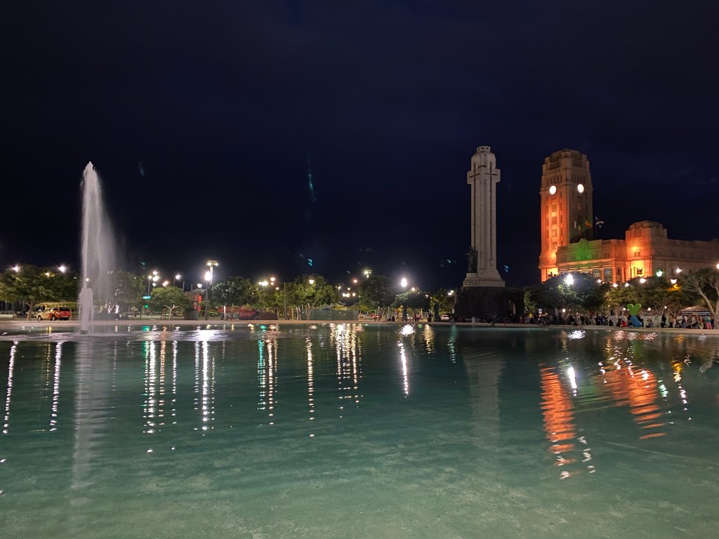
Plaza de España with Monumento a Los Caídos and the Cabildo Insular de Tenerife Basically just a few step on and off the bus / ferry today; no km.
- CANARIES – DAY 20
21-12-12
As it is Sunday (or for whatever reason), I decide to take another ‘rest’ day, that I spend with city walking and architecture nerding.
So after a late morning and breakfast, I set out to explore Santa Cruz de Tenerife.
huge tree in front of Parroquia de San Francisco de Asís, my neighbourhood church There is two architectural highlights (that I know about) here:
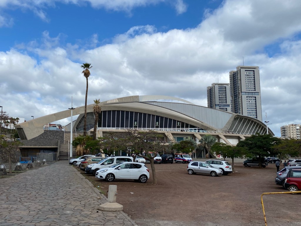
Firstly TEA, Tenerife Espacio de las Artes, a modern art / library / etc. space designed by Herzog&DeMeuron, from 2008.
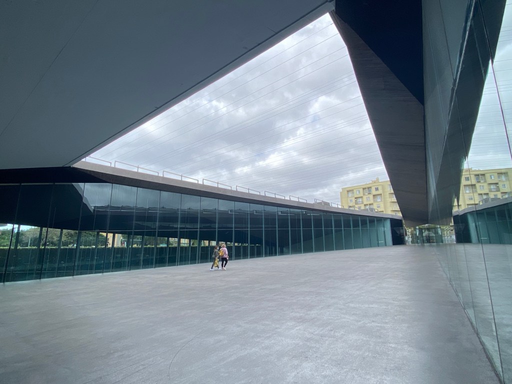

And secondly the Auditorio (Auditorio de Tenerife Adán Martín), by Santiago Calatrava from 2003.


Nice and simple detailing, and shapes like noone else does them.
Just from the model in the lobby, the inside also looks stunning – I will go back tomorrow morning, and see if there is guided tours for the inside available (as the internet promised; but Sundays all is closed).

Then I just continue to stroll around randomly, and discover things.
Like for example this huge oil and gast harbour / storage facility, where they’ve decided to paint it super colourful. From far I thought this was a fairground or something.

Another thing I stumble across is the open air bath / aquatic centre ‘Parque Marítimo César Manrique’ next to the sea – obviously by César Manrique – from 1995. If it wasn’t a bit cool today and if had I brought a towel, I would have considered spending a couple of hours there!
I also walk past the Centro Internacional de Ferias y Congreso de Tenerife, from 1996. A bit messy and run down, and currently used as vaccination centre. But also by Santiago Calatrava!
Then I get back into the old town – nothing too special though – but some really nice and lush parks.
And I find this in a shopping centre – a bit premature birth…

After some late lunch I go back to my flat for some chilling, clothes washing and planning of next week.
Acording to my phone I raked up 13km today. Nothing like city walking when H. is pulling… but still 😉
- CANARIES – DAY 21
21-12-13
I start the day with packing up from my ‘tiny house flat’ in the historic centre of Santa Cruz de Tenerife.

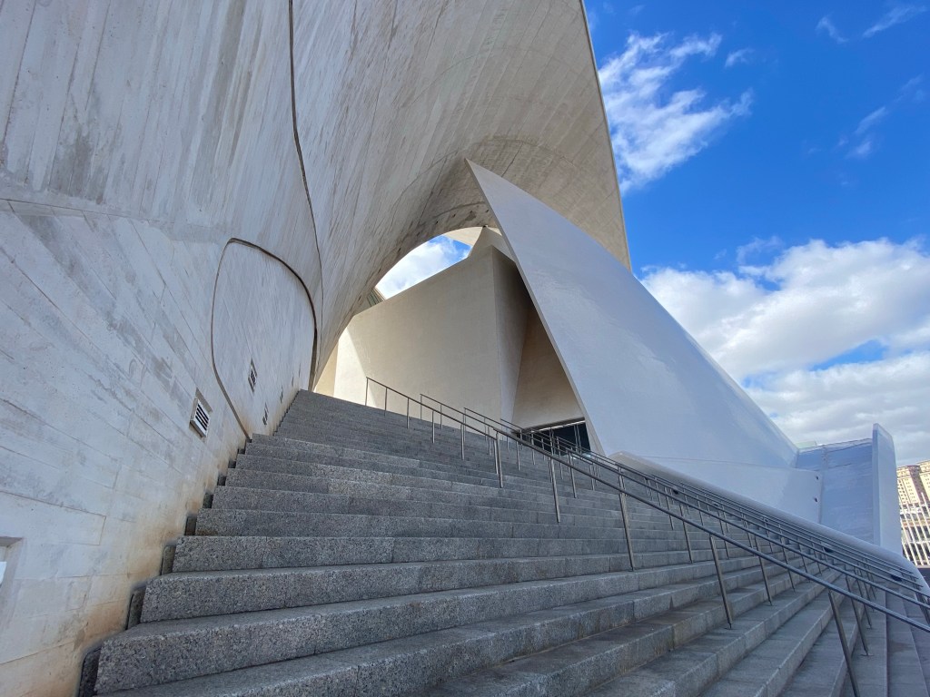
my room at Edi Astoria ‘tiny hose flats’ Then I make my way back to the Auditorio, to ask whether they do guided tours this morning. And, yes, they do – at 12:30! A bit later than I had hoped, but better than not at all 😉
So I wait, sitting on the quay wall in the sun, watching the fishers and reading.
Turns out, no one else wants to join this tour this morning; usually the minimum is 2 people… but the kind and knowledgeable guide gives me a ‘private’ tour anyway 🙂

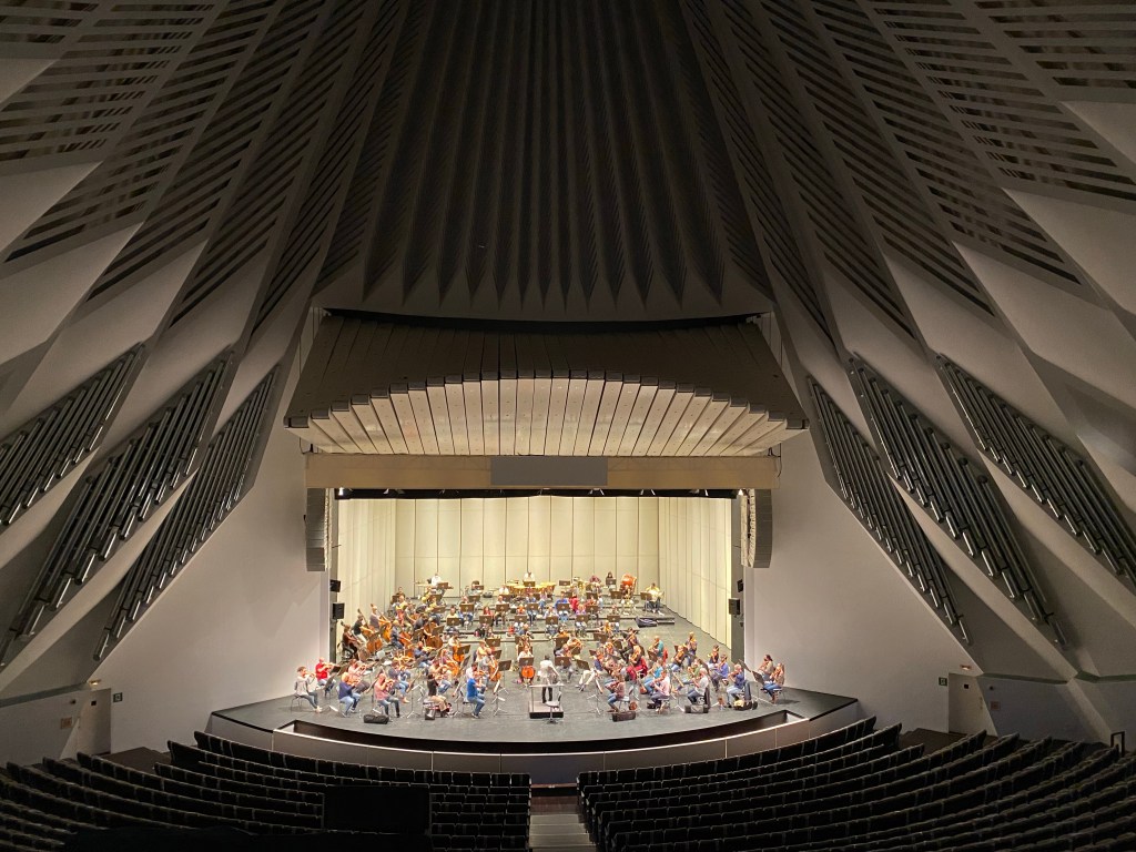
Tenerife symphonic orchestra in practice 
ceiling of the symphonic hall (with the lights turned off) After this highlight, I jump on a bus to San Christobal de la Laguna, where I have booked a good deal at the Grand Hotel for tonight.
An hour later (incl. the walk from the bus station and check-in at the hotel), I’m here:
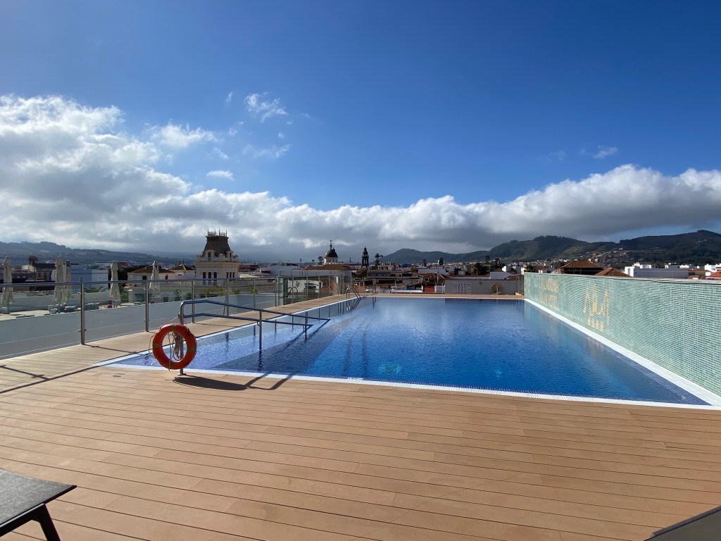
roof top pool at Grand Hotel La Laguna My original plan was for taking a bus up to the near Anaga-‘mountains’ and go for a 2-3hours walk there until sunset… but: this pool terrace looked too tempting!
So I spend another couple of hours relaxing and reading in the sun again, before heading out for a stroll to see La Laguna before nightfall.
It seems to have been quite an important and rich town; the islands oldest church location claims to be here.
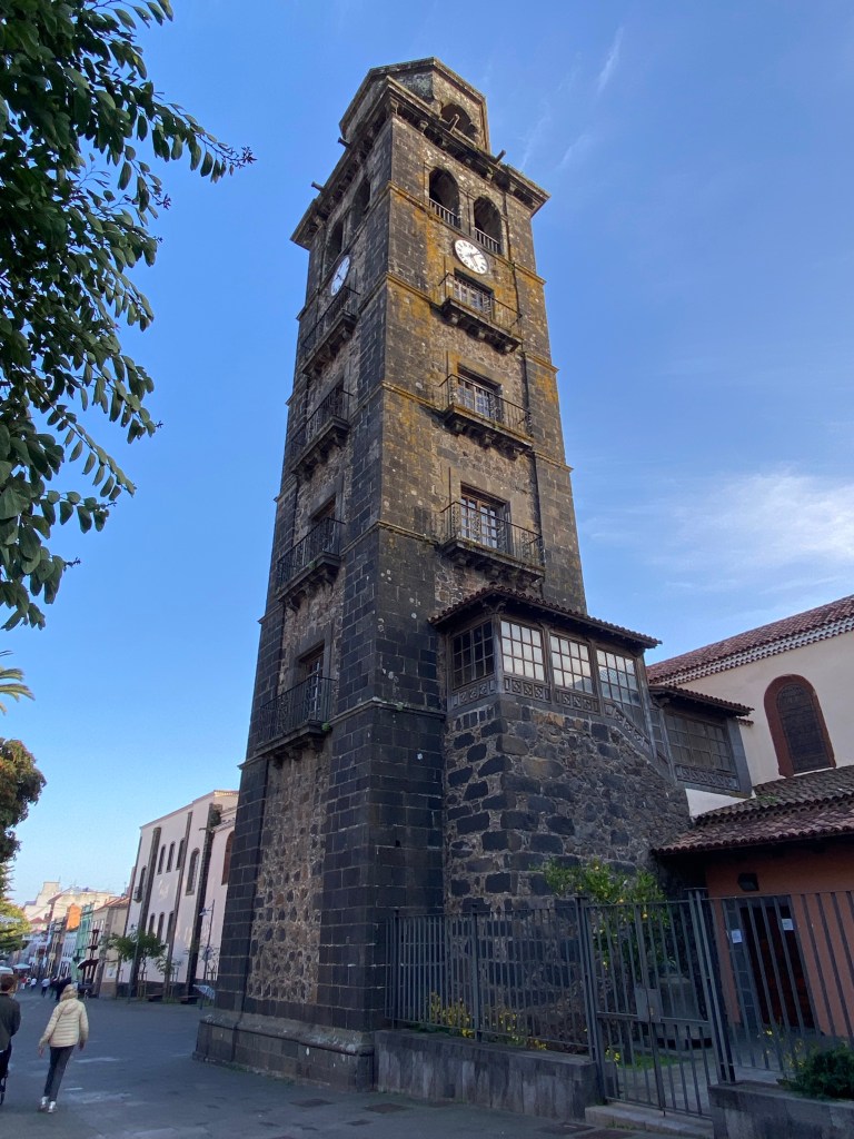
Iglesia de Nuestra Señora de la Concepción, San Christóbal de La Laguna And lots of very grand residential houses. One of which has been transformed to be part of my hotel.

That’s it for today… sorry, except the insides of the Auditorio (which photos can’t really do justice), not much exciting stuff today 😉
Not much km to speak of today.
- CANARIES – DAY 22
21-12-14
So today it’s finally Anaga! And getting my ass on, I’m ‘behind schedule’.
So I leave the luxury of the hotel behind and go for a bus.

stairs/corridor in the old part of Gran Hotel La Laguna And after quite some serpentine turns in a tiny bus, I’m rewarded with an effortless view.
view back towards La Laguna from Mirador Cruz del Carmen Just by the busy parking lot (a german team is just shooting some movie somewhere nearby, so there is a million trucks and other crew cars in addition to the tourists) there is also a tiny chaple, unfortunately it’s closed.
Eremita de la Cruz del Carmen But some of the holinesses can also be found just outside of it…
…and the forest around looks lovely, can’t wait to get started on my hike.

It’s such a difference in vegitation here to all the other islands so far!
There is proper high trees, fern and lots of moss – very visibly so, where the gravel road or path is cut into the terrain.

The Anaga forest was apparently protected quite early, because someone realised that it’s creating a water buffer and storage, and without it the fields lower down in the valley dry out.
It’s now especially famous for it’s Laurisilva – the laurel forest.
I do a lovely little circular track to Mirador de Zapata, and back via de Le Bosque de los Enigmas trail – well marketed the whole thing, and plenty of other visitors/hikers. But also really quite beautiful!
on the Le Bosque de los Enigmas trail After coming back to Cruz del Carmen, I take the old camino back down towards La Laguna.
There is some lovely view points back towards Santa Cruz, and the steep, green mountains around.
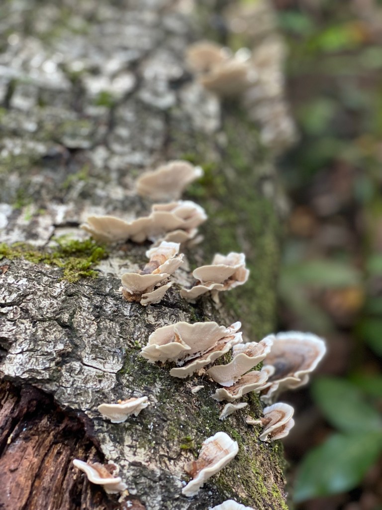
(probably) Barranco de Tahodio, with Santa Cruz harbour in the end It’s such a lush, humid place here, there is even mushrooms!
Then the path flattens out amoung agricultural areas, and into the surroundong villages of La Laguna. There is lots of small lizards, but they are too shy and quick, to get captured on a photo.
I pass by an interesting modern-ish church, before I catch a bus back to the centre.
Parroquia Nuestra Señora de las Mercedes I change busses at the Intercambiador…
Intercambiador La Laguna …and some minutes later, I’m on the other side of ‘civilisation’ and the airport Tenerife Norte, at La Esperanza – where the GR131 on Tenerife starts.

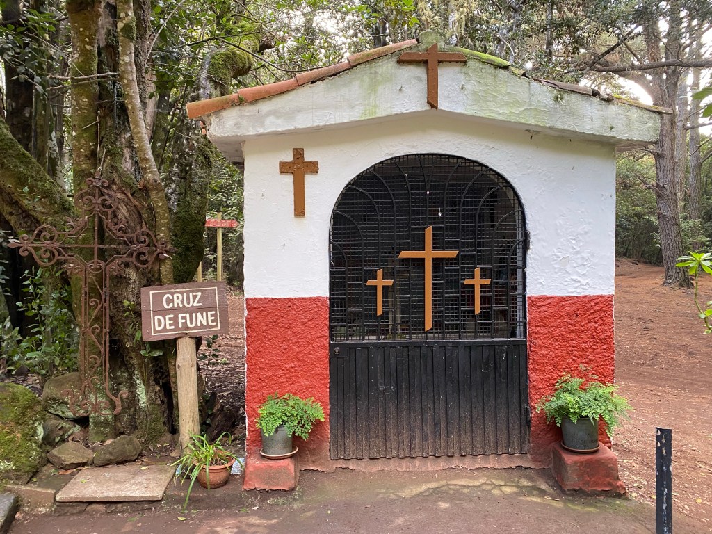
start of GR131 on Tenrife; ‘just’ 85,4km to the end at Arona I ‘fly’ along the forest road, aware that time until sunset, when I should have reached my goal, is running out. Take just a short photo-stop at Cruz de Fune – a tiny wayside chapel that contains ‘only’ about 10 or so variously sized crosses.
And make it just in time, to set up my tent at the Zona Acampada de las Calderetas.

Zona Acampada de las Calderetas Today’s hiked kilometers amount to roughly 18,4km, about 5,5km of it along the GR131.
- CANARIES – DAY 23
21-12-15
Not sure what I’ve done to aggravate the weather gods. I don’t have anything against a bit of rain… by why only on the mornings of a tenting night?!
good morning! But, can’t be helped… getting used to it 😉
I take it a bit slow, and luckily it stops while I’m packing up and I can wipe down the worst of wetness from the tent before bagging it.
With all the procrastination and faffing around, I get going quite a bit later than I had hoped… by that time it’s all blue sky – like the weather forcast had said.

It’s 11:45 when I make my first step on the trail, and it’s 27km to the next camping area, where I wanted to spend the night…
So, in order to make up time, I chose to take the Camino de Santiago pilgrim’s route instead of the GR131 for the next stretch (they basically criss-cross / run in parallel for a good while on Tenerife) – it’s slightly longer, but has a lot less ascent it seems. Also my guess is it’s on bigger trails, so less slippery after the rain. And, with fog drifting down again after the 5mins of blue sky, I hope for more views staying on lower altitudes.
GR131 (the red strip) and Camino de Santiago (the saints symbol), as well as another local trail (the yellow strip), running in parallel here I take a short second breakfast / technical stop at the shelter Las Canales.

picknick shelter Las Canales Then I get to the first viewpoint – lovely far view out to the coast:
And some hours later – another amazing view:

There is very few people on the trails; only one person on a motorcycle, and then these two guys:
lovely fellow hiker, that I meet 3-4 times during the day; always smiling and waving 
and this silent guy/chico – Roque Chico And there is some amazing huge trees, with their own organic lametta – ready for x-mas.
The trail continues more or less flat-ish on good and wide forest roads, ‘pistas’; so I make good progress. But the terrain is getting steeper and steeper.

steep terrain near the Barranco del Infierno Then there is some more imaginary views.
Before -finally- a short hour before sunset, the sun’s pushing through, and I get a glimpse of what I’ve missed all day!

Just seconds before sunset, with the moon already out, I arrive at the Zona Acampada de la Caldera…

Area Recreativa de La Caldera …where I hurry to set up my tent:
(so much in a hurry, I managed to obstuct half of the camera… but thought, I’d share it anyway;) Total of approximately 27km speed-hiked today.
- CANARIES – DAY 24
21-12-16
Lovely morning in my lonely campsite.

Zona Acampada da La Caldera As usual, I have no plan – so I start out by stopping at the nearby Area Recreativa de La Caldera to use the sanitary facilities, and then stroll a 100m along the road where there finally is mobile phone coverage – so I can do some research.
Area Recreativa de La Caldera Conclusion is, I’ve been up too late – again. Won’t make it with the next stage into the Teide national park to catch the bus back. Also, I’m running low on water, and need to stock up on other things, so take the bus down to La Orotava.
I find a hotel in the historical part of town, where I can already check into my room to freshen up; and also have lunch in the courtyard restaurant. Then a stroll around town.
Christmas exhibition in La Ortava Then what? I decide to ‘drop by’ Puerto de la Cruz – because I can. Anything interesting to see there? Don’t know – I’ll find out. I love this freedom!
From the bus I see that it might be the same weather up on the path as yesterday… clouds hugging the mountainside. I really hope it clears up tomorrow, when I plan to continue to hike there!

First impression of Puerto de la Cruz: yes, this might be another tourist town.

But it also has some lovely old churches,

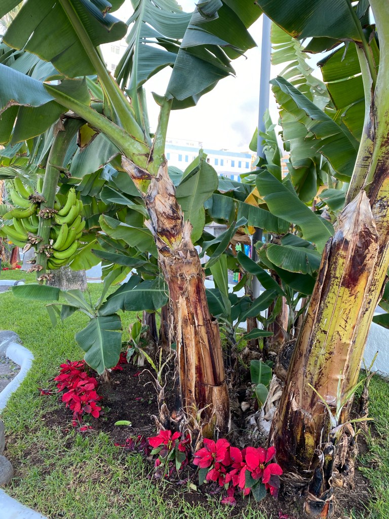
Iglesian de San Francisco / Eremita de San Juan Bautista banana trees in the city parks,
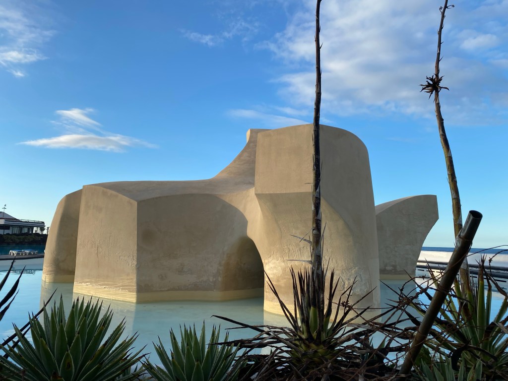
a seaside pools area that is -at least inspired by- Cesar Manrique,

fancy, humouristic zebra crossings,

and a really nice street-art area by the old port.
I watch the sunset, as well as the moonrise, and two paragliders from a large cross (maybe ‘the’ Cruz?!), before having some spanish omlette for dinner and then calling it a day.

My phone thinks I have walked 11,5km today… but I can’t really believe that. Anyway, they’re not counting towards the trail; but I still had an eventful day.
- CANARIES – DAY 25
21-12-17
After the easy day yesterday with a huge spanish omlette for dinner, and a good night’s sleep, I’m ready for more hiking. So it’s an early morning bus back up to La Caldera and continue from there.

TITSA bus returning from its end stop at La Caldera It’s really nice weather today, with far views down to Orotava and Puerto de la Cruz. Just a few too many trees in the way… need to get higher up!

view of the coast by Puerto de la Cruz from La Caldera The path starts nice and easy with some downhill and flat parts through dense woods – with a lot of autumn-y chestnut trees.
Then it starts to climb.
I meet a fellow hiker, nice guy from Nürnberg, and we walk together and talk for a while.
Whenever there is some more open areas, there is again lovely views back down towards the coast. Great sunshine!

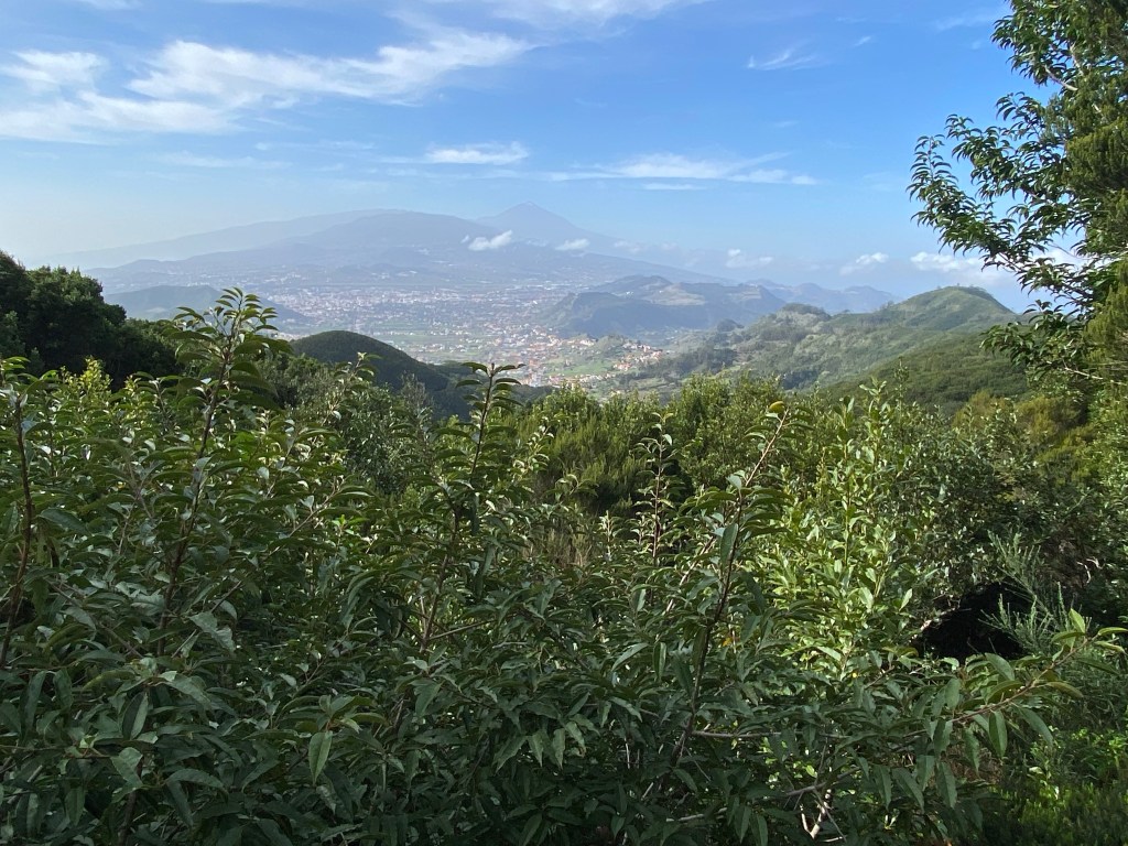
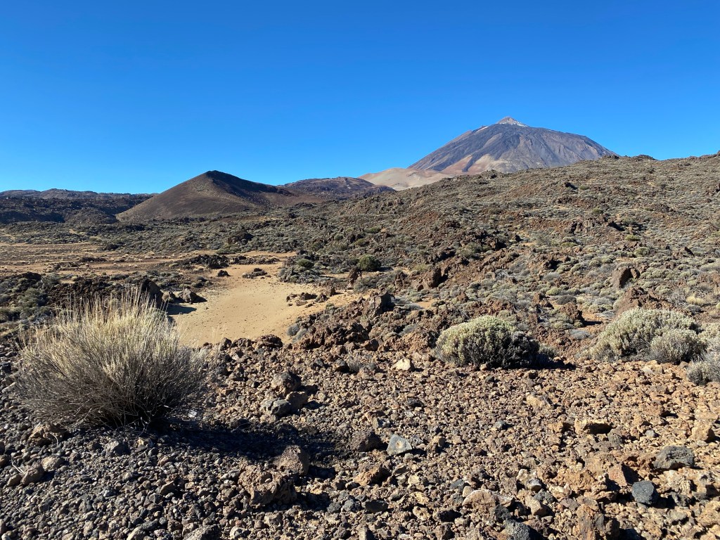
the coast around Puerto de la Cruz …and up to El Teide – which really has only very little snow this year (so far).

view up with El Teide in the background Then the now steep uphill path follows a barranco for a while; at this place it’s very canyon-like, steep cliffs where the river bed has dug down deep over the years.

Barranco de Guamaso Then we cross the road in a small tunnel.

tunnel under the road TF-21 And as we’re approching El Portillo and the border to the national park, the terrain flattens out and the vegetation changes completely within just a few 100 meters. From dense pine forest, with lots of undergrowth (at least a bit further downhill), to become almost desert-like.
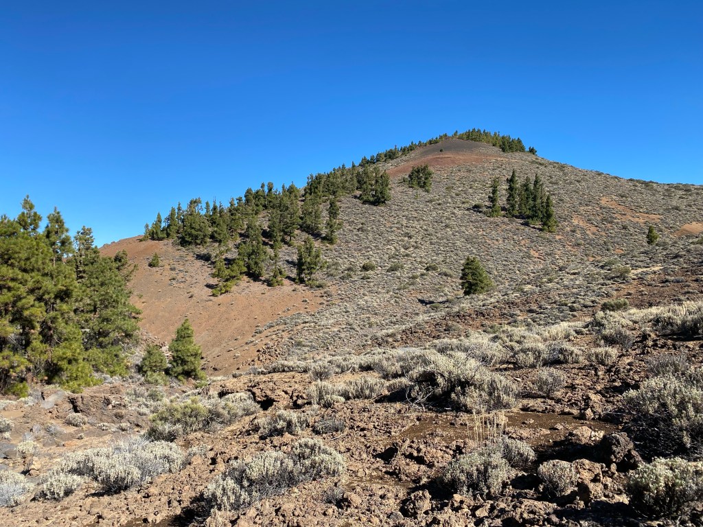
at the border to the Parque Natura Corona Forestal I go for a toilet break at the visitor’s and information centre; but can’t be bothered to check it out more. Just too nice weather outside!
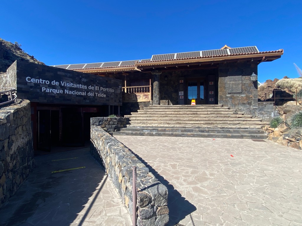
Centro de Visitantes de El Portillo, Parque Natural El Teide I stroll through the botanical garden that they’ve created just by the visitor’s centre, and then a bit onwards, until I find a nice stone bench in the sun for a long lunch and rest break.

lunch spot at 2070m asl, with view of the Riscos de la Fortaleza (cliffs on the left) From a sign I learn that these Riscos and the adjacent El Cabézon top are remains from an ancient volcano, that was there even before El Teide was formed.
And then it’s already time to catch the one and only bus back down to my hotel in Orotava. So I make my way to the El Portillo Alto cluster of mountain restaurents where there is a bus stop.

Restaurant Bamby, El Portillo Alto, with view of El Teide (again, of course) Just a last view towards the south-east – looking so much forward to continue hiking along there tomorrow!!
Today’s hike was about 16km with 1200m of ascent (but luckily with a light pack).
- CANARIES – DAY 26
21-12-18
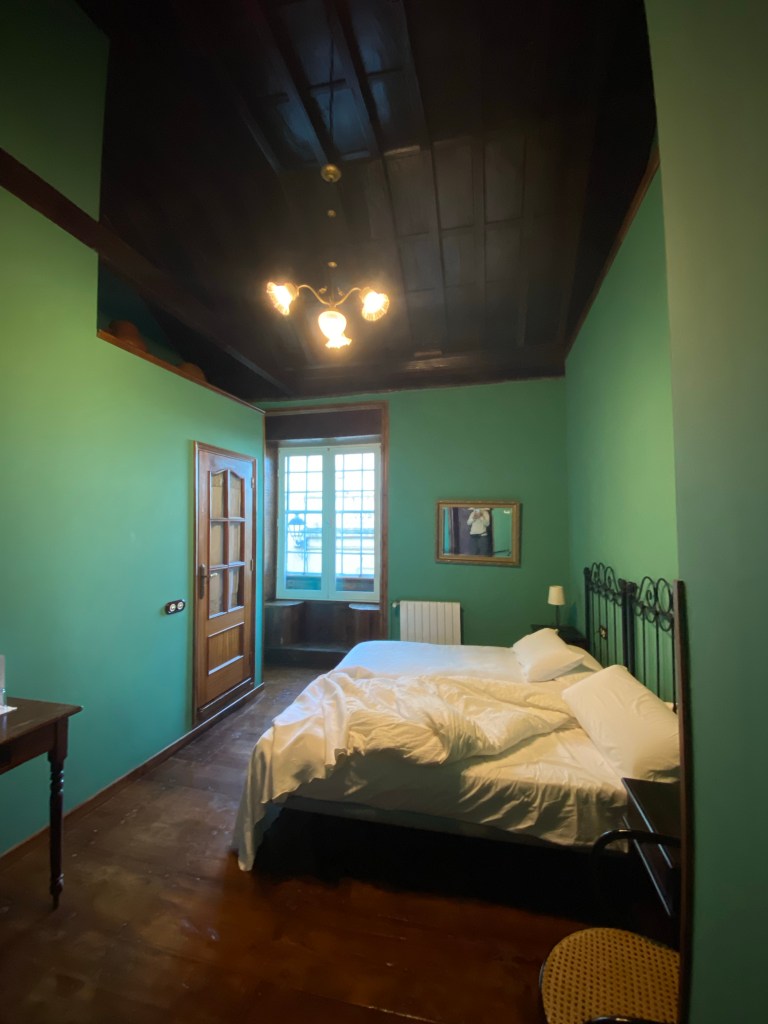
Time to leave the north coast of Tenerife, so I check out from my quiet little room at Hotel Rural Orotava.
Hotel Rural Orotava From the bus on the ride back up to where I left the trail yesterday, I can just see a glimpse of the neighbouring island – La Palma. No volcanic activity visible from this far; but I’m sure the population there is still suffering from the consequences.
Since this time I won’t make it to visit it, or the other two small islands out west (La Gomera and El Hierro), I hope I can come back sometime and continue my hike when the volcanic activity has stopped.
island of La Palma – just about visible from the bus Then I start my hike, from El Portillo.
El Teide is already well visible – I’m basically walking around it today, and think I’ve taken a hundred pictures of it during the day 😉
El Teide in the distance It’s a nice (to boringly wide), flatish gravel road – which in a way is good, because I don’t need my eyes on the ground constantly, but can take in the stunning surroundings as I walk.
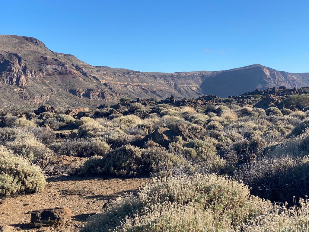
On my right hand side, sand flats (cañadas) alternate with moon landscape-like heaps of rocks…

Cañada de Diego Hernández …and on my left I follow the lower edge of the cliffs of this huge caldera (I have now learned from wikipedia that a caldera is, where the magma chamber has collapsed in on itself after emptying through a volcanic eruption, leaving a depression).

looking back at the caldera cliffs Los Cuchillos After a lunchbreak in the sun, I continue: there are just so many nice rock formations, in all different colours, with and without holes/caves, etc. – difficult to chose pictures (and they don’t do the landcape justice, I’m afraid).


And continuously, the view of El Teide, just changing slightly in angle and sunlight.
I take it slow today, taking lots of breaks, just enjoying the views and the sun, and not because of the heavy backpack 😉
Then towards the end it get’s even more dramatic – gorously eroded rock, and just perfect sunlight to make them shine. There is also several rock climbers, enjoying them more hands-on.

Then I arrive at the mountain hotel Parador de las Cañadas del Teide, which is the end point of today’s hike.
There is also a relatively ugly chapel in the middle of the even uglier huge car-park; but at least El Teide is still looking good in the evening light…

Ermita de las Nieves …and a well deserved cold cerveza 😀

at the evening-sun facing terrace of Centro de visitantes de Cañada Blanca, looking out at the Roques de García About 17km high-altitude (flat-ish, but constantly above 2000m asl) hiking today.
- CANARIES – DAY 27
21-12-19
After a good night (once I had turned off the heating/airconditioning completely around midnight, because it just would not regulate down and kept baking the room to 30 degrees), and a big breakfast (to get my money’s worth 😉 , I first had another stroll around the area before checking out.

breakfast with a view of El Teide @ Parador de las Cañadas del Teide Just a couple of 100m away, basically on the other side of the parking lot, there is the Mirador de la Ruleta with gorgeous views.

view west from Mirador de la Ruleta, of Llano de Ucanca and the rock La Catedral on the right Also just there are the spectacular Roques de García – amazing in the morning light (and not too many tourists yet).

Roques de García 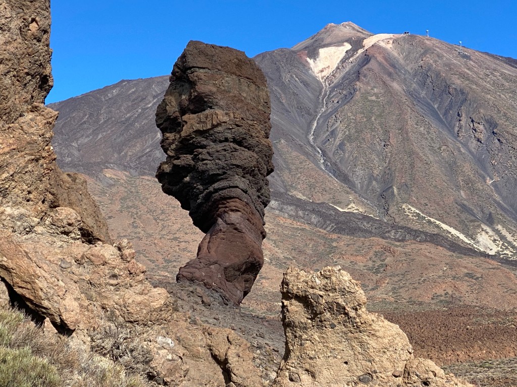
Roque Cinchado According to the sign this ‘guy’ (and several similar rocks around there), where once the centre of a volcanic conduit. When the magma there cooled down slowly, it formed a special type of very resistant rock. Now everything else of the volcano is eroded, just the solidified central conduit remains.
Then I got my backpack from the hotel and started today’s hike. First it was to backtrack about 3km.

view back to the hotel, chapel and parking lot, and the Roques de García And then it’s uphill, again looking over where I hiked along yesterday; and some last views of El Teide.

Quite quickly I reach Degollada de Guajara and then with 2380m asl the highest point on the GR131 route on Tenerife.
Once over the pass, great views open up towards the south and the coast there.

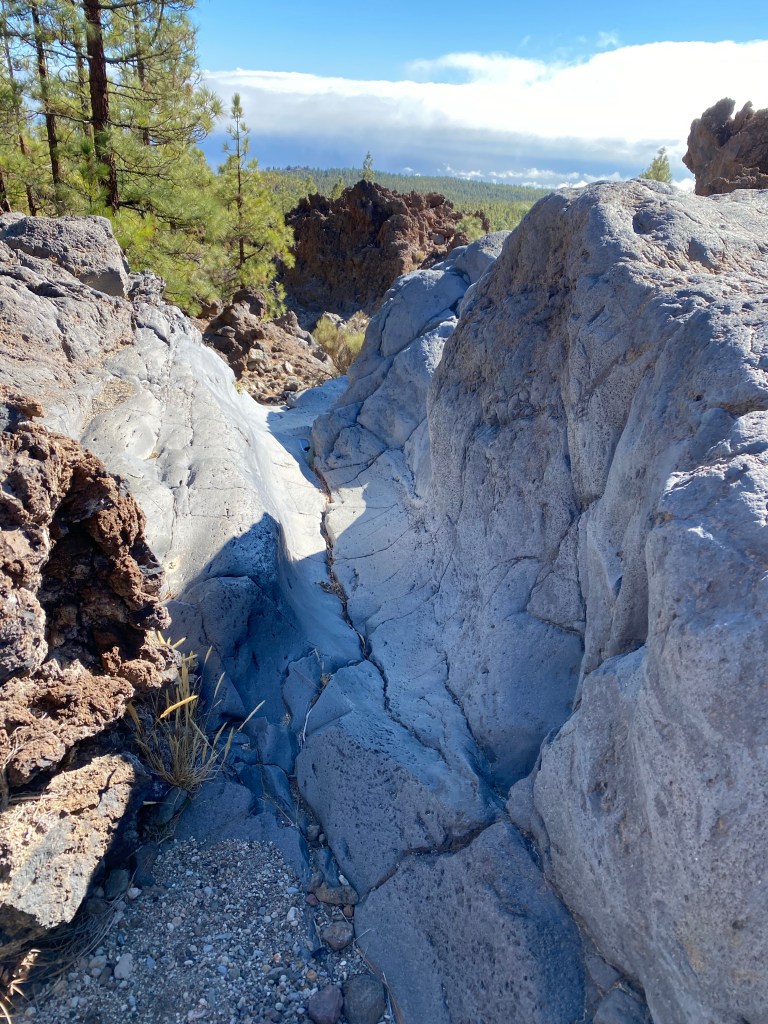
view south from Degollada de Guajara And that’s when the path gets really exciting!
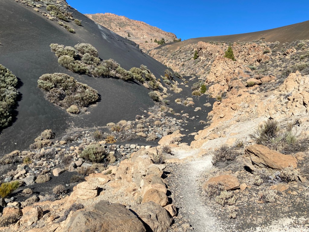
And then, a bit further down… does not disappoint!
near Baranquillo la Majada Vieja With the differently coloured gravel and sand, and the clusters of bushes, it almost looks like a carefully designed japanese rock garden.
Then I’m starting to get back into pine forest, which gradually gets denser and taller the lower I get.

I take a second lunch break by a dry stream, that would have been just sooo lovely to bathe in, had there been water! With a smoothened out bed, and waterfall with a ‘basin’ below… but impossible to take a picture of that covers it ;(
just before the ‘waterfall’ in Barranco el Charcón But the path doesn’t get boring then…
Fun fact – whenever the small, hikers-only paths cross a larger gravel road, there very often is a zigg-zagg of low stone walls to keep cyclists and horses (and cars) off.
chicane at the start of a hikers-only path (on the left) But finally – all too soon (if you ask anyone but my knees and ankles), I can see Vilaflor de Chasna through the trees.

It’s situated lovely on the hillside, with steep narrow streets; and the high mountains as backdrop.
Vilaflor de Chasna And, probably since it’s the fourth Sunday in advent, I get to see what I can only assume is the city’s marching band playing ‘Feliz Navidad’ while marching through the whole hamlet.

Feliz Navidad!
- CANARIES – DAY 28
21-12-20
Last day on the trail! Time has run so fast…
Starting out from my hotel in Vilaflor, I first check out the local churches. Make sure their Nativity scenes are up to standard.
beautiful and simple Parroquia San Pedro Apóstol 
slightly size disturbed Nativity scene, but with a cat… so, approved! The other church just next to it, Santuario del Santo Hermano Pedro, is a boring baroque thing. But the Casa de los Solero dating back to the 17th century, is more interesting – a magnificent example of traditional Canaria architecture (according to the sign). Sadly there seems to be no money to keep it up…

Casa de los Solero Then I make my way out of town, past a viewpoint with Ermita de San Roque, floating on a bed of clouds.
Ermita de San Roque Past some modern houses and a spa hotel, and then it’s back to the typical path and light, dry pine forest.

But it’s not boring for long. There is a whole sience to the watering system; all ages of pipes crisscrossing without apparent direction in the landscape… and then this:

Then it’s down into a deep gorge to cross the barranco on a high stone bridge.

view down onto the stone bridge crossing Barranco del Rey There is a beautiful open water tank.
And then the path is crossing another barranco. There is a warning sign that it might not be possible to cross…
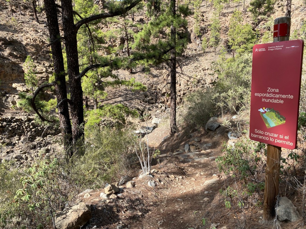
Barranco Seco So I carefully check the water level and speed of flow, and then make the decision that it should be save to cross today.

Barranco Seco, with about 2mm intermittant / unnoticably slow flowing water 😉 Then it’s steeply down along a ridge line in the pine forest, with views of the rocky canyons on both sides.
Save down the steep stretch, it flattens out, I pass some agricultural areas and then pass the hamlet of Ifonche.
And finally I get to see – and also take a picture of – one of the lizards that I just heard in many places; but only because it’s already dead… roadkill unfortunately. It has a lovely silver underside; otherwise I probably would not have spotted it…

After it, even more spectacular views down to the deep blue sea open up; and it’s Christmas here as well!

The path again snakes along a steep mountainside.
After a second (or third?) lunchbreak in the sun I continue through the rugged landscape. Partially it has been used for agriculture at some point – the terraces are still visible, but not in use anymore it seems.
Roque del Conde I’m starting to approach Arona, and the end of the trail; but there is two more highlights that I get surprised by.
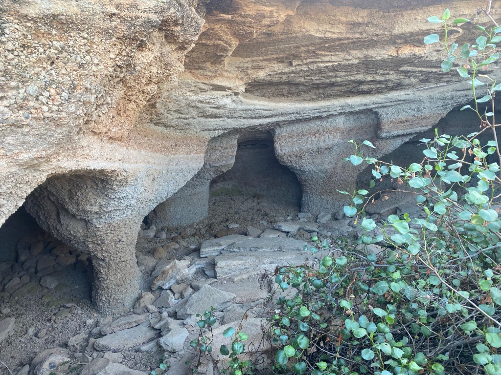
Firstly some really beautiful caves.
And then the path crosses a last barranco, which is dug deeply into the landscape.
Baranco Mara But then I arrive at the historic centre of Arona, by the Iglesia de San Antonio Abad – the end of the trail.

Iglesia de San Antonio Abad, Arona From there I take the bus to Los Christianos; a tourist heaven/hell… but nice sunset over the harbour visible from my hotel terrace!

puerto de Los Christianos Today a final 18 or so kilometers, with 1200m descent, and the full heavy backback. Funnily my legs seem to have got used to this – no complaints 😉
- CANARIES – DAY 29
bufferday
21-12-21
The last day before my flight home, I had earmarked as a ‘buffer’ day.
And I could not have planned it better; needed a day to chill out, get organized – take a covid test for the travel/border crossings, and do some last-minute Christmas shopping. And last, but not least, mentally prepare for this change in life and travel!
I also had hoped for a bit more of sunbathing at the beach… but the weather wouldn’t have it; mostly rainy and a bit cool.
not quite the weather for pool-ing I also get some more ‘sight’seeing done.
Playa del Callao 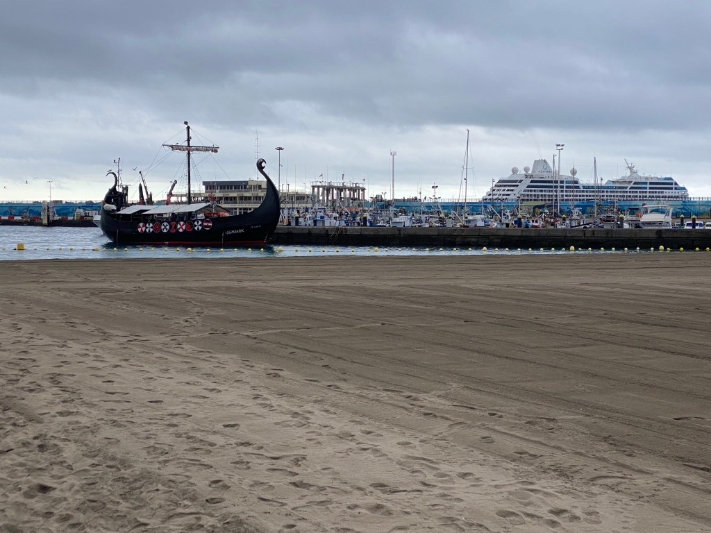
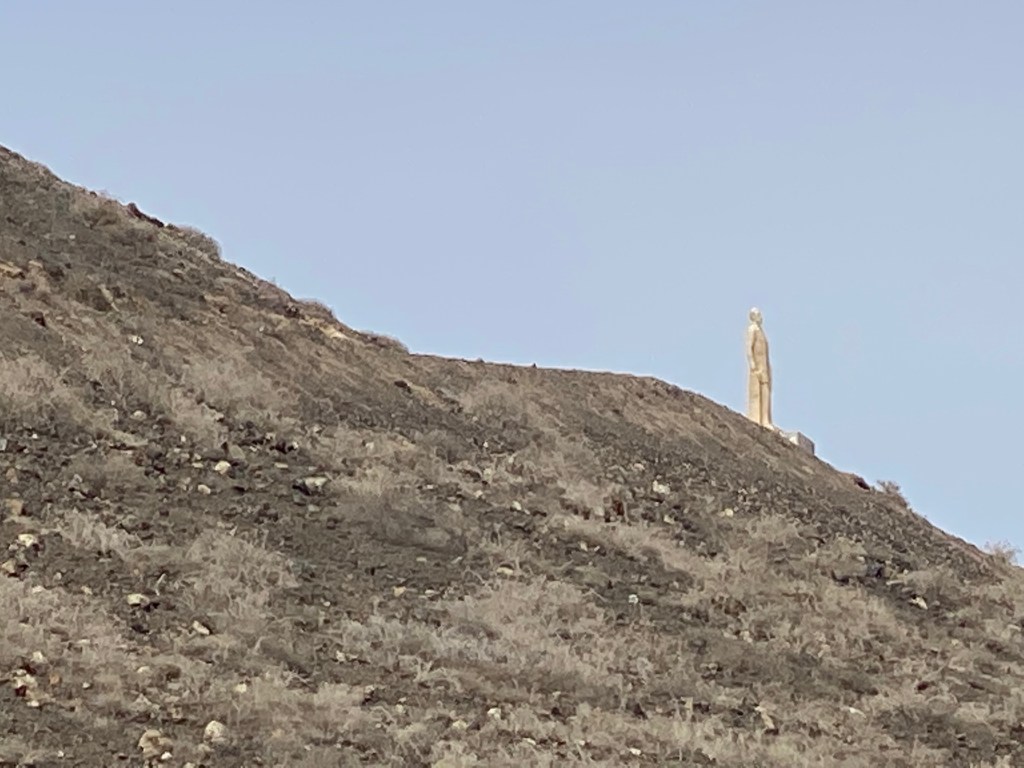
the vikings are also here it seems… And since I’m not quite done hiking, I also climb the local city vulcano.
Then it’s really saying a final good-bye to this lovely adventure; tomorrow’s my flight home.


Thanks to everyone following along and reading this; I do hope you have enjoyed it.
Unfortunately it’s only possible to like/comment when being logged on as a wordpress user (it may also be possible otherwise, but I never managed to find/change the settings to allow for this – apologies).
Anyway, those of you who know me, know how to get in touch though other means anyway. 😀
back to front page: Ines hiking
